Country:

 City:
City:


To reach the starting point from the village of Méaudre, follow the D106M towards ‘Les Narces’. There is a car park at the side of the road after a hairpin bend marked by a green sign reading ‘La Vira’.
(S/E) From La Vira, head uphill via the forest track that branches off the road (PR® de Pays markings, yellow-green).
Follow the markings until you see, on the right, the first marker indicating forest plots: a red-painted iron post (clearly visible in the landscape), followed by a second one.
(1) At this second post, turn onto the path (due west). Continue until you reach a small hut on the ridge.
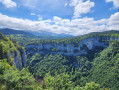
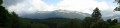
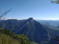
Enjoy this first viewpoint over the Saint-Julien-en-Vercors valley before continuing to your right. A path maintained by chamois and walkers allows you to follow the ridge and reach a small summit.
(2) Descend into the next hollow, where a path veers to the right (due east) to lead down into the Trou du Vau valley.
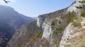
(3) Before taking this path, take a short detour to the major climbing routes at Méaudre, the final viewpoint over the Rencurel valley. Then retrace your steps.
(3) Leave the ridge via the path and head down. This widens into a (steep) forest track and joins the Route des Feuilles at the signpost for “Le Trou du Vau”.
Turn right onto the road and follow it for three hundred metres (heading south-east) before rejoining La Vira (S/E).

 Visorando Member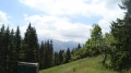
 Easy
Easy 
 Difficult
 Association / Club / Walk leader