Country:

 City:


At La Martinière, park at the side of the road opposite the small transformer on the left (space for three cars).
(S/E) Carry on uphill and, at the end of the road, take the path that leads into the forest for 300 m.
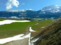
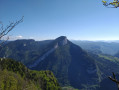
(1) Turn left to follow the yellow-green markings. The path climbs quite steeply, offering beautiful views over the valley and beyond to the mountain peaks. You’ll reach a pass (elevation 1209).
(2) Leave the signposted route and continue to follow the track which climbs to the left along the ridge.
(3) You’ll come across a newly created track. This is a good opportunity to take a short break on the large boulders at the side of the track, then continue straight on uphill. You’ll cross two more, older tracks. After the last one, our track disappears. Continue climbing due west, following the tracks leading towards the ridge until you reach the junction withthe GRP® on the ridge.
(4) Take it to the left (south). Pass by the Gros Martel (cross) and continue for a few dozen metres.
(5) Caution: theGRP® turns sharply to the right into a sort of small canyon; it’s easy to miss this turn as a path continues along the ridge. Descend quite steeply and emerge onto a lovely forest track. Cross the track and continue for about a hundred metres to the crossroads.
(6) Take the forest track on the left, which initially descends quite steeply. Follow this track as it continues to descend, becoming gentler, heading south. Pass under a high-voltage power line and come to a road.
(7) Turn right (GRP®) ontothis road for about 600 m and arrive at a fork (return route) at Pas de la Ferrière.
(8) Continue along the road, which turns into a track, until you reach a crossroads in a clearing.
(9) Turn right to follow theGRP® markings. After about 1 km, this good path reaches a narrow pass where it descends into the Pas des Rages.
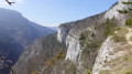
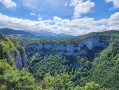
(10) At the signpost, leave the main path and take the track on the left which leads to a rocky outcrop formed by a sharp limestone pavement. Carefully make your way to the summit to admire a stunning view of the Gorges de la Bourne. Return to the previous junction.
WARNING: the following section from (9) to (8), via (11) and (12), is for experienced walkers only. If in doubt: return directly from (9) to (8) via the path taken on the way there.
(9) Then turn right onto an unmarked path which curves to head south. Pass under a high-voltage power line (viewpoint) and continue for about 50 m until you reach the junction.
(11) Turn left, heading south-east. The path is rarely used but a clear trail is visible.
Pass to the left of the ruins of La Haute Valette. A little further on, the path leaves the route of the old track it was following and becomes somewhat unclear. GPS recommended!
When the track becomes unclear, take the one that climbs slightly to the left. After a while, you’ll come to a much better path coming from the right. Follow it to the left as far as the Balme Noire.
(12) A deep cave and an impressive site well worth the effort. After taking in the sights, retrace your steps for about fifty metres and turn right onto the path which climbs quite steeply. The path, which is very clear at the start, can easily be lost if, as it was when I passed through, it is covered in dry leaves. But by looking for the tracks that climb whilst keeping the cliffs on your right, you’ll eventually rejoin the track you were following earlier. Follow it up to the right as far as the Pas de la Ferrière.
(8) After the left-hand bend, do not take the first path on the right (marked by a Yellow Cross and a Green Cross), but, just 50 metres further on, take the path (also marked by a Yellow Cross and a Green Cross) which descends quite steeply at first before levelling out.
Follow this path, which is marked fairly regularly with blue (circles or lines) and which runs several times along a ledge overlooking the gorges: breathtaking views, so take care if you suffer from vertigo.
(13) Further on, the path veers northwards, then becomes a good track which continues to the tarmac road.
(14) Take the road on the left, then the first on the right. After 500 m, you’ll reach another tarmac road; take this one on the left. Continue along this road until you reach (S/E).

 Association / Club / Walk leader

 Visorando Member
 Easy
 Moderate