Around Flavigny and the Étang du Breuil

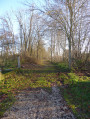
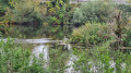
Walk between the Canal de l’Est and the Moselle, passing by the Écluse du Prieuré and theGR® 5F long-distance hiking trail. The stretch around Étang du Breuil is always a prime spot for watching anglers and birds. In summer, watching pleasure boats and barges pass through the locks is always an entertaining spectacle. In winter, the canal’s favourable aspect makes for a lovely walk in the sunshine.

Details

n°67697777
Creation:
Last update:
Last review:
  • Walking
    Activity: Walking
  • ↔
    Distance: 2.73 mi
  • ◔
    Average duration: 1h 15 
  • ▲
    Difficulty: Easy

  • ⚐
    Back to start: Yes
  • ↗
    Ascent: + 13 ft
  • ↘
    Descent: - 13 ft

  • ▲
    Highest point: 764 ft
  • ▼
    Lowest point: 741 ft

Photos

Description of the walk

Start at the Étang du Breuil car park.

(S/E) You’ll soon reach Étang du Breuil via Chemin du Vieux Moulin, which heads north-east. Cross the bridge over a branch of the water.

(1) Immediately afterwards, turn left (signposted) and walk along the right-hand side of the pond to its northern end.

(2) Join the greenway and follow it to the left between the Moselle and the canal. There are two parallel paths, one for pedestrians and one for cyclists: stay on the path. Pass under a road bridge (Pont du Gouvernement) and you’ll soon reach a junction.

(3) Take a sharp right-hand bend to reach a lock.

(4) Take the footbridge over the Canal de l’Est (southern branch). After about a hundred metres, take the bridge over the feed channel to the turning basin to reach Rue des Friches.

(5) Follow this street to the right and stay alongside the Canal de l’Est until you reach the next lock (Lock No. 44, known as the Prieuré Lock).

(6) Turn right to cross the canal and continue straight on along the Chemin des Écluses. Pass a path on your left and head towards the edge of the pond.

(1) Carry on straight ahead to cross the stretch of water and return immediately to the starting car park (S/E)

Waypoints

  1. S/E : mi 0 - alt. 751 ft - Car park at the - Étang du Breuil
  2. 1 : mi 0.08 - alt. 751 ft - Junction of the circular loop
  3. 2 : mi 0.63 - alt. 745 ft - T-junction – Greenway
  4. 3 : mi 1.15 - alt. 748 ft - Hairpin bend - Moselle (la)
  5. 4 : mi 1.22 - alt. 764 ft - Lock - Canal de l'Est
  6. 5 : mi 1.29 - alt. 761 ft - Rue des Friches
  7. 6 : mi 2.25 - alt. 764 ft - Prieuré Lock
  8. S/E : mi 2.73 - alt. 751 ft - Car park at the - Étang du Breuil

Worth a visit

Fishing and fish-rearing site at the Étang du Breuil.

Always be cautious and plan ahead when you're outdoors. Visorando and the author of this route cannot be held responsible for any accidents occurring on this route.

The GR® and PR® markings are the intellectual property of the Fédération Française de Randonnée Pédestre.

Reviews and comments

5 / 5
Based on 1 review

Reliability of the description
5 / 5
Ease of following the route
5 / 5
Route interest
5 / 5
frenchydoc1
frenchydoc1

Thank you, Denis, for your feedback.
I’ll suggest a different route around Flavigny as soon as possible.
Kind regards, Serge

Machine-translated

jojohamard
jojohamard

Overall rating : 5 / 5

Date of your route : Mar 24, 2025
Reliability of the description : ★★★★★ Very good
Ease of following the route : ★★★★★ Very good
Route interest : ★★★★★ Very good
Very busy route : No

ops

Machine-translated

Other walks in the area

For more walks, use our search engine .

The GPS track and description are the property of this route's author. Please do not copy them without permission.