A circular walk starting from Fexhe-Slins

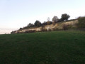
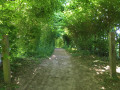
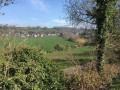
On the edge of Hesbaye, vast fields still make up the bulk of the landscape. This walk, however, takes you along a few tree-lined paths and through wooded valleys, and also allows you to discover a typical (and listed) limestone meadow that has developed following the reclamation of a former quarry.
Walk organised by the walking club “Les Pantouflards de Wihogne” (FFBMP, LG041)

Details

3196234
Creation:
Last update:
Last review:
  • Walking
    Activity: Walking
  • ↔
    Distance: 9.68 mi
  • ◔
    Average duration: 5h 00 
  • ▲
    Difficulty: Moderate

  • ⚐
    Back to start: Yes
  • ↗
    Ascent: + 604 ft
  • ↘
    Descent: - 607 ft

  • ▲
    Highest point: 541 ft
  • ▼
    Lowest point: 285 ft

Photos

Description of the walk

Park in the car park next to the church in Fexhe-Slins, Rue du Premier de Ligne (municipality of Juprelle).

(S/E) Walk to the end of the street, facing east, and turn left into Rue du Mont, then right into Rue Neuve.
Take the dirt track on the left, about 500 m past the cemetery, and join the grassy path that runs alongside the motorway.
At the end of the track, on the tarmac, cross the bridge over the motorway and immediately turn left onto the gravel path that runs alongside the motorway on the other side. Continue until you reach the motorway car park.

(1) Immediately after the car park (the path runs close to the motorway, with the edge of a meadow on the right), go through the narrow wooden gate and enter the meadow. Walk straight up to the other end, at the foot of the chalk cliff. Do not take the footbridge that leads to the other side of the fence, but walk alongside the fence, which runs along the foot of the cliff for about 750 m.

(2) Leave the meadow via the wooden gate (information board about the nature reserve) and take the gravelly path which climbs to the right. This path reaches the plateau, behind the quarry, and leads out into the meadows and then the fields.
Take the first dirt track on the left, level with a large mast. After 300 m, turn left onto a tarmac road, soon lined with trees, and follow it all the way down.

(3) After the hairpin bends, and before the railway bridge, take the path on the right which climbs back up towards the plateau. Follow it for 1 km until you reach a fork in the middle of the fields.

(4) Take the path on the left, which heads back in the opposite direction on a gentle slope. 400 metres further down, take the path on the right (Chavée Arecht).
Follow this path straight on, ignoring the first junction and the one that joins from the left, and continue through the village until you reach Rue Halin.

(5) Turn left onto Rue Halin, which continues as Rue du Rouwa and then as a footpath. You’ll reach the hamlets: Au Buisson / La Tombe (hexagonal signs).

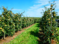
(6) Turn right onto the tarmac-surfaced, tree-lined footpath. At the junction with the road – where there is a large modern shed and a low-stem orchard – carry on straight ahead until you reach the Fork in the road, then turn right here.

(7) Go round an orchard and come out onto a slightly wider concrete path; turn right onto it. Keep to the left at the top of the hill and turn right at the next junction onto Rue de Hermée, which passes under the motorway to reach the village of Fexhe-Slins. Continue straight on along Rue du Chevalier and Rue de la Vallée.
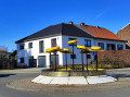
At the next junction (with a central traffic island), turn right and head for the church car park (S/E), situated a little further on to the left.

Waypoints

  1. S/E : mi 0 - alt. 492 ft - Fexhe-Slins Church car park
  2. 1 : mi 2.18 - alt. 328 ft - Chicane at the entrance to the chalk meadow
  3. 2 : mi 2.67 - alt. 292 ft - Chicane at the exit of the chalk meadow
  4. 3 : mi 4.23 - alt. 285 ft - T-junction before the railway line
  5. 4 : mi 5.06 - alt. 482 ft - Junction in the middle of the fields
  6. 5 : mi 6.26 - alt. 492 ft - Houtain-St-Siméon: Rue Halin
  7. 6 : mi 6.57 - alt. 459 ft - Aux Buissons / La Tombe
  8. 7 : mi 7.71 - alt. 472 ft - Orchard
  9. S/E : mi 9.68 - alt. 489 ft - Fexhe-Slins Church car park

Worth a visit

(1 and 2) Information boards and entrance to the Thier de Boirs Nature Reserve: chalk grassland, rough hay meadow and chalk cliffs, on the site of a former quarry. Managed by the non-profit organisation (ASBL) Natagora.
A non-profit association (ASBL) is a legal form of non-profit organisation in Belgium and Luxembourg.

Reviews and comments

4.7 / 5
Based on 2 reviews

Reliability of the description
5 / 5
Ease of following the route
4.5 / 5
Route interest
4.5 / 5
Gauth
Gauth
• Edited:

Overall rating : 4.7 / 5

Date of your route : Oct 29, 2020
Reliability of the description : ★★★★★ Very good
Ease of following the route : ★★★★☆ Good
Route interest : ★★★★★ Very good
Very busy route : No

My 5-year-old son and I didn’t complete the whole route (a circular route going as far as point 2), but the chalk cliffs alone make it well worth a visit. The view across this meadow makes you forget that the motorway is right next to it. Well worth a visit!
One downside, though: in the woods leading up to it, there are illegal rubbish dumps ☹.
Thank you for this walk – I hope we’ll be able to do the whole thing next time 😊

Machine-translated

DSLUSE
DSLUSE

Overall rating : 4.7 / 5

Date of your route : Jul 08, 2020
Reliability of the description : ★★★★★ Very good
Ease of following the route : ★★★★★ Very good
Route interest : ★★★★☆ Good
Very busy route : No

Just as described – quite a lot of tarmac and concrete. Suitable for everyone, as it’s not too difficult and features some classic spots such as the Boirs cliff and the stunning, tree-lined “Chavée”.

Machine-translated

Other walks in the area

For more walks, use our search engine .

The GPS track and description are the property of this route's author. Please do not copy them without permission.