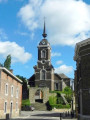
Les Hauts de Froidmont, starting from Houtain-Saint-Siméon

A varied countryside walk leading to the Hauts de Froidmont, passing through fields and tree-lined paths to reach the Geer and follow the valley floor as far as Wonck. The route runs alongside several chalk, marl and silica quarries, some of which have been abandoned and are currently being replanted, and passes several nature reserves.

Route suggested by the walking club “Les Pantouflards de Wihogne” (FFBMP, LG041).

Details

4378043
Creation:
Last update:
Last review:
  • Walking
    Activity: Walking
  • ↔
    Distance: 10.25 mi
  • ◔
    Average duration: 5h 15 
  • ▲
    Difficulty: Moderate

  • ⚐
    Back to start: Yes
  • ↗
    Ascent: + 610 ft
  • ↘
    Descent: - 614 ft

  • ▲
    Highest point: 476 ft
  • ▼
    Lowest point: 213 ft

Photos

Description of the walk

Car park on Rue de la Station, Houtain-Saint-Siméon.

(S/E) From the car park, head to the other end of Rue de la Station, cross Rue du Sartay and take the tarmac footpath lined with trees opposite.

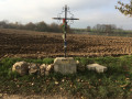
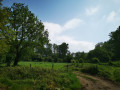
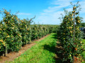
(1) At the first junction (a place known as Al Tombe / Aux Buissons), take the dirt track on the left and follow it for two kilometres. This track crosses fields above the village of Heure-le-Romain, which lies nestled in the valley, and runs alongside quarries and low-stem orchards. Cross the tarmac road and ignore the first junction of dirt tracks, as well as the second one marked by a cross (Croix d’Amry).

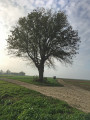
(2) 100 metres past the cross (large oak tree, orchard), take the grassy path on the left which descends to the Trou d’Enfer (signpost a little further down) and runs alongside an old quarry.

(3). Once at the bottom, take the concrete path to the left and join the main road.

(4) Cross the main road (watch out for traffic!) by first turning left then right, and head straight up the hill.

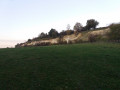
(5) Halfway up the slope, there’s a lovely view of a former quarry that has been fully replanted and is now a protected area. At the top, take the concrete path to the left, then the tarmac road, and pass through the hamlet of Les Hauts de Froidmont.

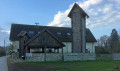
(6) When you reach the covered picnic area, keep to the dirt track on the right, which leads through the fields. Ignore the first track on the right and turn right at the next junction. After one kilometre, two other dirt tracks join this path from the left and it becomes tarmacked. Continue along this path, which soon begins to descend towards the bottom of the valley and starts to wind its way down.

(7) Before the bridge over the railway line, turn right onto a wide dirt track leading to a quarry. Follow it to the entrance of the quarry and continue along the dirt track to the left before the gates. Ignore the track branching off to the left (signpost) and begin the descent towards the Geer valley.

(8) At the bottom of the track, turn right onto a rough road (Chemin du Cherra), then left, 100 metres further on, onto a grassy track running between two pastures. At the bottom, turn left towards the main road. Cross the road diagonally to go round the farm on the left, keeping to the right just below the main road. The path runs between the pastures, crosses a small stream and reaches a junction, where you first turn left then right to continue in the same direction.

(9) At the end of the path (bench), turn left onto the concrete footpath and follow it between the meadows to the village of Wonck. Once in the village, continue straight on along Rue Champs des Course and, at the junction, continue straight on into Rue du Ruisseau (slightly to the right). At the end of the street, keep to the right and take the path leading to the Geer after crossing a small stream.

(10) Before reaching the Geer, take the path on the left which runs between the river and the pastures. The path soon veers away from the Geer to run alongside the other small stream. Continue until you reach the tarmac road and turn sharply left into Rue des Platanes. Cross the main road and head towards the railway bridge.

(11) A few metres past the bridge under the railway line and before the first house, take the path on the right which goes round this house and begins to follow the railway line below it through woodland. Follow it for a good kilometre.

(12) The path leads out onto a circular section of a tarmac road (Rue du Thier Collard). Walk down this road, turn right at the bottom and rejoin the main road near the railway bridge.

(13) Cross the road, making a slight first turn left then right, and head straight on along the track running alongside the railway line. After 400 m, keep to the left to take the small parallel path (signposted). The path soon overlooks the railway tracks and comes out onto a tarmac road near a house.

(14) Turn left onto the tarmac road and head up through the fields (Chavée d’Arecht).

(15) When you reach the junction (Arbre Patrotê), turn left onto the concrete path and follow it (it bends to the right after 50 m) to the village and the car park on Rue de la Station in Houtain-Saint-Siméon (S/E).


Waypoints

  1. S/E : mi 0 - alt. 466 ft - Car park on Rue de la Station – Houtain-Saint-Siméon
  2. 1 : mi 0.34 - alt. 456 ft - Lieu-dit "Au buisson / A la Tombe" : Bancs et table de pique-nique
  3. 2 : mi 1.52 - alt. 394 ft - Croix d’Amry – Heure-le-Romain
  4. 3 : mi 1.82 - alt. 295 ft - Trou d’Enfer
  5. 4 : mi 2.04 - alt. 279 ft - At the bottom of the climb up to the Hauts de Froidmont
  6. 5 : mi 2.23 - alt. 394 ft - "Aux Chênes" : Point de vue sur l'ancienne carrière
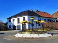
  7. 6 : mi 2.58 - alt. 456 ft - Hauts de Froidmont
  8. 7 : mi 4.18 - alt. 285 ft - Access path to the quarry (former railway line)
  9. 8 : mi 5.56 - alt. 305 ft - Rue Cherra (in poor condition!)
  10. 9 : mi 6.25 - alt. 223 ft - Junction towards Wonck (bench)
  11. 10 : mi 7 - alt. 240 ft - Footbridge over the - Geer (rivière) - Belgique
  12. 11 : mi 7.66 - alt. 259 ft - Start of the trail (after the railway bridge)
  13. 12 : mi 8.25 - alt. 335 ft - Rue Thier Collard (hairpin bend)
  14. 13 : mi 8.46 - alt. 259 ft - Paved crossing (start of the path alongside the railway line)
  15. 14 : mi 9.12 - alt. 322 ft - End of the path; climb up towards the fields
  16. 15 : mi 9.63 - alt. 453 ft - Arbre Patrotê - Houtain-Saint-Siméon
  17. S/E : mi 10.25 - alt. 463 ft - Car park on Rue de la Station – Houtain-Saint-Siméon

Notes

- Al Tombe (1): picnic table.
- Trou d’Enfer (3): picnic table.
- Hauts de Froidmont (6): covered picnic and barbecue area, water, toilets (bookings can be made with the Oupeye local council).
- L'Abreuvoir, Houtain-Saint-Siméon (S/E): light refreshments.

Worth a visit

The route runs alongside or through several nature reserves managed by the Natagora Association, Liège & Basse-Meuse regional section (https://liege.natagora.be)

Reviews and comments

4 / 5
Based on 4 reviews

Reliability of the description
4.3 / 5
Ease of following the route
4.7 / 5
Route interest
3 / 5
ManuRavel
ManuRavel

Hello,
I assume this refers to the section between 11 and 12.
I’ll do it again on Wednesday. It’s well known that the past season was very wet and highly conducive to overgrowth.
Best regards,
Emmanuel

Machine-translated

JPierre2101
JPierre2101

Overall rating : 3.3 / 5

Date of your route : Oct 07, 2024
Reliability of the description : ★★★☆☆ Average
Ease of following the route : ★★★★☆ Good
Route interest : ★★★☆☆ Average
Very busy route : No

A path running alongside the railway line, with limited visibility

Machine-translated

Jane1261
Jane1261

Overall rating : 4.5 / 5

Date of your route : May 30, 2021
Reliability of the description : ★★★★★ Very good
Ease of following the route : Not used / Not applicable
Route interest : ★★★★☆ Good
Very busy route : No

A lovely route, with no major difficulties. As for the advertised distance, I see that someone has noted that, for them, it was 12 km. In my opinion, they’re mistaken. There were two of us, and one of us clocked 16.7 km, whilst the other clocked a little more than that.

Machine-translated

jcmumu
jcmumu

Overall rating : 4 / 5

Date of your route : Dec 11, 2020
Reliability of the description : ★★★★☆ Good
Ease of following the route : ★★★★★ Very good
Route interest : ★★★☆☆ Average
Very busy route : No

A walk through the countryside with no major changes in elevation. A few interesting views over the old quarries. The route takes you through a beautiful natural area, passing through some lovely little wooded spots. There are a few tarmac sections, but not too many. The route is listed as 16 kilometres. Personally, I managed just under twelve kilometres.
The route is not signposted.

Machine-translated

dambich
dambich
• Edited:

Overall rating : 4 / 5

Date of your route : Dec 20, 2020
Reliability of the description : ★★★★★ Very good
Ease of following the route : ★★★★★ Very good
Route interest : ★★☆☆☆ Disappointing
Very busy route : Yes

Plenty of tarmac for my liking – about 40%
And the rest is made up of trails and dirt tracks that are far too busy with mountain bikes and motocross bikes
On the other hand, there’s a lovely picnic area at point 6, but the public toilets are inaccessible

Machine-translated

Other walks in the area

For more walks, use our search engine .

The GPS track and description are the property of this route's author. Please do not copy them without permission.