Country:

 City:
City:



Parallel parking at the entrance to the hamlet of Saint-Sauveur.
(S/E) To start your walk, head up the road for a few metres towards the main square; the start of the path is located between a house and the road leading down to Champ-sur-Drac (there are no directional signs to guide you). After a few dozen metres, the path climbs steeply and, after 1.5 km and an elevation gain of over 300 metres, following the yellow markings, leads you to a wide track.
(1) At a place called Les Sources, turn right onto the track, which climbs gently for just over 1 km – still marked in yellow – and this will take you to Les Hauts de Tillerets.
(2) Leave the track and take the path on your (far) right, which descends towards “Champ village”.
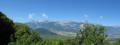
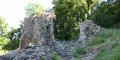
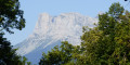
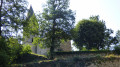
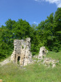
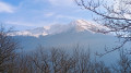
(3) After about 1 km, you’ll reach the site of the Prieuré Saint-Michel; do take a look around and admire, amongst other things, the panoramic view of the Vercors mountain range overlooking the Drac valley.
Continue your descent; after some 600 metres you’ll reach Champ Garo.
(4) Turning left, thePR® trail takes you to Champ Village (listed as Saint-Michel du Conest). Turn left, following Rue des Fontaines and Rue du 8 Mai 1945; here again, follow the yellowPR® markings for about 250 metres.
Please note: make sure you do not miss the turn-off on the right (small yellow marker), between the houses, onto the track which you will follow for about 2 km. When the track turns south, it becomes a track (tarmac in poor condition); after 600 m you will reach Le Touvier.
(5) At Le Touvier, leave this makeshift road and take another gravel track straight ahead for nearly 400 metres. After passing a plot of vineyards on your left, leave the track to the right and take the path towards Saint-Sauveur. This will lead you to a tarmac road which, to the right, takes you the final few hundred metres of the walk back to your starting point (S/E).

 Visorando Member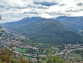

 Easy
Easy