A short walk around Fomperron starting from Le Marchais

A circular route around Fomperron offering beautiful scenery in this area, which consists of numerous patches of pasture bordered by low hedges and tall trees. There are a few points of interest, such as the Suzon wash house in Le Marchais

Details

4016600
Creation:
Last update:
Last review:
  • Walking
    Activity: Walking
  • ↔
    Distance: 6.20 mi
  • ◔
    Average duration: 2h 55 
  • ▲
    Difficulty: Moderate

  • ⚐
    Back to start: Yes
  • ↗
    Ascent: + 82 ft
  • ↘
    Descent: - 82 ft

  • ▲
    Highest point: 620 ft
  • ▼
    Lowest point: 528 ft
  • ⚐ Country: France
  • ⚐ City: Fomperron (79340)
  • ⚑
    Start/End: N 46.480403° / W 0.117332°
  • ❏
    IGN map(s): Ref. 1627SB
  • Hour-by-hour weather

Photos

Description of the walk

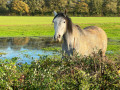
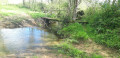
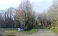
The car park is situated on the small grassy lay-by beside the D329 road at the south-eastern exit of the hamlet of Le Marchais. This car park is right next to a small pond.

(S/E) Leave the car park by carefully walking along the D329 road to the right for about 200 m before turning left onto a farm track. Join a small road at a right-angled bend to the left.

(1) Turn right onto the track flanked by two hedgerows. The route now follows theGR®364. Further on, carefully cross a small road and continue straight ahead along the track, which soon joins a second small road. Turn left and follow the road carefully for about fifty metres.

(2) Leave theGR®364and turn right onto a path lined with low hedges and tall trees. Follow the path, which passes under a high-voltage power line and joins the D58 road.
Follow the D58 to the left with care until you reach a track on the right (you may walk in single file on the roadside verge).
Take this shaded path heading towards the hamlet of La Grande Grivière.

(3) At the junction of three roads where the path joins, take the road on the right which immediately passes through La Grande Grivière. Follow it carefully and, a little further on, pass through the hamlet of La Parlière.
On leaving the hamlet, turn left onto the road that descends into the valley, crosses the Ruisseau de la Parlière and then climbs back up towards the hamlet of La Gâchetière.

(4) As you approach the hamlet, at a triangular junction, take the path on the right which heads south-west. This dirt track is lined with low hedges. Further on, it runs alongside a small pond on the right-hand side. Stay on the main track until you reach a small road to the south of the hamlet known as Le Frêne. The road comes to a junction with the D329 to the north of the hamlet known as La Matière.

(5) Cross the D329 with care and continue straight ahead along the small road leading to La Petite Matière. Just after passing it on your left, continue straight ahead along a farm track that runs west of La Grenière.

(6) At the junction where four paths meet in an almost cross-shaped formation, turn right, then turn right again about 200 metres further on to follow the short western edge of the Bois Porte-Faix before heading towards the hamlet of Le Chêne.
Pass Le Chêne and, on reaching the D58, turn carefully left for about thirty metres.

(7) At the Y-junction with the Route de la Gibaudière, turn right onto the farm track running along the edge of the Bois des Boules on your right.
Join the D121. Turn right and follow it carefully for a good hundred metres.

(8) Turn left onto the road leading to the hamlet of Les Andraudières. Before reaching the hamlet, take the path on the right heading north.
Further on, the track reaches a crossroads known as ‘Croisement de la Croix Michaud’.
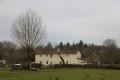
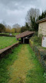
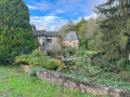
At this point, take a moment to enjoy the scenery and admire the pastures bordered by low hedges and tall trees.

Continue by taking the path almost directly opposite, slightly to the left, heading north-east towards the hamlet of Le Marchais.
On reaching the hamlet, the route follows the Chemin du Logis. At the Y-junction, take the road on the right which joins the D329.

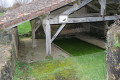
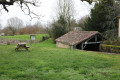
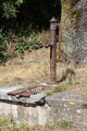
Turn right when you reach it and follow the road with care. Almost immediately, on the left-hand side of the road, you’ll see the Lavoir de Suzon (see the ‘During the walk’ section).
Walk through the entire hamlet and continue along the road to the car park (S/E).

Waypoints

  1. S/E : mi 0 - alt. 610 ft - Parking along the D329 road (pond)
  2. 1 : mi 0.4 - alt. 554 ft - Junction of roads and paths, including the GR364
  3. 2 : mi 0.9 - alt. 564 ft - Road–path junction
  4. 3 : mi 1.75 - alt. 535 ft - Crossroads and footpath at La Grande Grivière
  5. 4 : mi 2.26 - alt. 548 ft - Junction of road and footpath at La Grande Gâchetière
  6. 5 : mi 2.99 - alt. 591 ft - Junction with the D329 road at La Matière
  7. 6 : mi 3.72 - alt. 604 ft - Junction of farm tracks forming almost a cross
  8. 7 : mi 4.21 - alt. 610 ft - Junction of the D58 and La Guibautière, after Le Chêne
  9. 8 : mi 4.91 - alt. 587 ft - Junction of the D121 and the Route des Andraudières
  10. S/E : mi 6.2 - alt. 610 ft - Parking along the D329 road (pond)

Notes

This walk across varied terrain requires sturdy footwear.

This route is partially signposted as it follows theGR®364for a short stretch and, further on, part of a route published by the Deux-Sèvres Departmental Hiking Committee: ‘From the Fontaine Pérenne to the Lavoir de Suzon’, but in reverse (starting from5). On these sections of the route, it is signposted in white and red for theGR® and in yellow. The rest is not signposted, but is straightforward in terms of navigation. Nevertheless, it is advisable to follow the directions in this description and on the map, whilst also taking note of the surrounding landscape. Distance markers from the starting point, and even the GPS coordinates of waypoints (including the start), can also help hikers find their way.

Hike completed by the author on1 February 2022. A little-used route.

Worth a visit

_Fomperron_
Etymology: originally called Font-Perron (which became Fomperron) due to a fountain reputed to be inexhaustible, situated near the village.
It belonged in part to the Abbey of Les Châteliers, founded in 1110 by Saint Giraud de Salles.
Roman occupation: remains of an ancient tile works at La Gachetière.
Fortified farms: L’Eteil and La Guilletière. Church, 1693.
Ruins of the 12th-century Abbey of Les Châteliers: remains of the church, 12th-century nave, 13th-century chancel.
Remains of the former chaplaincy: vaulted walls.

Le Marchais
Suzon wash house
Suzanne Le Breton, née Leveau (1920–1999). Laundress – that was her trade in Suzon. Having arrived in the village when she was barely 14 years old, she would go from farm to farm every week to do the daily washing and the big washes. The ‘bugée’ (or ‘bugeaille’) – 60 to 80 sheets – once a year, in fine weather.
She certainly earned her wages, as she also had to look after the children, milk the cows and goats, and feed the pigs. There was no shortage of work…
Suzanne loved nothing more than the water from the fountain – pure and cool in summer, lukewarm in winter – and that from her washhouse. She remained faithful to it for sixty years.
Source: The washhouses of Deux-Sèvres

Always be cautious and plan ahead when you're outdoors. Visorando and the author of this route cannot be held responsible for any accidents occurring on this route.

The GR® and PR® markings are the intellectual property of the Fédération Française de Randonnée Pédestre.

Reviews and comments

4.7 / 5
Based on 2 reviews

Reliability of the description
5 / 5
Ease of following the route
5 / 5
Route interest
4 / 5
Bertrand94
Bertrand94

Overall rating : 4.7 / 5

Date of your route : Oct 31, 2023
Reliability of the description : ★★★★★ Very good
Ease of following the route : ★★★★★ Very good
Route interest : ★★★★☆ Good
Very busy route : No

A lovely walk through the countryside.

Machine-translated

jjbch86
jjbch86

Overall rating : 4.7 / 5

Date of your route : Jul 20, 2022
Reliability of the description : ★★★★★ Very good
Ease of following the route : ★★★★★ Very good
Route interest : ★★★★☆ Good
Very busy route : No

Hello, thank you for this app

Machine-translated

Other walks in the area

For more walks, use our search engine .

The GPS track and description are the property of this route's author. Please do not copy them without permission.