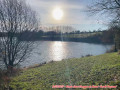
Around Chantecorps

A short walk through the former commune of Chantecorps, along sunken paths and small country lanes. It is based on a walk featured in a leaflet published by the Parthenay Gâtine heritage service.

Details

48384982
Creation:
Last update:
Last review:
  • Walking
    Activity: Walking
  • ↔
    Distance: 4.92 mi
  • ◔
    Average duration: 2h 20 
  • ▲
    Difficulty: Easy

  • ⚐
    Back to start: Yes
  • ↗
    Ascent: + 98 ft
  • ↘
    Descent: - 105 ft

  • ▲
    Highest point: 653 ft
  • ▼
    Lowest point: 548 ft
  • ⚐ Country: France
  • ⚐ City: Chantecorps (79340)
  • ⚑
    Start/End: N 46.496631° / W 0.155591°
  • ❏
    IGN map(s): Ref. 1627SB
  • Hour-by-hour weather

Photos

Description of the walk

Park at Place de l’Église.

(S/E) From the car park, head south along Rue de la Vallouze. After crossing the Ruisseau de Chantecorps, turn right at the junction and follow the path to the left.

(1) Take this track and, at the next junction, turn left until you reach a road. Take this road on the left. Walk past a pond and reach a track on the right.

(2) Walk along this track, cross the footbridge over the Ruisseau de Chantecorps and reach the D329. Cross carefully and continue along this lovely track, ignoring the track on the left, until you reach a road at a four-way junction.

(3) Turn right, heading towards Le Lessi, along the small road. Ignore the road on the right and arrive at another junction (near a stream).

(4) Head straight on towards La Coudre and, after the hamlet, you’ll reach a T-junction at the entrance to the Bois de La Coudre.

(5) Turn left and follow this track, which crosses the (private) woods, without leaving it, until you reach a crossroads.

(6) Turn left and return to the four-way junction you passed on the way there.

(3) Turn right onto the road and continue until you reach a left-hand bend, just before Les Fosses.

(7) Take the path opposite and follow it until you reach a road.

(8) Turn right and, in front of the wayside shrine, turn right again and head into Chantecorps to reach the starting car park (S/E).

Waypoints

  1. S/E : mi 0 - alt. 574 ft - Place de l’Église
  2. 1 : mi 0.29 - alt. 591 ft - Crossroads (road/path)
  3. 2 : mi 0.68 - alt. 568 ft - Crossroads (road/path)
  4. 3 : mi 1.53 - alt. 574 ft - Junction where the two circular loops meet. Road/path
  5. 4 : mi 2.14 - alt. 640 ft - Crossroads
  6. 5 : mi 2.52 - alt. 653 ft - Junction of the road and forest track
  7. 6 : mi 3.3 - alt. 620 ft - Crossroads (road/path)
  8. 7 : mi 4.37 - alt. 597 ft - Crossroads (road/path)
  9. 8 : mi 4.72 - alt. 568 ft - Crossroads opposite the wayside cross
  10. S/E : mi 4.92 - alt. 574 ft - Place de l’Église

Notes

This walk is not particularly difficult but, in wet weather, you will need suitable footwear.
After point (7), you may find that an electric fence blocks the path. In this case, turn back and head for the road, cross Les Fosses and proceed to point (8).

Worth a visit

The commune of Chantecorps no longer exists, having merged on 1 January 2019 with its neighbour Coutières to form the new commune of Les Châteliers.
Worth seeing in the village is the Romanesque-style Church of Saint-Philibert.
Near the Étang des Châteliers, you can see the ruins of the former Cistercian abbey, which have been converted into farm buildings.
In the village of Coutières, you can visit the Jardin des Sens at your leisure.

Reviews and comments

4.7 / 5
Based on 2 reviews

Reliability of the description
4.5 / 5
Ease of following the route
5 / 5
Route interest
4.5 / 5
79310
79310

Overall rating : 4 / 5

Date of your route : May 11, 2024
Reliability of the description : ★★★★☆ Good
Ease of following the route : Not used / Not applicable
Route interest : ★★★★☆ Good
Very busy route : No

Given the rainy spell we’ve had, the vegetation along some of the paths was tall,
very dense and damp. We altered the route to avoid these sections. A peaceful walk with
a very pleasant stretch along the edge of the woodland.

Machine-translated

Fanille
Fanille

Overall rating : 5 / 5

Date of your route : May 13, 2024
Reliability of the description : ★★★★★ Very good
Ease of following the route : ★★★★★ Very good
Route interest : ★★★★★ Very good
Very busy route : No

A really lovely route, with a pretty path through the woods. It had rained in the days leading up to it, so the path hadn’t dried out in several places. There was a bit of road, but no traffic.
-However, at point 7, the path is blocked twice by a live electric fence!! along the stream. It’s impossible to get round it. After enquiring, I learnt it’s a local council path – so why is the fence there?
Once we’d got past the inconvenience and the fear of crossing it, it’s still a walk I’d recommend
which we thoroughly enjoyed.

Machine-translated

Other walks in the area

For more walks, use our search engine .

The GPS track and description are the property of this route's author. Please do not copy them without permission.