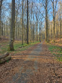
A short walk in Ransbeck

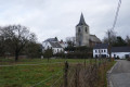
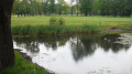
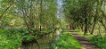
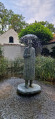
Here’s a short, circular walk to enjoy when you’re looking to unwind and don’t have much time. After a stretch of cobblestones, the path turns into a dirt track, then a sunken lane, before crossing the Royal Waterloo Golf Course. Another sunken lane leads us to a cobbled road, bringing the route to a close.

Details

47293852
Creation:
Last update:
Last review:
  • Walking
    Activity: Walking
  • ↔
    Distance: 1.89 mi
  • ◔
    Average duration: 1h 00 
  • ▲
    Difficulty: Easy

  • ⚐
    Back to start: Yes
  • ↗
    Ascent: + 135 ft
  • ↘
    Descent: - 164 ft

  • ▲
    Highest point: 404 ft
  • ▼
    Lowest point: 295 ft

Photos

Description of the walk

(S/E) Car park on the Place de Ransbeck or a little further on, on the Chemin du Mont near thefirst junction. Follow this cobbled path, ignoring a road coming from the left, and cross the small river, the Coulant d’Eau.

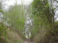
(1) Just after the river, turn right onto the Chemin du Bosquet, which quickly becomes a dirt track and climbs up a sunken path to emerge, at the plateau, on the edge of the Royal Waterloo Golf Course.

(1) At thefirst junction – see practical information – turn left and follow the Sentier de l’Abbaye (no. 57). You’ll cross the golf course. When you reach the tarmac road, follow it to your left for about 100 metres.

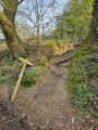
(3) Then head down the Chemin du Boiteux on your left and continue until you come to what looks like a flight of steps on your right, leading up the embankment.

(4) This is the start of the Sentier du Bois Theule (no. 70), which you follow until it joins the Chemin des Messes.

(5) Head down this path to the left and follow the cobblestones until you reach the Coulant d’Eau.

(1) Continue along the path you started on, in the opposite direction, to the car park (S/E).

Waypoints

  1. S/E : mi 0 - alt. 331 ft - Ransbeck car park
  2. 1 : mi 0.08 - alt. 295 ft - The Coulant d’Eau
  3. 2 : mi 0.45 - alt. 358 ft - Golf
  4. 3 : mi 0.92 - alt. 404 ft - Chemin du Boiteux
  5. 4 : mi 1.2 - alt. 351 ft - Staircase
  6. 5 : mi 1.44 - alt. 371 ft - Chemin des Messes
  7. S/E : mi 1.89 - alt. 331 ft - Ransbeck car park

Notes

This route partly follows another local walking trail, “Ohain champêtre”

Reviews and comments

5 / 5
Based on 2 reviews

Reliability of the description
5 / 5
Ease of following the route
5 / 5
Route interest
5 / 5
Patrick Vanbellinghen

Thank you for your kind words... I wish you lots more fun and discoveries on all the beautiful paths in our lovely region.

Machine-translated

McDuffe
McDuffe
• Edited:

Overall rating : 5 / 5

Date of your route : Dec 15, 2025
Reliability of the description : ★★★★★ Very good
Ease of following the route : ★★★★★ Very good
Route interest : ★★★★★ Very good
Very busy route : No

A superb little one-hour walk starting from the charming little square in Ransbeck. No tarmac or concrete, just varied and very pleasant paths, including a section on charming old cobbled roads. Lots of beautiful old trees along the route. A real discovery just 12 minutes from my home. Thank you to the author, whose other trails I will be eager to try out.

Machine-translated

Patrick Vanbellinghen

Thank you

Machine-translated

clucion
clucion

Overall rating : 5 / 5

Date of your route : Aug 10, 2025
Reliability of the description : ★★★★★ Very good
Ease of following the route : ★★★★★ Very good
Route interest : ★★★★★ Very good
Very busy route : No

Interesting and easy

Machine-translated

Other walks in the area

For more walks, use our search engine .

The GPS track and description are the property of this route's author. Please do not copy them without permission.