


 Country:
 City:
City:


Watch out for two difficult sections: a stretch along a field on a rough path, followed by a steep descent to join a path further down within the first kilometre.
A short walk in Ohain


There are several walking guides available for Lasnes. There are booklets and a map showing all the walks. This walk partly follows the route of Walk No. 1. Signposts are in place. The walk then returns fairly directly to Place de Ohain, the starting point. There is a bench at a junction of small roads.
Details
Creation:
Last update:
Last review:
–
–
-
 Activity: Walking
 -
 Distance: 2.30 mi
 -
 Average duration: 1h 10
 -
 Difficulty: Moderate
 -
-
 Back to start: Yes
 -
 Ascent: + 167 ft
 -
 Descent: - 453 ft
 -
-
 Highest point: 614 ft
 -
 Lowest point: 233 ft
Waypoints
- S/E : mi 0 - alt. 614 ft - Ohain
- 1 : mi 0.19 - alt. 266 ft - Route de la Marache
- 2 : mi 0.94 - alt. 236 ft - N271
- 3 : mi 1.42 - alt. 351 ft - Bench
- 4 : mi 1.51 - alt. 344 ft - End of walk no. 1
- 5 : mi 2.16 - alt. 308 ft - N271
- S/E : mi 2.3 - alt. 335 ft - Ohain
Notes
Other walks in the area
The Waterloo Golf Course, the Smohain Valley and its old mill
 Visorando Member
 7.60 mi
+531 ft
-531 ft
3h 55
Moderate
7.60 mi
+531 ft
-531 ft
3h 55
Moderate
 Departure from Lasne (Brabant Wallon)
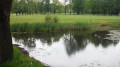
This walk will help you discover Ohain. Miss Kika will take you along small paths, trails and lanes, crossing the golf course towards the Smohain valley, which you will follow for most of the walk. Together with the Lasne river, into which it flows, it gives the village its relief, while the numerous ponds attract many species of birds. The variety of landscapes, horses and numerous marked trails are what make this town so charming.
Ohain champêtre
 Association / Club / Walk leader
 7.95 mi
+394 ft
-397 ft
4h 00
Moderate
Departure from Lasne (Brabant Wallon)
7.95 mi
+394 ft
-397 ft
4h 00
Moderate
Departure from Lasne (Brabant Wallon)
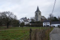
The route is suitable for Nordic walking, despite a few short stretches of tarmac on small country roads or, occasionally, cobblestones.Ohain is renowned for its agriculture and for the diversity and beauty of its landscape.Several watercourses flow through the municipality, such as the Lasne (a tributary of the Dyle) and a few streams, including the Ohain.
A short walk in Ransbeck
 1.89 mi
+135 ft
-164 ft
1h 00
1.89 mi
+135 ft
-164 ft
1h 00
 Easy
Departure from Lasne (Brabant Wallon)
Easy
Departure from Lasne (Brabant Wallon)
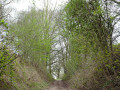
Here’s a short, circular walk to enjoy when you’re looking to unwind and don’t have much time. After a stretch of cobblestones, the path turns into a dirt track, then a sunken lane, before crossing the Royal Waterloo Golf Course. Another sunken lane leads us to a cobbled road, bringing the route to a close.
Circular route around Waterloo Golf Course starting from Ransbeck
 2.62 mi
+266 ft
-266 ft
1h 25
Easy
Departure from Lasne (Brabant Wallon)
2.62 mi
+266 ft
-266 ft
1h 25
Easy
Departure from Lasne (Brabant Wallon)
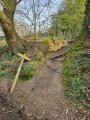
A lovely 4 km circular route around the Royal Golf Club of Waterloo, starting from the charming Place de Ransbeck. This route is a slightly longer version of the walk entitled ‘A short walk in Ransbeck’, with the difference that this route passes by the Chapelle Jacques.
Short loop at the Royal Golf Club of Waterloo
 3.77 mi
+210 ft
-187 ft
1h 55
Easy
Departure from Lasne (Brabant Wallon)
3.77 mi
+210 ft
-187 ft
1h 55
Easy
Departure from Lasne (Brabant Wallon)
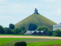
This short walk takes you through the countryside to the bleak plain of Waterloo and its magnificent golf course, where golf enthusiasts have long since replaced Napoleon's armies.
A short walk in Couture-Saint-Germain
 4.32 mi
+433 ft
-433 ft
2h 20
Easy
Departure from Lasne (Brabant Wallon)
4.32 mi
+433 ft
-433 ft
2h 20
Easy
Departure from Lasne (Brabant Wallon)
Starting from the car park on the Route de l’Etat near the Maransart ponds, this short walk allows you to discover various aspects of Couture-Saint-Germain. Narrow nature trails link little-known neighbourhoods, with their beautiful houses, to the ponds in the Lasne Valley. Couture-Saint-Germain, like its neighbours Plancenoit and Lasne, has managed to preserve a wealth of walking trails waiting to be explored.
Double circular loop starting from Fedasil Rixensart
12.50 mi
+978 ft
-968 ft
6h 35
 Difficult
Departure from Rixensart (Brabant Wallon)
Difficult
Departure from Rixensart (Brabant Wallon)
A route starting from Fedasil Rixensart. It then passes by Lake Genval, Maubroux Church, the Carpu Nature Reserve, the Mahiermont district, Route de Renipont, Odrimont (Lasne), the village square (Ohain), Saint-Etienne Church, Route de la Marache, Dadelane, Rue du Moulin, Renipont beach, Rue du Baillois, Bourgeois, the tram quay and Rixensart Park. Fairly significant elevation gain
Circular route to Couture-Saint-Germain and La Lasne
 5.88 mi
+492 ft
-479 ft
3h 10
Moderate
Departure from Lasne (Brabant Wallon)
5.88 mi
+492 ft
-479 ft
3h 10
Moderate
Departure from Lasne (Brabant Wallon)
Here is a circular walk allowing you to discover the beautiful spots of the Lasne - Couture-Saint-Germain area, sometimes completely surrounded by nature, sometimes passing through the pretty neighbourhoods of this area. It involves a lot of ups and downs: the walk is in the "Brabant double 'v'allon" and the views are superb.
For more walks, use our search engine .
The GPS track and description are the property of this route's author. Please do not copy them without permission.

