Country:
 City:


Coming from Bandol or Sanary, head towards Sanary Zoo. Just after passing under the motorway, instead of turning left onto Avenue du Pont d’Aran, which leads to the zoo (ZOA Parc), carry on straight ahead along Chemin de Sainte-Trinide, which – after the junction on the right-hand side of which stands the Chapel of Sainte-Trinide (private property) – continues under the name Chemin de la Piole. Carry on for about 600 metres until you reach a right-hand bend in a more open area; just before this bend, there is a sign describing the walking trails. To the right, opposite the sign, there is a parking area alongside a low dry-stone wall, with space for about three cars. Park here. If there is no space, there are a few widenings of the road before or after this point, each of which can accommodate one car. This is a drawback of this spot: there aren’t many parking options.
(S/E) Set off from the hiking signpost. The path runs between two private properties, lined with wattle fences and bamboo, heading north. Once you reach the back of the houses in an open area, leave a path on your right which you will take on the return journey. Continue straight ahead, climbing up the rocky area.
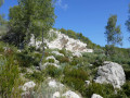
(1) After climbing for about 60 m, turn right onto a clearly marked path that climbs quite steeply; you will soon come across a white marker vaguely resembling a ruin (see the first photo). The first of these ruins (in fairly good condition) will, in fact, be visible on the left after about 200 m, followed by several others that are much more dilapidated. After the last ruin, and after taking a sharp bend to the left, the path descends towards the bottom of the valley.
(2) At the bottom of the valley, the vegetation becomes very dense; alongside the kermes oaks, sarsaparilla and other plants grow, making progress more difficult, especially as you have to cross quite a number of rocky ledges. After about 500 m of this ‘ordeal’, the path climbs into a more welcoming pine forest and, after a few hairpin bends, turns westwards to emerge into a clearing where there is a cistern.
(3) Leave a wide path on your left which descends back towards our starting point (described in a previous walk), and walk past the SNR14 cistern.
(4) At the junction, leave the path on your right which descends southwards (and leads to LaRoche Curade, described in a previous walk) and join the ridge road.
(5) On the other side of the road, take the botanical trail heading east. However, the road itself is very pleasant, and you’ll rejoin it further on. It’s also possible to find a path continuing from the botanical trail, which allows you to reach the next point without ‘treading on tarmac’.
(6) Turn right off the road onto the short forest track which leads to a clearing with some buildings whose purpose I do not know; from there, you join the path known as the Chemin de la Colle, which descends eastwards and then very quickly southwards. This path, which retains good surfacing in places, was certainly once a much-used logging track. After a wide circular route, it crosses a small valley and climbs back up onto the Piste Forestière Jean-Paul Siri. Follow this southwards for about 200 m.
(7) Then take a path on the right which climbs up onto a rocky outcrop and continue westwards for about 150 m, until you find the entrance to a footpath at a bend in the path.
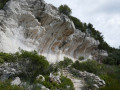
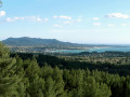
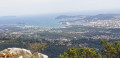
(8) This path, known as the Chemin du Jardin Japonais, heads broadly north-west, almost horizontally. It crosses a beautiful rock-carved basin, where a lovely natural pool of water almost always remains, then continues along a ledge, often offering fine views of Sanary and Bandol.
(9) When you reach a five-way junction, take the path straight ahead to descend a very rocky, gullied track which acts as a stream bed during heavy rain. As you approach the houses, you can admire a fairly well-preserved old lime kiln on the right. You then rejoin the original path between the stone walls.
(S/E) Return to the road and the car park.

 Visorando Member

 Difficult
 Easy
 Association / Club / Walk leader