Walk in the hills above Sanary

Set between the hustle and bustle of the promenade and Sanary’s largest beach, and the tranquillity of the vineyards and olive groves on the town’s hillsides, this is a very simple walk suitable for everyone, particularly wheelchair users (see the description for further details).

Details

n°21536484
Creation:
Last update:
Last review:
  • Walking
    Activity: Walking
  • ↔
    Distance: 3.57 mi
  • ◔
    Average duration: 1h 55 
  • ▲
    Difficulty: Easy

  • ⚐
    Back to start: Yes
  • ↗
    Ascent: + 302 ft
  • ↘
    Descent: - 308 ft

  • ▲
    Highest point: 282 ft
  • ▼
    Lowest point: 0 ft

Photos

Description of the walk

Coming from the Sanary area, heading towards Bandol along the coastal road (Route de Bandol – D559), as soon as you reach the coastal road, park on the right: there are parallel parking spaces along a large wall clad in facing stones, with palm trees growing at the top.

(S/E) Cross the road to take the footpath overlooking the bay. Continue towards Bandol until you come to a small gate on the left leading to the beach (sign reading: ‘Smoke-free beach’).

(1) You can use this access point to make your way down to the beach.

For wheelchair users, this option is available, provided you have assistance for the approximately 300-metre walk along the sand. Alternatively, you can continue along the pavement until you reach a wooden ramp, which allows you to descend easily onto the beach.

(2) Just at the bottom of the beach access ramp, there is a tunnel that allows you to pass under the road and join the Vallon des Fosses path. This path is concrete and very easy to navigate by wheelchair along its entire length.
Be careful, however, as it ends with a flight of steps leading to the Chemin de la Canolle. Assistance is required to climb these in a wheelchair (around 25 wooden steps, which are not very high). One way to avoid this obstacle is to continue through the tunnel towards Bandol, then turn right onto the Chemin de la Canolle, which first passes under the railway viaduct, then climbs up to the level of the railway line, and descends again through the pine trees back to the Chemin de la Canolle. This adds 700 metres to the journey, but the Chemin de la Canolle is very pleasant at this higher elevation and has very little traffic.

(3) Walk down the Chemin de la Canolle to the roundabout. Then turn left onto the old Chemin de Toulon, which has good, smooth pavements.

(4) After a gentle climb, turn right onto the Chemin de la Grande Bastide. It first passes through an area of pine forest and then, higher up, through vineyards, whilst drawing closer to the motorway, which is neither visible nor audible; this is the Chemin de la Carrerade de l’École Sainte-Trinide (phew! quite a long name).

As it reaches a pine forest, this little road turns right at a right angle and descends steeply at first, then more gently, through a residential area, until it joins the old Chemin de Toulon. Then turn left onto this street, lined with lovely pavements, until you reach the roundabout.

(5) At the roundabout, turn right onto the Chemin de la Morvenède and follow it down until you’re running alongside the railway line. After 300 metres alongside the railway line, pass underneath it through a short tunnel. Then turn left and follow the road until you reach the coastal road, near the restaurant “Le Dragon d’Or”. Walk a few dozen metres towards Bandol to return to the car park (S/E).


Waypoints

  1. S/E : mi 0 - alt. 79 ft - Parking along the coastal road
  2. 1 : mi 0.31 - alt. 39 ft - Access to the sea
  3. 2 : mi 0.54 - alt. 13 ft - Tunnel under the coastal road
  4. 3 : mi 0.9 - alt. 118 ft - Junction with the Chemin de la Canolle
  5. 4 : mi 1.41 - alt. 125 ft - Access to the Chemin de la Grande Bastide
  6. 5 : mi 2.78 - alt. 223 ft - Access to the Chemin de la Morvenède
  7. S/E : mi 3.57 - alt. 79 ft - Parking along the coastal road

Notes

Walk taken in March 2022.

For a walker without any disability, this walk presents no difficulty whatsoever. For a wheelchair user, assistance is required for the section along the beach and for the flight of steps at the end of the Vallon des Fosses path, but we have mentioned above (between points (1) and (2), and between points (2) and (3)) the options for getting round these difficulties.

Worth a visit

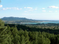
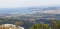
The first section runs along the coast, on the Corniche road, offering a beautiful panoramic view of Bandol Bay, between Pointe de la Tourette and Bendor Island, with the pine-wood-lined residential area of Sanary to the left and the somewhat garish development of Bandol to the right, which flaunts its somewhat ‘upmarket’ seaside resort character.

Depending on sea conditions, you can watch the surfers in action off the coast of Plage Dorée.

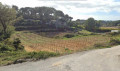
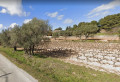
Up on the hills, you can enjoy the tranquillity of the vineyards and olive groves, with views out over the coastline.

Reviews and comments

4 / 5
Based on 3 reviews

Reliability of the description
4.3 / 5
Ease of following the route
4.3 / 5
Route interest
3.3 / 5
User 31021649

Overall rating : 5 / 5

Date of your route : Oct 04, 2026
Reliability of the description : ★★★★★ Very good
Ease of following the route : ★★★★★ Very good
Route interest : ★★★★★ Very good
Very busy route : No

A very pleasant walk – easy to do and, above all, with lovely scenery – and paths I didn’t know, even though I drive past them very regularly

Machine-translated

stjo
stjo

I’m sorry if my reply, which was meant to be a bit of a joke, upset you.
Let’s set the record straight: this isn’t a hike but simply a stroll through a semi-urban area, obviously with streets, roads and cars – especially in summer (as you’d expect from a seaside resort) – intended for those who want to ‘pop out for a bit’ without any difficulty (including accessibility for people with reduced mobility). I can assure you that it’s thoroughly enjoyable out of season, and I’d invite you, if you get the chance, to do it again on a lovely winter’s day and in the opposite direction, which is more enjoyable.
Kind regards.

Machine-translated

Dominique Duc
Dominique Duc

It’s a shame we can’t leave a review without being mocked!!
Then again, given the number of reviews for this walk, it can’t be attracting many people.

Machine-translated

stjo
stjo
• Edited:

@Dominique Duc, that would have surprised me!
Too much driving: when you’re planning a trip, you look at the map first, and if you reckon there’s too much driving involved, you move on to something else.
Too many cars: when doing this route in summer, it’s hardly surprising – as Michel Galabru might have said: “It’s the summer!”
The train: it won’t have escaped your notice that the map shows a railway line, which, incidentally, we only run alongside for a very short stretch!
Conclusion: next time, lay your towel on the Plage Dorée.

Machine-translated

Dominique Duc
Dominique Duc

Overall rating : 3 / 5

Date of your route : Sep 22, 2024
Reliability of the description : ★★★★☆ Good
Ease of following the route : ★★★★☆ Good
Route interest : ★☆☆☆☆ Very disappointing
Very busy route : No

The appeal of the walk is limited to Dorée Beach.
Too much road, too many cars – and the train to boot!!
The route is busy with cars, not walkers 😭

Machine-translated

stjo
stjo
• Edited:

To address in advance any concerns from those, such as @Autrautruche, who might find it difficult to reach the point (2) after heading down to the beach: it is clear that, given the retreat of the coastline, access is now difficult at the first rocky headland you come to, unless you wade through the water (not recommended in rough seas) or climb over the rocks. You should therefore now continue along the road and walk down about 250 metres further, to ‘Plage du Lido’, where there is a good staircase providing access. I will therefore amend the route description to reflect this.

What’s more, we’ve done this route twice, but in the opposite direction, and it’s much more pleasant, if only because you have the sun at your back, and because most of the climb is at the start. This is just my opinion, but I much preferred this route in that direction (anti-clockwise).

Machine-translated

Autrautruche
Autrautruche

As for the crossing between 1 and 2, it wasn’t possible yesterday via the beach. I got stuck just after the first beach, but there were a few waves – it might be possible on calmer days.

Machine-translated

stjo
stjo

@Autrautruche, regarding the passage between (1) and (2), that’s an interesting point: perhaps you arrived when the sea was a bit rough, and it’s possible that the waves were preventing you from crossing by water? Please could you clarify? It’s also possible that, as is often the case along this coast, the beach has receded since I was last there. If so, I hope a path has been created to get across that threshold. I’ll certainly go and have a look in person over the next few days.

Machine-translated

Autrautruche
Autrautruche

Overall rating : 4 / 5

Date of your route : Jan 29, 2023
Reliability of the description : ★★★★☆ Good
Ease of following the route : ★★★★☆ Good
Route interest : ★★★★☆ Good
Very busy route : Yes

A lovely, easy walk that takes you along the classic (very busy) seaside promenade as well as inland, where I bumped into a few locals out for a stroll.
However, I couldn’t work out how to get from point 1 to point 2; once I’d gone down to the beach, the path was blocked. Perhaps it’s possible when the sea is calmer?

Machine-translated

Other walks in the area

For more walks, use our search engine .

The GPS track and description are the property of this route's author. Please do not copy them without permission.