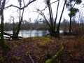
A route in the Korker Wald

This route takes you through the Kammbach-Niederung (Natura 2000 site), Rench-Niederung and Korker Wald bird protection areas, as well as the Östliches Hanauer Land flora and fauna protection area (Natura 2000 site).

Details

3725845
Creation:
Last update:
Last review:
  • Walking
    Activity: Walking
  • ↔
    Distance: 7.77 mi
  • ◔
    Average duration: 3h 35 
  • ▲
    Difficulty: Moderate

  • ⚐
    Back to start: Yes
  • ↗
    Ascent: + 26 ft
  • ↘
    Descent: - 30 ft

  • ▲
    Highest point: 489 ft
  • ▼
    Lowest point: 436 ft

Description of the walk

In the village of Legelshurst, which is about twenty kilometres from Strasbourg, follow Rue Eichenweg to the edge of the forest. Park at the Fork in the road at the edge of the forest.

(S/E) Take the path on the right into the forest.

(1) At the four-way junction, turn right. Turn left at the Fork in the road, then right. Cross the bridge and you’ll soon come to a path branching off to the left.

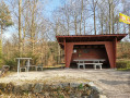
(2) Turn left, follow the river and reach a multi-way junction with a shelter.

(3) At this point, take a sharp right-hand bend.

(4) Turn right after the bridge, pass a path on the left and join the next one at the edge of the woodland.

(5) Turn left and follow the edge of the forest. Cross a causeway and continue straight on until you reach a path branching off to the right.

(6) Turn right into the woodland. Cross a path and carry straight on.

(7) Turn left at the T-junction. Go straight on at the next junction, then at the four-way junction, turn right onto a causeway.

(8) Turn left onto the embankment running alongside a canal. Continue along it until you reach a lock.

(9) Turn left onto the embankment. Stay on this embankment as it bends to the left. Continue straight ahead at the next junction.

(10) At the fork in the road, turn right. Cross a road and head back to the four-way junction from the outward journey.

(3) Turn right, cross the bridge at the junction with the shelter and carry on straight on towards Legelshurst. At the four-way junction, go straight on and then take the left-hand turn at the Fork in the road.

(11) Turn left, then turn right at a small hut. Return to the Fork in the road where you started at the end of the forest (S/E).

Waypoints

  1. S/E : mi 0 - alt. 463 ft - Fork in the road at the edge of the forest.
  2. 1 : mi 0.27 - alt. 463 ft - Turn right at the junction.
  3. 2 : mi 0.57 - alt. 453 ft - Turn left at the river.
  4. 3 : mi 1.42 - alt. 456 ft - Junction of the circular loop
  5. 4 : mi 1.77 - alt. 440 ft - Turn right at the fork after the bridge.
  6. 5 : mi 2.14 - alt. 456 ft - Turn left at the fork along the edge of the forest.
  7. 6 : mi 2.46 - alt. 463 ft - Turn right at the fork in the forest.
  8. 7 : mi 3.06 - alt. 466 ft - Turn left at the fork.
  9. 8 : mi 3.83 - alt. 446 ft - Turn left onto a dyke.
  10. 9 : mi 4.5 - alt. 436 ft - Turn left onto a dyke.
  11. 10 : mi 5.78 - alt. 453 ft - Turn right at the fork.
  12. 11 : mi 7.27 - alt. 489 ft - Turn left at the fork.
  13. S/E : mi 7.77 - alt. 459 ft - Fork in the road at the edge of the forest.

Notes

No water source.
Shelter at (3).
Can be done easily in all weathers.

Worth a visit

Kammbach-Niederung (Natura 2000 site), Rench-Niederung and Korker Wald bird protection areas.

Östliches Hanauer Land Flora and Fauna Protection Area (Natura 2000 site).

Reviews and comments

4.5 / 5
Based on 2 reviews

Reliability of the description
5 / 5
Ease of following the route
5 / 5
Route interest
3.5 / 5
Daniel67
Daniel67

Overall rating : 4.7 / 5

Date of your route : Mar 23, 2026
Reliability of the description : ★★★★★ Very good
Ease of following the route : ★★★★★ Very good
Route interest : ★★★★☆ Good
Very busy route : No

a lovely walk

Machine-translated

User 11447137

Overall rating : 4.3 / 5

Date of your route : Feb 22, 2026
Reliability of the description : ★★★★★ Very good
Ease of following the route : ★★★★★ Very good
Route interest : ★★★☆☆ Average
Very busy route : No

Very good hike, pleasant trail and not too busy.

Machine-translated

Other walks in the area

For more walks, use our search engine .

The GPS track and description are the property of this route's author. Please do not copy them without permission.