Tuc des Pans

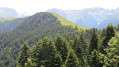
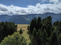
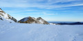
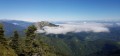
In Fos, just before the Spanish border, this walk takes you through woodland and along a ridge where you’ll pass several border markers. The climb is very steep at the start but offers magnificent views.
I recommend using a GPS or the app, particularly between points (3) and (4), where the path is not visible.

Details

3111898
Creation:
Last update:
Last review:
  • Walking
    Activity: Walking
  • ↔
    Distance: 7.72 mi
  • ◔
    Average duration: 7h 00 
  • ▲
    Difficulty: Difficult

  • ⚐
    Back to start: Yes
  • ↗
    Ascent: + 3,996 ft
  • ↘
    Descent: - 3,993 ft

  • ▲
    Highest point: 5,689 ft
  • ▼
    Lowest point: 1,824 ft
  • ⚐ Country: France
  • ⚐
    Area: Pyrenees
  • ⚐ City: Fos (31440)
  • ⚑
    Start/End: N 42.86624° / E 0.748617°
  • ❏
    IGN map(s): Ref. 1947OT
  • Hour-by-hour weather

Photos

Description of the walk

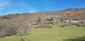
You can park just before the old border post.

(S/E) Carefully go round the large, wooded roundabout on the left . Then walk past the signal tower, keeping well to the left. A forest track branches off to the left; take this. At the first hairpin bend, leave the track and follow the path straight ahead.

(1) Keep well to the right. Cross the Rouéu bridge and head into the forest. The path is difficult to see. If possible, use your GPS for guidance. Make sure you keep heading south-east.

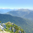
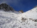
(3) Just before the stream, veer right up the steep slope. The path isn’t very visible. Use a GPS to stay on course. If necessary, don’t hesitate to zigzag up the very steep slope to eventually reach the border ridge, where you can admire the view of Spain.

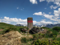
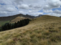
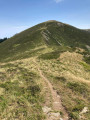
(4) Turn left to follow the ridge and its various boundary markers until you reach the Tuc de la Goute.

(5) Carry on right to the end to go round the field of ferns and rejoin the ridge. Pass the Col de Puymaurin and then the Tuc de Puymaurin before reaching the Tuc des Pans.

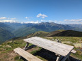
(6) Enjoy the view, then continue along the ridge, passing Cap des Canerilles. Further on, begin the descent, leaving the ridge on your right to take a path that leads to a shepherd’s hut at Courrau Grand.

(7) Turn left and head towards the watering trough to descend in a straight line between the two branches of the stream. Please note that there is no clearly visible path.

(8) You’ll come to a hiking trail that takes you past the Salontère hut. Continue straight down to reach the Courrau d’Artigue clearing and its hut.

(9) Carry on straight ahead to reach the junction where the route began.

(1) Go straight on, following the forest track which leads back to the roundabout and the car park at the start (S/E).

Waypoints

  1. S/E : mi 0 - alt. 1,824 ft - Former border post – car park
  2. 1 : mi 0.33 - alt. 1,913 ft - Junction on the circular loop
  3. 2 : mi 0.42 - alt. 1,932 ft - Rouéu Bridge
  4. 3 : mi 0.88 - alt. 2,559 ft - Junction in the forest
  5. 4 : mi 2.05 - alt. 4,678 ft - Ridge
  6. 5 : mi 2.71 - alt. 5,371 ft - Tuc de la Goute
  7. 6 : mi 3.37 - alt. 5,623 ft - Tuc des Pans
  8. 7 : mi 4.7 - alt. 5,463 ft - Courrau Grand hut
  9. 8 : mi 5.03 - alt. 4,895 ft - Return to the hiking trail
  10. 9 : mi 5.82 - alt. 3,825 ft - Courrau d’Artigue
  11. S/E : mi 7.72 - alt. 1,827 ft - Former border post – car park

Notes

The use of a GPS system is recommended.

Reviews and comments

3.3 / 5
Based on 5 reviews

Reliability of the description
3.2 / 5
Ease of following the route
3.2 / 5
Route interest
3.6 / 5
POULIN Gérard
POULIN Gérard ★

Hello,
Two important points to note:
1 – Signposting on the ground is the responsibility of organisations independent of Visorando. As the description of this walk makes no reference to signposting, this cannot be taken into account in the rating.
2 – Tourist Offices are not responsible for clearing or signposting walking trails, but only for promoting them. These tasks fall within the remit of local councils, inter-municipal associations or urban communities. It is to them that you should direct your enquiries.
The author states in the ‘Practical Information’ section of their listing:
Use of a GPS system is recommended.

Machine-translated

Tri Tri
Tri Tri
• Edited:

The path you describe as steep isn’t fully signposted. And the signposting isn’t at all easy to follow. I think some effort should be made to mark out the route and provide clearer signposts; it feels as though the Tourist Office or the council has never maintained anything at all.

Machine-translated

Tri Tri
Tri Tri
• Edited:

Overall rating : 2.3 / 5

Date of your route : May 17, 2022
Reliability of the description : ★★★☆☆ Average
Ease of following the route : ★☆☆☆☆ Very disappointing
Route interest : ★★★☆☆ Average
Very busy route : No

Hike completed today following the GPX track provided.
The route starts in the forest on the path to the right after the signpost. I strongly advise against this as the path is no longer signposted after a 30-minute climb.

There are pink markings which are difficult to follow (sometimes on trees, sometimes on rocks); it’s hard to understand the logic behind the person who put them there. What’s more, the track no longer follows the markings, so it’s up to you to decide which path to take.

Be that as it may, the climb is gruelling and of little real interest. After a while, with 300 metres of elevation gain remaining before the start of the ridge, the pink dot markings stop. We carried on straight towards the ridge to rejoin the GPX track, regardless of the obstacles.

Three hours later. Here we are on the ridge, but still in the forest. Don’t hesitate to walk on until you emerge from the woods onto a rock that ends abruptly, revealing the main ridge where you’ll enjoy the best view of the whole hike.

I’d advise you to start on the path on the left. The one on the right is of no interest, except for orienteering enthusiasts or those who enjoy walking in the middle of nowhere off the beaten track. What’s more, there’s no wildlife to be seen on this side, unlike on the other path.

The only attraction is the ridge path and the view of the Spanish peaks. That’s a bit meagre for a 6-hour hike...

I should point out that the GPX track was drawn up rather haphazardly… Probably on a computer rather than in the field, I reckon.

There are places where you have to wade through streams. Or else head straight down a sheer slope into the forest or down a ravine xD! The path is impossible to follow using the tracklog after the Shepherd’s Hut on the return journey for the descent.
Make sure you cross the stream properly and keep it on your left for the descent.

A hike for those who want a good bit of elevation gain; otherwise, there’s a way to reach some nice summits once you’re on the ridge.

Easy camping available. However, there’s no water source!

THIS TRAIL DESERVES TO BE MAINTAINED AND PROPERLY SIGNPOSTED FOR THE VIEW IT OFFERS.
It’s quite a challenge for a seasoned hiker, but you don’t want to spend your time trying to find your way… If the Tourist Office reads this message, there’s work to be done!

Machine-translated

Michel Doret
Michel Doret

Overall rating : 3 / 5

Date of your route : Sep 16, 2020
Reliability of the description : ★★☆☆☆ Disappointing
Ease of following the route : ★★★★☆ Good
Route interest : ★★★☆☆ Average
Very busy route : No

A GPS is essential as there are NO paths up to the ridge. What’s more, on this first section, the slope is EXTREMELY steep. Fortunately, the ground was dry, but a 900-metre climb without breaking a sweat!
The GPS route is nevertheless fairly reliable.
Allow just over 4 hours for the ascent to the Tuc des Pans, and the descent – which is quite long – also takes around 4 hours.
From the ridge, the path is well marked and the view is lovely.
A word of advice: start in the opposite direction and do a round trip to the Tuc des Pans. That way, you can enjoy the scenery without having to constantly check your GPS, and you avoid having your boots as your only point of reference...

Machine-translated

tegon
tegon

Overall rating : 3.3 / 5

Date of your route : Jun 23, 2020
Reliability of the description : ★★★☆☆ Average
Ease of following the route : ★★★☆☆ Average
Route interest : ★★★★☆ Good
Very busy route : No

A very interesting route, especially once you reach the Franco-Spanish ridges and beyond. However, having misjudged the location of point 3, I continued too far to the left and, after two hours’ walk, I found myself at the bottom of a ravine (this path was relatively well marked).
From there, I set about the (very dangerous) climb due south and, after two and a half hours, I reached the ridge between points 5 and 6 (between the pass and the Tuc de Puymaurin). In conclusion, without a GPS, this section is difficult to navigate. It’s a shame, given how attractive the route is, that there are no signposts or a few large cairns at the changes of direction.
Otherwise, the walk is magnificent, along the ridges and towards the Courrau Grand shelter. The descent is relatively long; keep to the left to take shortcuts which are not marked. I am familiar with the descent route, having completed this ascent to the Cap de la Pique as a round trip in the opposite direction.

Machine-translated

emilefri
emilefri

Overall rating : 5 / 5

Date of your route : Jun 21, 2020
Reliability of the description : ★★★★★ Very good
Ease of following the route : ★★★★★ Very good
Route interest : ★★★★★ Very good
Very busy route : No

The route is reliable

Machine-translated

Trez31
Trez31

Overall rating : 3 / 5

Date of your route : May 21, 2020
Reliability of the description : ★★★☆☆ Average
Ease of following the route : ★★★☆☆ Average
Route interest : ★★★☆☆ Average
Very busy route : No

We attempted the climb this Sunday, 21 May 2020 – a word of warning to anyone venturing onto this route.
There are no paths for the ascent and no signposting – don’t stray from the GPS route, as we ended up having to do a circular route trying to get back on track. The climb is also extremely steep – so much so that we turned back halfway up…
It’s a shame, as the view from the top must have been well worth the climb!!

Machine-translated

Other walks in the area

For more walks, use our search engine .

The GPS track and description are the property of this route's author. Please do not copy them without permission.