Country:

 City:
City:


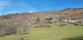
In Fos, park in the car park at the end of the street called Le Pas du Moine.
(S/E) Take the path leading up towards Argut. A small wooden sign points the way. Walk uphill for about 1.2 km, keeping the side paths on your left.
(1) At the stone bridge, follow the path leading uphill to the left towards the transmitter. You’ll reach the entrance to the village of Argut-dessous, where you’ll find the tarmac road.
(2) Do not continue towards the village, but turn right onto the path leading up towards the transmitter.
(3) At the transmitter, head north-east towards the solitary birch tree, then continue along the ridges amongst the broom and ferns. The easiest way is to follow the deer tracks. Pass three headlands and head towards a small cottage in the middle of the woods. The village of Argut-dessus lies slightly higher up on the left.
(4) Take the path between the little cottage and the rocks to reach a large meadow, which you simply need to cross.
(5) Go through the fence, close it behind you, and follow the path to the left which runs beneath the village until you reach the houses.
(6) When you reach the road at the Cap de Caou cross, take the small path marked in yellow which descends to the left in front of the house. This path leads down towards Argut-dessous, which you’ll reach as you leave the village. Turn left onto the road and continue to the church and its small cemetery.
(7) Leave the road and take the path on the right which goes round the church. Continue along the street, then turn right, left and right again to reach the town hall. With the town hall on your right, walk straight down to the end of the tarmac road.
(2) Continue along the path opposite and follow the outbound route in the opposite direction to return to the starting point (S/E).



 Visorando Member
 Difficult
 Association / Club / Walk leader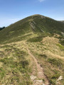

 Easy
Easy