Refine your search for walks in Trou de l'éléphant
Trou de l'éléphant walks


 The Lantosque elephant via the Crête des Martourins
 Visorando Member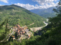
 8.77 mi
 +3,399 ft
 -3,428 ft
 7h 00
7h 00
 Difficult
 Departure from Lantosque (Alpes-Maritimes)
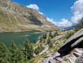
A pleasant hike thanks to its diversity. Wooded areas with different species of trees, beautiful views, ancient trails including the Crête des Martourins, and a finale in this little aquatic paradise where the elephant is located, a swimming spot once known mainly to the people of Lantosquois and its surroundings.
Walks near Trou de l'éléphant
From Utelle to Nice Ville railway station
 21.50 mi
+3,806 ft
-6,385 ft
13h 10
Difficult
Departure from Utelle (Alpes-Maritimes)
21.50 mi
+3,806 ft
-6,385 ft
13h 10
Difficult
Departure from Utelle (Alpes-Maritimes)
This twenty-first stage, once you have crossed the Vésubie, takes place in the Nice Pre-Alps and brings the GTA (Grande Traversée des Alpes) to a close by the sea. From the Place de la Fontaine in Utelle, the GR®5 heads west, then south, crossing a few small valleys to reach the hamlet of Cros d’Utelle. It crosses the Vésubie valley, climbs the opposite slope after the town of Levens, ascends through woodland to Colla Partida, passes beneath Mont Cima and descends to the beautiful circular fortified village of Aspremont. The path climbs the western flank of Mont Chauve d’Aspremont without reaching the summit. It descends the Crête de Graus until it reaches Château Renard and then La Bauma. The path enters a valley, which it follows eastwards, then due south towards La Fontaine Sainte, and crosses the bridge over the Autoroute de la Provençale. It enters the city of Nice, which it crosses from north to south to reach Nice Ville railway station.
Utelle - Levens
7.41 mi
+1,870 ft
-2,680 ft
5h 00
 Moderate
Departure from Utelle (Alpes-Maritimes)
Moderate
Departure from Utelle (Alpes-Maritimes)
Etape de la traversée des Alpes d'Utelle jusqu'à Levens. Randonnée entre la vallée de la Vésubie et les derniers reliefs alpins.
La Baisse de Camp d'Argent – Sospel
 13.53 mi
+1,670 ft
-6,289 ft
10 hrs
13.53 mi
+1,670 ft
-6,289 ft
10 hrs
 Very difficult
Departure from La Bollène-Vésubie (Alpes-Maritimes)
Very difficult
Departure from La Bollène-Vésubie (Alpes-Maritimes)
The sixth stage ofthe GR®52, where the landscapes change dramatically. Due to its length and significant descent of nearly 2,000 metres, the stage is very difficult. The descent to Sospel, which makes up two-thirds of the route, puts a real strain on the knees and ankles. Please note, it gets very hot in summer on this section.
Merveilles Rest House – Merveilles Mountain Hut
 5.68 mi
+3,688 ft
-1,909 ft
5h 50
Difficult
Departure from Belvédère (Alpes-Maritimes)
5.68 mi
+3,688 ft
-1,909 ft
5h 50
Difficult
Departure from Belvédère (Alpes-Maritimes)
The aim of this fourth stage is to reach the Merveilles mountain refuge. The route is less well-travelled than the classic one via the Pas de l’Arpette. You’ll discover the Verrariers valley and the Pas du Trem. This small pass lies at the foot of the Cime du Diable, which you simply must climb. This magnificent viewpoint offers a 360° panorama of the Mercantour, as well as the Authion, the Col de Turini and all the way to the sea. You’ll then walk alongside the lakes of La Muta, Le Trem and Fourca.
Mercantour route via the GR®52
 65.54 mi
+21,585 ft
-24,639 ft
7 days
Very difficult
Departure from Saint-Martin-Vésubie (Alpes-Maritimes)
65.54 mi
+21,585 ft
-24,639 ft
7 days
Very difficult
Departure from Saint-Martin-Vésubie (Alpes-Maritimes)
TheGR® 52 is a route that crosses the Mercantour National Park, through the Alpes-Maritimes from Saint-Dalmas-de-Valdeblore to Menton.
ThisGR® route is very challenging due to the varied terrain and significant elevation changes.
You’ll reach altitudes of up to 2,700m, where you can admire the high-mountain landscapes, flora and fauna. Then, in the second half of the route, you’ll encounter panoramas that are more southern in character but just as extraordinary.
Saint-Martin-de-Vésubie - Saint-Dalmas de Valdeblore
 4.01 mi
+1,821 ft
-732 ft
3h 25
Moderate
Departure from Saint-Martin-Vésubie (Alpes-Maritimes)
4.01 mi
+1,821 ft
-732 ft
3h 25
Moderate
Departure from Saint-Martin-Vésubie (Alpes-Maritimes)
The GR®52 starts in Saint-Dalmas de Valdeblore. This first stage is a transition to reach the starting point of the GR®.This is a lovely hike that passes through the small resort of La Colmiane and offers a relatively easy climb, following the GR®52 A through the woods for just over 6km.
The steep path on the western flank of Mont Arpasse
 6.19 mi
+1,424 ft
-2,136 ft
4h 05
Difficult
Departure from Alpes-Maritimes
6.19 mi
+1,424 ft
-2,136 ft
4h 05
Difficult
Departure from Alpes-Maritimes
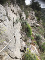
This unique one-way hike (allow for two vehicles) takes you up Mont Arpasse via the little-used south-eastern route. The final stretch is a path nearly 3 km long, sometimes carved into the cliff face, steep and vertiginous, clinging to the mountainous western flank of Mont Arpasse. It was built by the constructors of the Vésubie Canal in the 1870s and offers views of the Var throughout.
The section between marker 296 and the finish is reserved for experienced walkers.
Levens - Nice
13.55 mi
+2,077 ft
-3,734 ft
8h 00
Difficult
Departure from Alpes-Maritimes
Étape de la traversée des Alpes de Levens jusqu'à Nice. Randonnée permettant de traverser la bande littorale typiquement méditerranéenne et arriver à la Mer Méditerranée à Nice.
From Pont du Countet to the Refuge des Merveilles
5.87 mi
+3,271 ft
-1,824 ft
5h 35
Difficult
Departure from Belvédère (Alpes-Maritimes)
The first stage of a three-day trek in the heart of the Mercantour National Park, this route immediately takes the hiker into the high mountains via a little-used alpine route, away from the classic Pas de l’Arpette. On the itinerary: a steady climb up the Vallon des Verrairiers from the Gordolasque Valley, crossing the Pas du Trem (2,477 m) at the foot of the legendary Cime du Diable (2,685 m), then a long descent past a string of glacial lakes – Lac du Diable, Lac de la Muta, Lac du Trem, Lac Fourca – down to Lac Long Supérieur and the Refuge des Merveilles (2,130 m). A route combining the geological richness of the upper Gordolasque, breathtaking views of the Authion, Mont Capelet Supérieur and the Mediterranean on clear days, and a majestic entrance to the Vallée des Merveilles, a site listed as a Historic Monument. Characteristic wildlife: chamois, ibex, marmots.