


 Country:

 City:
City:


Leave one car near the roundabout at La-Roquette-sur-Var, which will be the end point of our walk. Continue towards Levens in a second car and park in the car park on Avenue du Docteur Faraut, the starting point.
(S) Continue along Avenue du Docteur Faraut to Place de la République. Once at the square, turn right onto Rue Arthur Malaussena, at the corner of the Chapelle des Pénitents Blancs, a light blue building.
Walk past the chemist’s, then turn left onto Rue Masséna.
(1) At the end of Rue Masséna, on the western side of the village, a paved slanting street leads down into the Coumba valley. After a few winding bends, you’ll reach the valley floor. Turn left onto the tarmac road known as the Chemin de la Coumba.
(2) At the fire station, turn right onto the tarmac road known as the Chemin de la Mole.
(3) At the 90° right-hand bend, take the wooded path directly opposite and rejoin the road. Cross the road and continue straight ahead along the path, which rejoins the tarmac La Mole track; follow this to the right. Continue until you reach number 1710.
(4) Turn right and continue towards a gate marked 1720: the start of the path is to the left of the gate. Continue along the hillside until you come out onto a track suitable for vehicles.
(5) Head up to the right along this track towards the summit of the nearby Mont Arpasse.
(6) Summit of Mont Arpasse: marker 295. Take a few moments to enjoy the 360° panorama. Views stretch from the Mercantour to the mouth of the Var. Then, head off along the north-west track towards the electricity pylon and begin the descent. You’ll reach a junction of tracks at marker 296.
(7) Turn left towards “Le Plan du Var” and tackle a series of hairpin bends. You’ll reach marker 297 at the bridge over the Vésubie Canal.
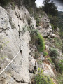
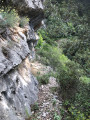
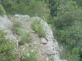
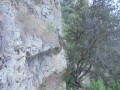
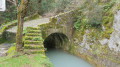
(8) Turn left and follow the canal, heading due south. A few hundred metres further on, the canal disappears into a tunnel carved into the rock, giving way to a path built into the rock face by the builders of the Vésubie Canal.
This path, which is in poor condition in places, requires constant vigilance and is suitable only for hikers who know their own limits. With a little care, however, you can follow the path without any difficulty. You will emerge onto the Route de Moulestre.
(9) Continue straight on for 50 metres towards the end of the road until you reach number 1525, marked on the boundary wall. Turn right at number 1525 and go down the steps towards the water channels, which are enclosed by a fence.
Go down the steps; the staircase turns left and goes round the site, then runs parallel to the water pipes. Go down the steps to the bottom of the small valley. Then climb the few remaining steps directly ahead, still keeping parallel to the water pipes.
At the end of the steps, continue across this sloping field, heading towards the edge of the woodland on the right, on the western side.
(10) At the top of the field, you’ll come across a footpath. Turn right for a few metres until you reach a tarmac road. At the junction, turn left: this is the lower part of the village. Follow the tarmac road uphill, which will take you back to the finishing point and on to your car park (E) (refreshing fountain).



 Thanks for your reply
 Visorando Member
 Moderate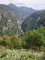
 Very difficult
