Trois Châtels

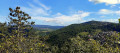
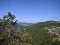
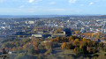
In 1940, Bishop Dubourg vowed to erect a statue of the Virgin Mary if the town were spared. From this viewpoint overlooking the circular part of the town crowned by its Citadel, you’ll enjoy beautiful views of the town and, on a clear day, of the Vosges and the Jura Mountains. You will continue, still in a spirit of devotion, past the Grotte-Ermitage de St-Léonard and Notre Dame-des-Buis, skirting our beautiful Citadel and pausing for a few moments at a viewpoint overlooking the lower reaches of the Doubs valley and the old rooftops of Besançon.

Details

n°21527100
Creation:
Last update:
Last review:
  • Walking
    Activity: Walking
  • ↔
    Distance: 3.89 mi
  • ◔
    Average duration: 2h 30 
  • ▲
    Difficulty: Easy

  • ⚐
    Back to start: Yes
  • ↗
    Ascent: + 771 ft
  • ↘
    Descent: - 768 ft

  • ▲
    Highest point: 1,594 ft
  • ▼
    Lowest point: 1,027 ft
  • ⚐ Country: France
  • ⚐ City: Morre (25660)
  • ⚑
    Start/End: N 47.219879° / E 6.051083°
  • ❏
    IGN map(s): Ref. 3323ET
  • Hour-by-hour weather

Photos

Description of the walk

The route starts from the car park on the esplanade by the Liberation Monument at the Chapelle des Buis.

Markings: Yellow and Red, Yellow and Blue. A very short section is unmarked.

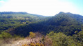
(S/E) To begin with, a superb view of the old town, crowned by its citadel. Then head towards the statue of the Virgin Mary, taking the small concrete path on the left to walk round it. Behind it, a 180° view of the countryside and the Jura mountains. In the late afternoon, the illuminated Hautepierre rock certainly lives up to its former name: the Roche du Soleil. To its right lies the Grand Taureau, above Pontarlier. Head down to the crypt; it’s open.

Leave the esplanade via the small tarmac road, crossing the little bridge. Walk on for about forty paces, then head down the hillside along the path on the right, towards the town centre. At the first fork, continue down to the left, quickly passing a path on your right, and carry on to the pond and the tarmac-surfaced Chemin de La Bro. Turn left.

(1) At the junction with the Chemin des Mialottes, head down to the right until you reach the Chemin de la Chapelle-des-Buis. Carry on straight ahead, following the stone Roman road – with its cart tracks – which runs alongside the main road until it ends.

(2) Turn right onto the path flanked by two dry-stone walls, heading towards the Grotte Saint-Léonard. You’ll reach the edge of the cliffs and come to a wire fence, which you’ll follow to the right until you reach the cave.

There’s a lovely view of the Citadel, Besançon and its circular area, the Porte Taillée, the Bregille hills and the upper reaches of the Doubs valley, overlooked by the ruins of the feudal castle of Montfaucon.

(3) Head down to the cave. Caution! The rocky path is slippery. Then return to the Chemin de la Chapelle-des-Buis.

(2) Then head off to the right.

(4) Leave the Chemin de la Jourande on your left and continue down the path to the right. There are lovely views to the left of the Monts Chaudanne and the Monts de Planoise.

After the ‘Trois Châtels’ bus stop, look out for the signpost at No. 15 and climb up the embankment via the small stony path on the right. After a lovely circular route through the grassy areas that brings you closer to the Citadel, you’ll return to the road, walk down it for about a hundred metres and, at the spot known as ‘Le Petit Chamonix’ (a former open-air café), turn left, heading up to the viewpoint 200 metres away.

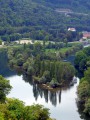
There are lovely views over the old rooftops of Besançon (particularly the Notre-Dame de Tarragnoz Tower) and the lower reaches of the Doubs valley. Don’t forget to glance to the left at the chapel perched on the Colline des Buis.

(5) Head back up a little before the junction with the Chemin de la Jourande (gate at no. 36) via the Chemin des Buis (tarmac) or the Sentier des Pelouses, but you’ll miss (at no. 20) a lovely view of the rear of the citadel.

(4) Take the path on the right which climbs through the copse to Fort Tousey, now converted into a dwelling, of which you will only see the top of the tower.

(6) Head down to the left, passing in front of the walls and the moat of the fort, to join the Chemin de la Jourande. At the nearby junction with the Chemin de Claire-Combe, at signpost 84, turn left. After house no. 5, pass the signpost, continue straight on and, at the next fork, turn right until you reach the end of the gravel cul-de-sac.

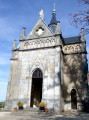
Continue through the woods along the path that runs along the bottom of the hill to reach the D144, at a hairpin bend, at the foot of the Way of the Cross – which, I hope, will not be your own… Then head up to the right to the Chapelle des Buis, where you can visit the statue of the Virgin and Child. There’s a view of the Citadel and Besançon. On the house opposite, there is a striking lion sculpture.

(7) After the chapel, turn left straight away, stopping at another viewpoint, then make your way back to the car park (S/E).

Waypoints

  1. S/E : mi 0 - alt. 1,591 ft - Notre Dame de la Libération (Morre)
  2. 1 : mi 0.67 - alt. 1,309 ft - Chemin des Mialottes
  3. 2 : mi 0.93 - alt. 1,168 ft - Celtic Trail
  4. 3 : mi 1.22 - alt. 1,158 ft - Grotte Saint-Léonard (Besançon)
  5. 4 : mi 1.78 - alt. 1,138 ft - Chemin de la Jourande and the lawns of Trois Châtels - Doubs (rivière)
  6. 5 : mi 2.28 - alt. 1,076 ft - At the foot of the Citadel – Viewpoint
  7. 6 : mi 2.7 - alt. 1,220 ft - Fort Tousey
  8. 7 : mi 3.6 - alt. 1,483 ft - Chapelle Notre-Dame des Buis (Besançon)
  9. S/E : mi 3.89 - alt. 1,591 ft - Notre Dame de la Libération (Morre)

Notes

The paths are rocky and slippery in places. Sturdy footwear is essential and the use of walking poles is recommended.

Worth a visit

(S) Notre-Dame de la Libération: in 1940, Bishop Dubourg vowed to erect a statue of the Virgin Mary if the town were spared. Notre-Dame de la Libération was built on Mont des Buis within the moats of an ancient fort that once stood at an elevation of nearly 500 metres. It offers an exceptional panoramic view of the town and its surroundings. The statue was created by the Franche-Comté sculptor Henri-Paul Rey.

(2) The Roman Road of La Bro. The more accurate term would be a rutted track, as the track width does not correspond to that of Roman carts. Whilst the track is Roman in origin, the deeply carved ruts are the result of the iron-rimmed wheels in use during the Middle Ages. The Chapelle des Buis was an important thoroughfare at that time.

(3) Saint-Léonard Cave: in fact, there are two caves, but the lower cave has been closed to the public since 1995, as it is home to several colonies of bats. The upper cave extends beneath the gently sloping plateau for 110 metres in a long, dry, conical passage. The 20-metre-wide vent is accessed via a metal staircase. The cave takes its name from a hermit who is said to have lived there in the 5th century.

(4) The Citadel, a masterpiece by Vauban and a UNESCO World Heritage Site, stands on Mont Saint-Étienne.

(6) The Chapelle des Buis is one of the town’s most beautiful chapels. There is evidence of a 13th-century hermitage on the site, which was replaced by the present chapel at an unknown date.

Reviews and comments

5 / 5
Based on 1 review

Reliability of the description
5 / 5
Ease of following the route
5 / 5
Route interest
5 / 5
GISORANDO
GISORANDO

Overall rating : 5 / 5

Date of your route : Oct 06, 2025
Reliability of the description : ★★★★★ Very good
Ease of following the route : ★★★★★ Very good
Route interest : ★★★★★ Very good
Very busy route : No

We have done this hike several times and it is perfect.
Of course, the views from the Chapelle des Buis car park are simply extraordinary!
The St Léonard Cave is now completely closed off by a gate (perhaps the description should be changed?).
It is still worth heading in that direction, however, as just before it there is a beautiful viewpoint over Bregille, formerly Rhodiacéta, etc.
The descent takes us to the entrance to the Citadel, where we can see another viewpoint over Besançon, namely Faubourg Tarragnoz.
The climb back up to the Chapelle des Buis car park is easy
Worth doing.

Machine-translated

Other walks in the area

For more walks, use our search engine .

The GPS track and description are the property of this route's author. Please do not copy them without permission.