Country:
 City:
City:


Park in the hamlet of La Chapelle des Buis, in the small car park in front of the chapel forecourt. If there are no spaces available, park in the forecourt of Notre-Dame de la Libération, but this will add about one kilometre to the walk. Markings: yellow and white, yellow and red, and yellow; some sections are unmarked.
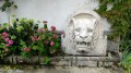
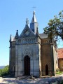
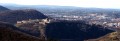
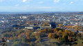
(S/E) On arrival, you’ll be treated to a superb view of the town, crowned by its citadel. Don’t miss the striking carved lion’s head opposite the chapel. Head up the stony path opposite the car park, passing to the left of a long wooden building. At the first fork, carry on straight ahead (the right-hand path). The path soon becomes a trail winding through the boxwood, which is currently ravaged by the box tree moth.
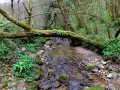
(1) At the second fork, carry on straight ahead (ignoring the signposted path which descends to the right). At the junction of nearby paths, carry on straight ahead to reach the ditch of the Fort des Buis, into which you descend. Let yourself be guided by this strange trench with its gnarled, moss-covered trees, reminiscent of an enchanted forest. After completing the circuit, climb back up the embankment and take the path on the left down to a junction where you’ll meet the signposted path a little further down. Head straight down. Yellow markings.
(2) After a short descent, signpost no. 61 marks a crossroads. Head down to the far left, despite the crosses. After about a hundred metres, leave the path that descends to the left and continue straight on for another hundred metres or so, then look out for the small path that branches off to the left towards the Mercureaux viewpoint.
(3) Head back up to signpost no. 61.
(2) Then turn left, leaving the signposted route, onto the path that follows the ridge. You’ll pass a few trees marked with white paint. Go round a rocky hillock on the left, then climb it, coming down the other side of the ridge. You’ll pass a small stone marker and reach a fork in the path; continue to the left.
(4) You’ll soon reach an old dry-stone wall and a fork in the path (marked ‘Trail7’ in the opposite direction to your walk); continue to the left and stay on the ridge, ignoring the paths leading down to the right.
(5) After walking alongside a low wall, at its end, step over the scree to carefully make your way to the unsecured viewpoint. Continue down the slope to reach a stony path, which you will follow uphill to the right (Trail 9 route) until you reach the hunting lodge.
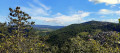
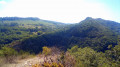
(6) Carry on to the left across the pasture to the viewpoint over the Doubs valley. There’s a bench here where you can take a break. Carefully descend for 150 metres to the right along the ledges for a beautiful view of Le Bout du Monde and the valley. Make your way back up to the bench.
(7) Continue straight on along the edge of the trees lining the cliffs and, after about fifteen metres, you’ll come across a small, inconspicuous path on your left which continues to follow the cliffs and leads you to La Baume Martin (a ‘baume’, derived from the Gaulish word ‘balma’, is a rock shelter). Return to the pasture and head off to the left; at the corner of the pine copse, turn left for a careful 50-metre round trip along the ledge towards a viewpoint overlooking Planoise. Return to the edge of the pine copse and continue along the edge until you reach a path that enters the woods; this soon joins a wider forest track, which you’ll take to the right to reach the hunting lodge and the signposting.
(6) Turn left onto this lovely stony path. When it splits into three, simply continue to the right, following the signposting to reach post no. 60. Carry on straight ahead along the farm track. You’ll emerge from the woods and pass the La Jourande farm, which offers views over the Besançon hills and their fortifications; from left to right: Chaudanne, La Citadelle, Fort Bregille and, directly opposite you, the keep of the feudal castle of Montfaucon.
(8) At marker post no. 84, turn right onto the Chemin de Claire Combe. Ignore the two paths on the left. After house no. 5, pass the marker post and continue straight on along the small tarmac road towards the Chapelle des Buis.
(9) You’ll come out onto the D144, at a hairpin bend, at the foot of the Way of the Cross. Head up to the right towards the chapel and the car park (S/E).
 The route includes ledge paths and unsecured viewing points. The paths are rocky and slippery in places. Sturdy footwear is essential and the use of walking poles is recommended.
 Visorando Member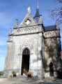

 Moderate