La Jourande

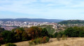
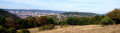
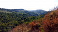
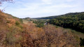
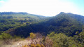
Starting from the small chapel overlooking the citadel and the Besançon circular route, you’ll walk alongside the ruins of the Fort de l’Ouest des Buis to reach the viewpoint over the Mercureaux Valley, where a temple dedicated to the god Mercury once stood. After this stretch through the woodland, you’ll emerge onto the slopes of La Jourande and its views over the Besançon hills and their fortifications.

Details

1483709
Creation:
Last update:
Last review:
  • Walking
    Activity: Walking
  • ↔
    Distance: 3.26 mi
  • ◔
    Average duration: 1h 55 
  • ▲
    Difficulty: Easy

  • ⚐
    Back to start: Yes
  • ↗
    Ascent: + 472 ft
  • ↘
    Descent: - 489 ft

  • ▲
    Highest point: 1,611 ft
  • ▼
    Lowest point: 1,224 ft
  • ⚐ Country: France
  • ⚐ City: Besançon (25000)
  • ⚑
    Start/End: N 47.218194° / E 6.046016°
  • ❏
    IGN map(s): Ref. 3323ET
  • Hour-by-hour weather

Photos

Description of the walk

Park in the hamlet of La Chapelle des Buis, in the small car park in front of the chapel forecourt. If there are no spaces available, park in the forecourt of Notre Dame de la Libération, but this will add about a kilometre to the walk. Markings: yellow and white, yellow and red, and yellow. As you get out of your car, you’ll be greeted by a superb view of the town, dominated by its citadel. Don’t miss the striking carved lion’s head opposite the chapel

(S/E) Head up the stony path opposite the car park, passing to the left of a long wooden building. It soon becomes a path winding through the box trees, which are currently ravaged by the box tree moth. At the first fork, carry on straight ahead (the right-hand path).

(1) At the second fork, head down to the right, immediately coming to a signpost (No. 62) and a wider path. Turn left. You’ll pass a ruined bunker from the Fort de l’Ouest des Buis. Do not be tempted to go inside. At the path junction, at the corner of some old walls, head down to the far right. Yellow markings. After a short descent, marker post No. 61 marks a crossroads.

(2) Head down to the far left, despite the crosses. After about a hundred metres, leave the path that descends to the left and continue straight on for another hundred metres or so, then look out for the small track that branches off to the left towards the Mercureaux viewpoint.

(3) Head back up to signpost No. 61.

(2) Carry on straight ahead. Shortly afterwards, at the next signpost (No. 60), turn sharp right onto a farm track.

(4) You’ll emerge from the woods and pass the La Jourande farm and its views over the Besançon hills and their fortifications; from left to right: Chaudanne, La Citadelle, Fort Bregille and, directly opposite you, the keep of the feudal castle of Montfaucon.

(5) At signpost no. 84, turn right onto the Chemin de Claire Combe. After house no. 5, pass the signpost and continue straight on along the small tarmac road towards the Chapelle des Buis.

(6) You’ll come out onto the D144, at a hairpin bend, at the foot of the Way of the Cross. Head up to the right towards the chapel and the car park. (S/E).

Waypoints

  1. S/E : mi 0 - alt. 1,483 ft - Chapelle des Buis
  2. 1 : mi 0.64 - alt. 1,611 ft - Fort de l’Ouest des Buis
  3. 2 : mi 1.23 - alt. 1,480 ft - Bois de Peu
  4. 3 : mi 1.36 - alt. 1,362 ft - Mercureaux Viewpoint
  5. 4 : mi 1.69 - alt. 1,450 ft - Ferme de la Jourande
  6. 5 : mi 2.52 - alt. 1,224 ft - Claire Combe
  7. 6 : mi 3.03 - alt. 1,355 ft - Way of the Cross
  8. S/E : mi 3.26 - alt. 1,483 ft - Chapelle des Buis

Notes

The paths are rocky and slippery in places. Sturdy footwear is essential and the use of walking poles is recommended.


Reviews and comments

4.6 / 5
Based on 3 reviews

Reliability of the description
4.7 / 5
Ease of following the route
5 / 5
Route interest
4 / 5
morganne52
morganne52

Overall rating : 4.7 / 5

Date of your route : Jan 20, 2025
Reliability of the description : ★★★★★ Very good
Ease of following the route : ★★★★★ Very good
Route interest : ★★★★☆ Good
Very busy route : No

A walk in the fog at a temperature of -2°.
Perfect for getting some fresh air that day.
Easy, with no difficulties at all.
One to do again in fine weather!

Machine-translated

Souris0205
Souris0205

Overall rating : 4.3 / 5

Date of your route : Aug 26, 2024
Reliability of the description : ★★★★☆ Good
Ease of following the route : ★★★★★ Very good
Route interest : ★★★★☆ Good
Very busy route : No

A lovely, easy walk for the whole family. The first part takes you through the woods along a narrow path, then the return leg offers a lovely, unobstructed view of the town of Besançon and its hills.

Machine-translated

MariThé
MariThé

Overall rating : 4.7 / 5

Date of your route : Dec 15, 2020
Reliability of the description : ★★★★★ Very good
Ease of following the route : ★★★★★ Very good
Route interest : ★★★★☆ Good
Very busy route : Yes

A short afternoon stroll. A lovely view of the citadel and the surrounding hills when you reach the Ferme de la Jourande. And at the start, a lovely view of Besançon.
Thank you. Marie

Machine-translated

Other walks in the area

For more walks, use our search engine .

The GPS track and description are the property of this route's author. Please do not copy them without permission.