Country:
 City:


We park at a small hiking car park on the K97 near Niederburg
(S/E) From the car park, we set off on the ‘Traumschleife’ trail, cross the road and follow the signposts along a wide, gravelly forest path gently uphill to the Spitzer Stein rock formation. Right next to this 412-metre-high peak, a beautifully designed steel viewing tower has been erected. We follow rocky paths across the ridge into the Niederwald. The route leads down a flight of steps, passing ruggedly jagged rock formations here too.
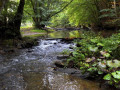
(1) We cross a tiny stream before a wide footpath leads us across open fields to the left, towards the outskirts of Niederburg. At the crossroads, we turn left and then immediately right again at the mountain hut. At the ‘Altes Pumpenhaus’ hut, a ‘Generations Park’ has been set up, featuring a Kneipp foot bath. The information board there provides interesting facts about the municipality of Niederburg. We cross the stream again and turn right.
(2) We make our way over the hill through scrub and hedgerows. At the K93, we follow the footpath to the left, then turn right at the next junction and immediately right again. We walk along the edge of the woodland for a short while and take the next left.
(3) We reach a cross-path, turn left and then immediately right again. At the next cross-path, we turn right and then left at the next one.
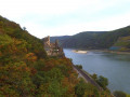
(4) From the Klüppelberg in Niederburg, we catch our first glimpse of the broad River Rhine, glistening silver in the brilliant sunlight. The town of Oberwesel on the left bank of the Rhine, with its countless towers and Schönburg Castle, can be seen down in the valley. Far in the distance, on the opposite bank of the Rhine, the wine-growing village of Kaub with Gutenfels Castle comes into view. In the middle of the Rhine, our gaze falls upon the Pfalzgrafenstein.
(5) Behind the Klüppelberg viewpoint, the ‘Traumschleife’ takes a sharp left turn and then runs briefly right along the edge of the Rhine Heights. Now the stunning panoramic views of the Rhine Valley accompany us at every turn. We follow the narrow meadow paths through Niedergehölz.
(6) We come across a ‘troll path’. To the right and left of the route here are metal figures known as ‘Trollinge’. The Urbar-Oberwesel Sculpture Park also surprises visitors with a number of contemporary artworks.
(7) From the right, the RheinBurgenWeg joins the ‘Traumschleife’, which climbs from Oberwesel up to the Rhine Heights via the Oelsberg via ferrata. At the next junction, we follow the footpath to the right, ignore the next two turn-offs to the left, follow the path as it curves to the left and then turns right, and keep to the right again at the crossroads.
(8) The long-distance hiking trail on the left bank of the Rhine takes us on level ground, with gentle ups and downs, to the Loreley viewpoint ‘Maria Ruh’. From this exposed rocky outcrop, we catch our first glimpse of the legendary Loreley Rock. From a wooden hiking pavilion, we enjoy the magnificent panorama of the Rhine Valley. The rugged, steep cliffs of the Loreley drop almost vertically into the Rhine Valley, which is at its narrowest and deepest point here. Further downstream, the wine-growing village of St. Goarshausen on the right bank of the Rhine, with Katz Castle, can be seen in the distance.
(9) We continue to enjoy beautiful views, cross the Galgenbach and the Seelenbach streams, and keep to the right at the crossroads beyond.
(10) We reach the ‘Dreiburgenblick’ viewpoint on the Wackenberg. From here, three medieval castles can be seen: Rheinfels Castle high above St. Goar, Katz Castle on the opposite bank of the river, and, a little further downstream, Maus Castle. From the Wackenberghütte, the path leads steeply downhill into the Lohbach Valley.
(11) Then we climb countless steps back up to the banks of the Rhine.
(12) We reach the St Goar district of Biebernheim, walk along the street ‘Im Stockgarten’, then turn left into ‘Dorfstraße’, which we follow to the left at the Protestant church and turn left again at the second junction. We then follow the road ‘In der Hohl’ to the right, continue straight ahead and, at the end of the built-up area, turn left, then right twice.
(13) At the Loreley organic holiday farm, we turn left and cross the Seelenbach stream.
(14) Just before the K95, we turn right and cross the road. We walk across a scenic piece of farmland, turn left at the first opportunity and then immediately right again.
(15) We reach the woodland, walk along the edge of the woodland to the right for a short distance and then turn left into the woodland.
(16) We cross the K97 and return to the Spitzer Stein rock formation. From here, we walk back to the hiking car park on the K97 (S/E).



 Visorando Member

 Difficult