


The route starts to the north of the village of Lajares. Park at the junction of Calle Majanicho and Calle Los Cascajos.
Circular walk and ascent of Calderón Hondo from Lajares


This circular walk takes you around Caldero Hondo and up to its summit via a well-signposted path. There are a few parking spaces available at the start of the route, along Calle Majanicho, but the car park is not really organised or official. The route is easy to follow, but make sure you wear sturdy footwear: the terrain is rocky and has large stones.
Details
Creation:
Last update:
Last review:
–
–
-
 Activity: Walking
-
 Distance: 3.09 mi
-
 Average duration: 1h 50
-
 Difficulty: Easy
-
-
 Back to start: Yes
-
 Ascent: + 440 ft
-
 Descent: - 420 ft
-
-
 Highest point: 702 ft
-
 Lowest point: 282 ft
-
 Country:
Canary Islands
-
 City:
La Oliva
-
 Start/End: N 28.688992° / W 13.93149°
-


 Hour-by-hour weather
Description of the walk
Waypoints
- S/E : mi 0 - alt. 282 ft - Car park – Calle Majanicho
- 1 : mi 0.32 - alt. 322 ft - Junction of the circular loop
- 2 : mi 1.24 - alt. 636 ft - Fork in the road
- 3 : mi 1.49 - alt. 653 ft - Access to the summit
- 4 : mi 1.56 - alt. 702 ft - Calderon Hondo (273 m)
- 5 : mi 1.7 - alt. 610 ft - Junction
- 6 : mi 2.27 - alt. 617 ft - North side of the - Montaña Colorada (242 m)
- S/E : mi 3.09 - alt. 282 ft - Car park – Calle Majanicho
Other walks in the area
The Calderon Hondo and the Montagne Rouge
 Visorando Member
 3.00 mi
+656 ft
-650 ft
1h 55
 Moderate
 Departure from La Oliva (Province de Las Palmas)
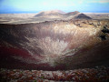
This hike takes you to the summit of Calderon Hondo, a magnificent cauldron with a deep, well-marked crater.
On the way back via Montaña Colorada, you'll enjoy lovely panoramic views of the malpais de la Arena and the other volcanoes of northern Fuerteventera in the distance...
⚠️Some technical difficulties (hand assistance) and a little gas for those prone to vertigo on the crater crossing.
Calderón Hondo Volcano Tour
 3.72 mi
+682 ft
-673 ft
2h 20
Easy
Departure from La Oliva (Province de Las Palmas)
A relatively short hike offering beautiful panoramic views of the volcano and surrounding countryside.
The dunes of Corralejo
 Association / Club / Walk leader5.88 mi
+20 ft
-20 ft
2h 45
Moderate
Departure from La Oliva (Province de Las Palmas)
The dunes of Corralejo in Fuerteventura offer a natural spectacle of incomparable beauty. Formed by volcanic eruptions and trade winds, these dunes of marine origin stretch for eight kilometres of fine white sand to the south of the town. Protected by conservation laws, they are a must-see destination for those seeking both the discovery of the seafront and the serenity of the dunes.
Bayuyo Tower
 6.81 mi
+856 ft
-860 ft
3h 55
Moderate
Departure from La Oliva (Province de Las Palmas)
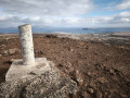
The Great Route 131 (GR®-131) is part of an international trail that crosses the island of Fuerteventura and the other Canary Islands. The route takes you from the centre of Corralejo, leaving it a few kilometres further on to climb Mount Bayuyo, which reveals all the beauty of the landscapes of northern Fuerteventura, as well as views of Lanzarote and Lobos.
Montana Roja
 2.74 mi
+925 ft
-925 ft
2h 05
Easy
Departure from La Oliva (Province de Las Palmas)
A magnificent hike to the top of the red mountain, offering views of Lobos Island opposite and the white sand dunes of Corralejo Natural Park. This old inactive volcano is known as Montaña Roja because of its layers of deep red rock and stone interspersed with green rock.
Tour of the Sacred Mountain of Tindaya
4.47 mi
+807 ft
-810 ft
2h 45
Easy
Departure from La Oliva (Province de Las Palmas)
A very easy hike as it is mostly flat or gently sloping on a very wide path. The walk itself is not particularly interesting, but the view is beautiful. Please note that it is forbidden to climb to the summit as the site is protected. It is easy to park at the start on a large dirt area on the right-hand side of a bend, after leaving the road connecting La Oliva to Tindaya.
Lobos Islet
6.22 mi
+328 ft
-328 ft
3h 10
Moderate
Departure from La Oliva (Province de Las Palmas)
Hiking on the island of Los Lobos. Discover the island of Los Lobos, a natural gem located between Fuerteventura and Lanzarote. During this hike, you will explore spectacular volcanic landscapes, wild trails and beaches with turquoise waters.Along the way, you will enjoy exceptional views of the Atlantic Ocean, unspoilt nature and a peaceful atmosphere, far from the hustle and bustle of tourism. An ideal experience for lovers of walking, nature and the great outdoors.This is a half-day hike with an easy to moderate level of difficulty. Bring hiking boots, water, sunscreen and a swimsuit.A unique adventure between volcanic land and crystal-clear sea, not to be missed!
Barrancos de los Molinos and Fuerte Ventura
6.45 mi
+417 ft
-427 ft
3h 20
Moderate
Departure from Puerto del Rosario (Province de Las Palmas)
A magnificent walk (a real surprise!) in a wild, very quiet barranco, carpeted with greenery around a permanent stream, with birds (ducks, waders, eagles) and goats roaming free. The water comes from the rock, 500 m after the car park. A haven of wild peace and a real surprise in such an arid environment.
For more walks, use our search engine .
The GPS track and description are the property of this route's author. Please do not copy them without permission.

