Country:

 City:




Coming from Perpignan via the N116, at the roundabout at the entrance to Prades, turn fully left towards Los Masos on the D24B. Continue on the D24 to Villerach and pass through the village. At the old signposts, continue along the Piste Forestière du Llec and, after passing the Coll del Forn car park, leave the track leading to the village of Clara on your right and carry on straight ahead for 2.5 km to the Refuge du Mas Malet: a designated fire zone and picnic area, but with no drinking fountain. End of the authorised section.
Very old yellow markings
(S/E) Before the steel barrier, head up to the right along the Chemin de Muletiers, which runs parallel to the track below. Small signpost: Tour du Jocavel.
(1) The junction shown on the IGN map no longer exists. After a sharp bend to the right, climb steeply due south via a series of hairpin bends. Pass a signpost: in the middle of nowhere. After a virtually flat section, reach a very well-marked junction with signposts. Wooden sign: ‘La Mouline’ on the left, attached to a tree.
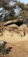
(2) Head down to the left, towards the Refuge de la Mouline. Pass the Còrrec de les Beçoses and continue due east for 200 m, passing under a slab of rock overhanging the path, and you’ll immediately reach a visible fork. No signpost. Two cairns on either side of the ascending path.
Cairns at the start of the path
(3) ‘Leave the marked path on your left, which joins the track’. The rest of the route no longer corresponds at all to the IGN map. The OSM data is correct.
At the cairns, head up to the right via several hairpin bends, then keep to the hillside. The path heads due south, continuing to climb gently but steadily.
:4:: Pass a recent electric fence with a wooden chicane (June 2023), climb to the right via three hairpin bends and continue along the hillside, due south, along a path marked on the ground. I have added cairns. Stay along the hillside, between the 1210 m and 1220 m contour lines: no ascents or descents.
Much further on, the path turns south-west, descending very gently, and finally crosses the Còrrec de la Socarrada. After that, the track is visible below on the left.
Head towards the large area, which is still used for grazing, and the Refuge de la Mouline (La Molina), which has a lovely fountain, a designated campfire area and a picnic area. Free access area.
(5) Continue along the track, immediately cross the Còrrec de Salze and carry on climbing for 500 m.
Keep an eye out on the right, towards the forest.
Scatteredold yellow markings
(6) Before the track bends to the right, look out for a steep path leading uphill into the forest on the right.
A cairn has been added (8 June 2023) and an old yellow ‘turn right’ marker is still present at this point.
Take this path, which climbs steadily until it reaches a grassy area with a rock on your left. Look out for a yellow marker, facing the opposite direction, on a tree in this relatively flat area.
Do not try to head down onto the track. Continue along level ground on a path that is still clearly marked on the ground, then very quickly climb slightly up a straight section of the track.
(7) Cross it and head up the opposite side, running parallel to the track, to join it further up.
(8) Follow it to the left as you climb up to the sharp right-hand bend. Look out for a red inscription on the rock at the bottom of this bend: Prat de Crabera.
(9) Continue along the stony path, which is very clearly marked on the ground. Carry on through the forest with the track to your right, slightly higher up. After a short, steep climb of a few metres, rejoin the track once more.
(10) Follow it as it climbs due south for about a hundred metres. Look out for wooden steps and a signpost on the right. Signposted for Prat Cabrera – sign missing (noted on 8 June 2023).
Recent yellow markings
(11) Climb up to the right via these steps and continue along the lovely path. Pass the Còrrec de les Collisses and carry on south-east, climbing steadily. Ignore a grassy track that descends to the left. You’ll arrive, almost at the edge of the forest, in a grassy area where you’ll spot a tree with a yellow ‘turn left’ marker (intended for the descent).
(12) Turn right, keeping the tree on your left, climbing very steeply up through the pasture and following the clear yellow markings and the cairns along the way. You’ll reach a flat area and a track.
(13) The Prat Cabrera refuge and its spring are on the left, behind a wooden fence. The hut is occupied by the shepherd during the summer months.
Please respect the peace and cleanliness of the site. Thank you.
If necessary, a free-access area is available, adjacent to the hut. A fire pit is compulsory.
After a well-deserved rest, turn back towards the Mouline Refuge.
(5) At this point, you have two options:
- either follow the same route (Chemin des Muletiers) back the way you came to Mas Mallet.
Be aware of the significant climb before you actually start descending towards Mas Mallet.
- or head down via the track (route map attached). You’ll reach a wide open area at Lous Grounells.
The appeal of returning via the track lies in the scenery, with its sheer drops. You’ll be back at Mas Malet in under an hour.
(14) A Canadian-style crossing with two large steel gates and directional signs.
At this point, there are two further options:
- without going through the gate, head up to the left and rejoin the path you took on the way out, then continue along the route in the opposite direction to the outward journey. Please note the same comment regarding the elevation gain.
- continue along the track. Pass various car parks which are now off-limits and thus reach the Mas Mallet car park (S/E).

 Visorando Member


 Easy
 Moderate