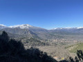
The Salver de Taurinya Mines

An easy walk, suitable for everyone, with a moderate elevation gain of less than 200 m. On this educational trail, immerse yourself in the fascinating history of local mining through numerous information boards and archaeological remains that bear witness to this rich past.

Details

66261104
Creation:
Last update:
Last review:
  • Walking
    Activity: Walking
  • ↔
    Distance: 2.35 mi
  • ◔
    Average duration: 1h 45 
  • ▲
    Difficulty: Easy

  • ⚐
    Back to start: Yes
  • ↗
    Ascent: + 761 ft
  • ↘
    Descent: - 761 ft

  • ▲
    Highest point: 2,589 ft
  • ▼
    Lowest point: 1,821 ft

Description of the walk

Park in the car park near the village grocery shop, Camí del Canigó.

(S/E) Follow the D27 road to the right (red and white GRT83 markings) for about 300 m and negotiate the right-hand bend. Then leave this road to take a side road on the left (Camí de las Tarteres) until you reach a junction with information boards.

(1) Turn right onto theGRP®, marked in red and yellow, and follow it alongside a stream until you reach another junction.

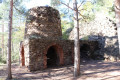
(2) Turn right, pass a lodge and arrive at the official starting point of the Sentier des Mines. Walk past the “Grande Trémie” and begin the first ascent, which leads to Galerie 703, where a locomotive is situated. A few metres further on, just after the “Plan Incliné”, you’ll face a steep climb of around a hundred metres, leading to an old roasting furnace. Climb again to reach the Salver Mines plateau.

(3) Make the most of this vast open space to take a short break and admire the old miners’ buildings, as well as the second roasting furnace used for extracting iron ore. Leave theGRP® markings behind and head north following the yellow and white markings, which will take you back to Taurinya. After three hairpin bends, rejoin the red and white markings of the GRT 83.

(4) Go straight on, turn left onto the path, then carefully cross the RD27 to follow Carrer dels Ocellets opposite. You’ll come to a junction at the corner of the cemetery.

(5) Turn right onto Carrer de la Torre and you’ll reach the car park a few metres further on (S/E).

Waypoints

  1. S/E : mi 0 - alt. 1,827 ft - Taurinya car park
  2. 1 : mi 0.29 - alt. 2,100 ft - Junction with signposts
  3. 2 : mi 0.67 - alt. 2,260 ft - Junction with signposts
  4. 3 : mi 1.25 - alt. 2,579 ft - Salver Mines
  5. 4 : mi 1.9 - alt. 2,290 ft - Junction with the GRT83
  6. 5 : mi 2.21 - alt. 2,024 ft - Cemetery
  7. S/E : mi 2.35 - alt. 1,827 ft - Taurinya car park

Notes

Worth a visit

At point (5), you can head to the Corts Tower by turning right.

Col de Millères, one of the many starting points for the legendary ascent of Mont Canigó, is nearby.

Reviews and comments

4.4 / 5
Based on 3 reviews

Reliability of the description
4.3 / 5
Ease of following the route
4 / 5
Route interest
5 / 5
Dubois Thérèse
Dubois Thérèse

Overall rating : 5 / 5

Date of your route : Jun 12, 2026
Reliability of the description : ★★★★★ Very good
Ease of following the route : ★★★★★ Very good
Route interest : ★★★★★ Very good
Very busy route : No

A really interesting route (even for adults!)

Machine-translated

CHAPPELLE
CHAPPELLE

Overall rating : 4 / 5

Date of your route : Dec 09, 2024
Reliability of the description : ★★★★☆ Good
Ease of following the route : ★★★☆☆ Average
Route interest : ★★★★★ Very good
Very busy route : No

Very educational for my 10-year-old children. Magnificent scenery and a lovely spot at the top of the mines with a >large wooded plateau. The turn-off leading to the tunnels and the locomotive is poorly signposted in your >description, as there are no signs indicating it on site. You simply have to work it out for yourself. At least, in my opinion.

Regarding point 2 of your description: after ‘large hopper’, I would suggest, if I may, adding: ‘Begin the first climb and, halfway up, turn right, go through a closed gate and follow the path that leads to gallery 703, etc.’
Kind regards.

Machine-translated

CHAPPELLE
CHAPPELLE

Overall rating : 4.3 / 5

Date of your route : Dec 02, 2024
Reliability of the description : ★★★★☆ Good
Ease of following the route : ★★★★☆ Good
Route interest : ★★★★★ Very good
Very busy route : Yes

A short but very educational walk for our children.

Machine-translated

Other walks in the area

For more walks, use our search engine .

The GPS track and description are the property of this route's author. Please do not copy them without permission.