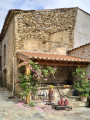
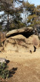
This short circular walk, starting from the village of Taurinya in the Pyrénées-Orientales, follows a forest track through the woods to the Col de Clara before returning to the village. Mid-mountain forest landscape. Enjoyable in all seasons.
When travelling to Taurinya from Prades via the D27, park on the left-hand side of the road on the earthed areas just before the junction with a forest track. After the (S/E), there is a car park (for walkers) 200 metres further on, on the right, after crossing the Lliterà, and another in the village.
(S/E) Turn left onto the track which climbs directly to the Col de Clara.
(1) Take the track on the right which descends south-west towards the village. After crossing the Lliterà, you’ll come out onto the Cami de les Tarteres, opposite some greenhouses.
(2) Continue to the right and join the D27.
(3) Follow the D27, keeping in the same direction, until you reach the car park (S/E).
Waypoints
S/E : mi 0 - alt. 1,690 ft - Parking along the D27
2 : mi 2.64 - alt. 2,057 ft - Cami de les Tarteres
3 : mi 3.01 - alt. 1,883 ft - Taurinya, D27 junction
S/E : mi 3.63 - alt. 1,690 ft - Parking along the D27
Notes
Walking shoes or trainers. T-shirt. Fleece. Windbreaker in winter. Cap. Sunglasses.
Worth a visit
Taurinya is a commune situated in the Pyrénées-Orientales department, in the Occitanie region, in the Conflent area. It lies approximately 25 km south of Perpignan and close to the Canigou massif.
Cultural and historical heritage:
Saint-Fructueux Church: this religious building, whose bell tower has been listed as a historic monument since 1963, is a notable example of Romanesque architecture.
Llasseras pastoral site: situated at an altitude of 1,365 metres, this site features dry-stone structures, notably ‘orris’ (shepherds’ huts), reflecting the region’s rich pastoral heritage.
Natural heritage :
The municipality forms part of the Catalan Pyrenees Regional Nature Park, which boasts a rich and varied biodiversity. It is crossed by the River Llitéra, also known as the Riu de Fillols. Two Natura 2000 sites, the ‘Canigou massif’ and ‘Canigou-Conques de La Preste’, are partly situated within the territory of Taurinya, highlighting the region’s ecological importance.
Activities and festivals:
Taurinya is renowned for canyoning, an activity involving descending canyons using ropes, jumps and slides, which attracts outdoor sports enthusiasts. Local festivities include the patron saint’s day on 21 January and the village festival at Whitsun.
The inhabitants of Taurinya, known as Taurinyans, enjoy a peaceful way of life, combining cultural richness with natural beauty.
Reviews and comments
4.3 / 5
Based on 2 reviews
Reliability of the description 4.5 / 5
Ease of following the route 4.5 / 5
Route interest 4 / 5
Gilles Reinhardt
Overall rating :
5 / 5
Date of your route : Oct 01, 2025 Reliability of the description : ★★★★★ Very good Ease of following the route : ★★★★★ Very good Route interest : ★★★★★ Very good Very busy route : No
I was very pleased with this hike. I particularly enjoyed the descent into the Taurinya valley to reach the village. It is a green area with irrigation water to supply the market gardeners. We were able to buy local vegetables in the village!
Machine-translated
GONG54
Overall rating :
3.7 / 5
Date of your route : May 20, 2025 Reliability of the description : ★★★★☆ Good Ease of following the route : ★★★★☆ Good Route interest : ★★★☆☆ Average Very busy route : No
An easy walk with no difficulties – ideal for warming up.
The only thing of interest is the variety of plants along the forest track, which are in bloom at this time of year; otherwise, there’s nothing in particular to see.
To open this route on your smartphone, you must have the Visorando app installed. If not, got to the Apple Store (iPhone) or Google Play Store (Android) to download the app.



 Country:

 City:
City:



 Visorando Member
 Moderate
 Very difficult