Country:
 City:


Starting point: Héricourt Town Hall.
(S/E) Cross Rue du Général de Gaulle to take Rue de l’Église opposite the town hall. Follow the Red Triangle markings.
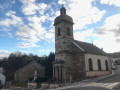
As you walk uphill, admire the temple, the church and, right at the back, the remains of the castle. Turn left into Rue André Launay, then right into Rue du Docteur Gaulier. Carefully go round the roundabout on the right, using the pedestrian crossing, and take the second street on the right, Rue George Marconnet.
(1) Just before the cemetery, turn left onto the street and continue along the path. The signposting changes to that of theGR®5-GR®59link route, marked with a Yellow Rectangle. Turn right onto Rue Georges Bretegnier and continue along the path which runs alongside the cemetery and crosses the countryside before joining the cycle path.
(2) Turn right. At the next junction, carry on straight ahead, pass under the D483 and follow the left bank of the Lizaine.
Green Ring signposting
(3) Turn slightly right, following the Green Ring signposting. On the other side of the Lizaine, look out for the Chevrets Business Park. Walk alongside the E54/N19 expressway, following the very well-maintained footpath behind the noise barrier.
(4) Carry straight on, leaving the cycle path. Follow the Green Ring signposts. You’ll arrive in the village of Couthenans. Look out for the information board near the school, which details the village’s history.
(5) At the junction just after the school, turn right onto the D9H (Rue d’Héricourt). Look out for the Maison Graber on the right. At the roundabout, turn right into the Grande Rue.
(6) After the church, turn right into Rue des Capucines. On leaving the village, carry on straight ahead along the path, join the cycle path and cross over the E54/N19 expressway. Arrive in Luze via Rue de la Mouteille.
At the first junction, turn right onto Rue de la Grande Goutte, cross the bridge over the Lizaine and take the path on the left immediately afterwards. This stretch along the Lizaine is superb. The ‘Green Ring’ signposting is very helpful throughout the journey through the village. Follow the first path on the right, moving away from the river, to reach a playground.
(7) Turn right onto Rue de la Luzine. Take the first left, Rue du Breuil, and walk along the left-hand side of the D16 (Rue de la Morette), which has a lot of traffic. Cross it carefully and turn right onto Rue de la Fontaine. At the next junction, continue straight ahead onto Rue des Étambois, then Rue des Quatre Vents, and leave the village.
(8) At the junction before the woods, carry on straight ahead, following the ‘Green Ring’ signposts. Enter the woodland and turn left straight away to head uphill, keeping the Fort du Mont Vaudois at a distance. Pass several paths on your right, keeping closely to the ‘Green Ring’ route, and emerge from the woods to reach the D130 road.
(9) Turn left and enter the village of Échenans-sous-Mont-Vaudois. Just before the church, turn right onto Rue du Levant, cross the Ruisseau du Martenot and then turn right. At the bend just after this, carry straight on to join a forest track further on.
Yellow Rectangle signposting
(10) Turn right. Change the markings and now follow the Yellow Rectangle to the end. The path descends, crosses the Martenot and climbs back up in a series of hairpin bends. Note: the river continues for 500 m and disappears into a ‘perte’.
It is possible to follow the river on foot as far as this ‘perte’, but be warned: the route is difficult as there is no path.
Continue to the D130 road.
(11) Follow it to the left for just under a hundred metres. Cross with extreme caution (bend) and take the second road on the right leading towards the recycling centre, following the Yellow Rectangle markings. Walk past the recycling centre and continue along the path until you reach a four-way junction.
Yellow Rectangle signposting
(12) Do not follow the Blue Triangle sign which heads off to the right, but carry on straight ahead following the Yellow Rectangle sign.
Pass a path on your left and leave the forest, coming out onto a small tarmac road (Chemin de Sacy).
(13) Cross the road and head straight ahead, following the Yellow Rectangle. Continue down Rue Jean Sainty.
(14) Cross over the E54/N19 expressway via Rue des Vignes and arrive in Héricourt. At the end of Rue des Vignes, turn right onto Rue Pierre et Marie Curie.
(15) Cross the road at the pedestrian crossing, then keep right to reach the D16 roundabout. Cross carefully (the D16 is a major road) and take the second left onto Rue Pierre Carmien. At the corner by the cemetery, turn right onto a small lane.
(1) Turn left and follow Rue Georges Marconnet. At the roundabout, follow Rue du Docteur Gaulier, then turn left onto Rue André Launay and finally right onto Rue de l’Église to return to the starting point at the town hall (S/E).

 Visorando Member


 Easy