Tour du Mont in Vercorin

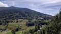
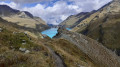
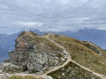
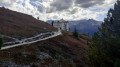
A pleasant circular walk around Vercorin. Several vantage points overlooking the peaks of the Rhône Valley and the upper reaches of the Val d’Anniviers.

Details

n°37228074
Creation:
Last update:
Last review:
  • Walking
    Activity: Walking
  • ↔
    Distance: 1.89 mi
  • ◔
    Average duration: 1h 15 
  • ▲
    Difficulty: Easy

  • ⚐
    Back to start: Yes
  • ↗
    Ascent: + 400 ft
  • ↘
    Descent: - 404 ft

  • ▲
    Highest point: 4,383 ft
  • ▼
    Lowest point: 4,222 ft

Photos

Description of the walk

Getting to Vercorin:

  • By road: from Sierre, take the Chippis road towards Vercorin.
  • By public transport: Swiss Post bus route 441, Sierre–Vercorin.
  • By cable car from Chalais (free car park).

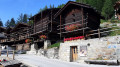
The start of this walk is in the centre of the village, near the Hôtel La Brinta.

(S/E) From the small square, take the Chemin du Bouillet. Pass the first street on your right, and look out for a sign for the Tour du Mont at the next junction.

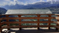
(1) Turn right and begin your walk along this circular route that encircles the mountain. Take a moment to look at the orientation board near the paragliding take-off point. Enjoy the view of the peaks of the Rhône Valley, from the Grand Chavalard to the Wildstrubel.

(2) Stay on the path to the right, which is the most obvious one. Discover the peaks at the entrance to the Val d’Anniviers; spot the Illhorn and the Bella Tola overlooking Chandolin. Continue along this beautiful path, heading back towards the village whilst admiring the summit of the Crêt du Midi. Descend to a junction as you approach the village.

(3) Walk up the Ruelle des Flives, which is quite steep, and return to the village centre (S/E).

Waypoints

  1. S/E : mi 0 - alt. 4,327 ft - Village centre – Hôtel La Brinta
  2. 1 : mi 0.08 - alt. 4,301 ft - Sign: Tour du Mont
  3. 2 : mi 0.76 - alt. 4,304 ft - Junction: keep right
  4. 3 : mi 1.76 - alt. 4,301 ft - Ruelle des Flives
  5. S/E : mi 1.89 - alt. 4,327 ft - Village centre – Hôtel La Brinta

Worth a visit

  • Vercorin.
  • Crêt du Midi.
  • Several viewpoints overlooking the peaks of the Rhône Valley and the upper reaches of the Val d’Anniviers.

Reviews and comments

5 / 5
Based on 1 review

Reliability of the description
5 / 5
Ease of following the route
5 / 5
Route interest
5 / 5
User 29539115

Overall rating : 5 / 5

Date of your route : Jun 01, 2026
Reliability of the description : ★★★★★ Very good
Ease of following the route : ★★★★★ Very good
Route interest : ★★★★★ Very good
Very busy route : No

A lovely walk, suitable for everyone…

Machine-translated

Other walks in the area

For more walks, use our search engine .

The GPS track and description are the property of this route's author. Please do not copy them without permission.