Country:

 City:
City:


Access by public transport
Sierre SBB station, then take bus 451 towards Vissoie Poste (Vissoie Poste stop), change to bus 454 towards Chandolin (Chandolin, Poste stop).
Access by car
From Geneva and Lausanne, take the A9 motorway. Drive through Chandolin and park in the paid car park at the end of Impasse de Crouvalor. Please note: ensure you park in the spaces in the unpaved section of the car park. The spaces on the central reservation on the left are private.
(S/E) From the car park, take the path that climbs furthest to the right; you’ll soon reach a track. Cross the track and take the path opposite, which passes in front of two chalets. You’ll reach another track; cross it and carry on straight ahead. After a few dozen metres, you’ll come out onto another track.
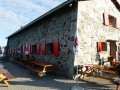
(1) Turn left. The route then quickly leaves the track and continues to the right. When you come within sight of a ski lift, turn right and head for the Illhorn hut.
(2) Leave the return route on your right and head up to the left, above the hut. You will soon reach a ski run and a signpost marked ‘Cabane Illhorn’. Cross the ski run and carry on straight ahead, towards Pas de l’Illsee and Illhorn. The ascent offers stunning views of the Matterhorn, the Pointe de Zinal and the Dent Blanche.
(3) Turn right. Follow the white and red-marked path. This passes close to a track once more, then joins another path coming from the left.
(4) Continue to the right, following the markings. You’ll come out onto a track again; turn left and, a few metres further on, turn right onto the white and red-marked path leading to the Pas de l’Illsee.
(5) Enjoy the view over the Illsee. Turn left to climb to the summit of the Illhorn (2,717 m).
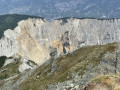
(7) The view takes in the peaks of the Valais and Bernese Alps and offers magnificent vistas over the Rhône Valley and the impressive Illgraben cirque. Descend back to the Pas de l’Illsee via the same route.
(5) Continue left towards Illsee and Obere Illalp, passing close to the Wäschtsee. On the descent, take time to admire the surrounding peaks, particularly the Rothorn.
(8) Turn sharply right and head straight on along a rather faint path. You’ll soon reach a well-marked path, signposted in white and red.
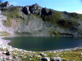
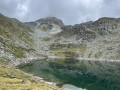
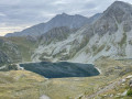
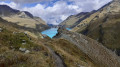
(9) Turn left and walk alongside the Illsee. The path climbs and runs alongside a small lake. Continue the ascent to the Lac Noir.
(10) The Rothorn is reflected in the lake. Turn right and climb to the top of a small hill (signpost). Continue straight on along the path towards Tsapé and Illpass, ignoring the two successive paths branching off to the left. After coming out onto a track (Route du Tsapé), you’ll soon reach the Illpass on the right.
(11) Follow the track towards Tsapé and Chandolin. You’ll reach the top station of the Tsapé chairlift (signpost).
(12) Continue left along the track for about a hundred metres.
(13) Leave the track by turning left onto a narrower path that curves sharply to the right. After skirting a small lake, pass La Grand-Remointse farm, before coming out onto Route du Tsapé once more, which you follow for just a few metres.
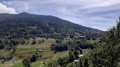
(14) Just before passing under the chairlift, turn left. The descent through the mountain pastures offers lovely views of the valley and Chandolin. You will then come out onto a track at Plan l’Ozier.
(15) Turn right onto the track. Head towards the Cabane Illhorn.
(2) Follow the same path as on the way there, in the opposite direction, to return to the car park (S/E).
 Visorando Member

 Moderate
 Easy
Easy