Markstein Route

This walk allows you to explore the Markstein resort, starting by following Long-Distance Trail No. 5 through the pastures, then on to the Steinlebach farm, before returning via the ski area and the Notre-Dame-des-Neiges Chapel.

Details

50318458
Creation:
Last update:
Last review:
  • Walking
    Activity: Walking
  • ↔
    Distance: 2.73 mi
  • ◔
    Average duration: 1h 30 
  • ▲
    Difficulty: Easy

  • ⚐
    Back to start: Yes
  • ↗
    Ascent: + 279 ft
  • ↘
    Descent: - 279 ft

  • ▲
    Highest point: 4,042 ft
  • ▼
    Lowest point: 3,714 ft

Description of the walk

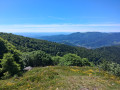
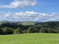
(S/E) Cross the road between the Speck Sports shop and the Petit Chamois. TheGR® 5 climbs gently to the right (Red Rectangle) and overlooks the resort. Looking back, you can catch a glimpse of the Grand Ballon (the highest point in the Vosges Mountains at 1,424 m) and its radar dome. Further away lie the Jura and the Black Forest beyond the Alsace Plain. On very clear days, you can make out the Swiss Alps, and in winter the view stretches as far as Mont Blanc.

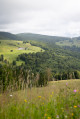
Continue along the path, crossing the slalom course which hosted World Cup events in 1983 and 1987. On the other side of the valley, the view takes in the Steinlebach farm, the destination of the walk. In late June and July, the meadows you pass through are carpeted with countless yellow arnica flowers, which are picked for use in medicines and cosmetics. You may also spot paragliders in the sky. Staying on theGR® 5, head towards the Route des Crêtes.

(1) Once you’ve crossed, take the small tarmac road that leads down towards the Steinlebach farm and inn.

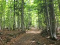
(2) From the farm, head right towards the Markstein, following the wide path marked with a Red Triangle. After crossing the pastures and then the forest, you’ll reach the ski runs.

Head back into the forest, continuing along the same path. After the two chalets, a large building stands out on the right. This is the former Hôtel des Crêtes, built in 1931. Continue along the path; just before you leave the forest, a path (marked with a Red Triangle) climbs towards the Notre-Dame-des-Neiges Chapel. Follow this, then return to the starting point via the small road on the left. (S/E)

Waypoints

  1. S/E : mi 0 - alt. 3,904 ft - Markstein (le)
  2. 1 : mi 0.95 - alt. 3,970 ft - Route des Crêtes
  3. 2 : mi 1.51 - alt. 3,734 ft - The Steinlebach
  4. S/E : mi 2.73 - alt. 3,904 ft - Markstein (le)

Worth a visit

The Markstein is the leading site in north-eastern France for paragliding and hang-gliding.

The first ski lift at Markstein was built in 1948. Today, the resort comprises nine ski lifts and a snow-making system. It mainly attracts skiers from the region, as well as hosting numerous competitions in both alpine and cross-country skiing, at regional, national and international levels.

Hôtel du Markstein: unfortunately, it closed its doors in 1934 and was converted into a holiday centre for works councils; this activity continued until 1994, and it could accommodate 300 people. The Hôtel Wolf dates from the same period.

Notre-Dame-des-Neiges Chapel: Built in 1948, it was fully restored by a team of volunteers from 2001 onwards. A service is held there every Sunday in the late afternoon, and it also hosts numerous weddings and christenings.

Always be cautious and plan ahead when you're outdoors. Visorando and the author of this route cannot be held responsible for any accidents occurring on this route.

The GR® and PR® markings are the intellectual property of the Fédération Française de Randonnée Pédestre.

Reviews and comments

4.4 / 5
Based on 3 reviews

Reliability of the description
5 / 5
Ease of following the route
4 / 5
Route interest
4.3 / 5
ajvoyage
ajvoyage

Overall rating : 4.7 / 5

Date of your route : Sep 08, 2025
Reliability of the description : ★★★★★ Very good
Ease of following the route : ★★★★☆ Good
Route interest : ★★★★★ Very good
Very busy route : No

a few difficulties at the start because we couldn't find the little chamois... but (thanks to downloading the route) we quickly found the right path – beautiful views of the Vosges and the Alsace plain
easy hike with a pleasant stop at Steinlebach and, above all, far from the noise of motorbikes

Machine-translated

Martine Feg
Martine Feg

Overall rating : 4.7 / 5

Date of your route : Jun 30, 2025
Reliability of the description : ★★★★★ Very good
Ease of following the route : ★★★★☆ Good
Route interest : ★★★★★ Very good
Very busy route : No

on the stubble with a 360° view – pure bliss.
unfortunately, there is a small paved road to access the farmhouse inn
a bit hot in summer

Machine-translated

User 25959434

Overall rating : 4 / 5

Date of your route : Jun 02, 2025
Reliability of the description : ★★★★★ Very good
Ease of following the route : ★★★★☆ Good
Route interest : ★★★☆☆ Average
Very busy route : No

Very easy route with beautiful views. The aim of this walk was to take a short trip with some 5-year-old children. It was great, with a stop at the farmhouse inn in the middle of the route. The only slight downside with children is that the route follows the tarmac road leading to the farmhouse inn.

Machine-translated

Other walks in the area

For more walks, use our search engine .

The GPS track and description are the property of this route's author. Please do not copy them without permission.