Country:

 City:
City:


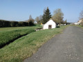
The walk starts in Senonches from the Champ de Foire car park on Rue du Tramway.
No signposting
(S/E) From the car park, head towards the old railway bridge on Rue de la Libération. First cross Rue de la Petite Vitesse, go under the bridge and turn left onto Rue du Perthuis de Manou. Cross this street and turn right onto Chemin des Noues. Walk past the wash house and continue along the path behind the factory. Carry on along the Fossé des Noues until you reach the first path crossing it.
(1) Head towards the houses on the right; before reaching them, follow the path on the left which runs behind the houses. Continue straight on until you come to a path running perpendicular to the corner of an orchard. Turn right and you’ll come out onto Rue de l’Ancienne École (D319.2).
(2) Turn right, then left onto Rue de la Gourderie. At the end of this street, you’ll come out onto the D20 near the wayside cross.
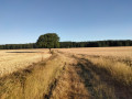
(3) Cross the D20 carefully and take Rue du Gros Chêne opposite. Continue along this street, which becomes a track crossing the fields and leads to the edge of the woodland in front of a deep ditch.
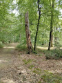
(4) Follow the ditch to the right to find an easier passage at the corner of the woodland. Once you have crossed, follow the old bridle path to the right along the edge of the woodland. Stay close to the edge of the woodland at all times, cutting across the ends of several paths. The track widens and, after crossing two sunken gullies which are sometimes filled with water, you’ll reach the D155.3.
(5) Take this road to the right. You’ll reach the D20. Follow it to the left along the wider left-hand verge until you reach the entrance to Rue de l’Évêché on the right.
(6) Cross the D20 carefully to join this street. You’ll come to Rue de l’Ancienne École. Turn left and continue until you reach Rue de La Libération – D20. Cross it carefully and follow it to the left for a few metres. At the barrier, turn right and, via the passageway, reach Rue des Sabotiers, which is full of flowers in summer. Turn right immediately to join Rue Roland Dorgelès. Turn right again to reach the memorial stone, erected in memory of the American soldiers killed on their arrival in Senonches whilst liberating the town on 14 August 1944.
(7) Walk across the grassy area at the back and through the plot behind the houses, which turns into a path on the right. This leads out onto Avenue d’Horicon. Turn right, then at the Stop sign turn left along Rue de la Libération (D20). Walk under the bridge, then carefully cross Rue des Marronniers at the pedestrian crossing. Follow Rue de la Petite Vitesse to the Champ de Foire car park (S/E).
 Visorando Member
 Moderate
 Difficult