Country:

 City:
City:


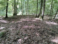
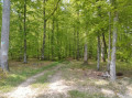
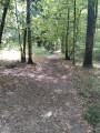
Start from the car park of the Jacques-Yves Cousteau School, Place du Bicentenaire des États-Unis, Senonches.
No signposting
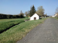
(S/E) From the car park, with your back to the school, turn right onto Rue du Maréchal de Lattre de Tassigny and follow it along the fence. Turn right onto Rue de la Moinerie and then immediately left onto Rue Maurice de Vlaminck. At the end of this street, turn right onto Rue du Chemin de Paris. At the pumping station , cross carefully, passing between the hedge and the retention basin. Cross the Ruisseau de la Goette near the bridge and follow it to the left until you reach the entrance to the forest (this section is sometimes flooded). Continue along the Ligne Forestière de Sauveloup until you reach the corner of the fence on the right.
(1) Take the path on the right between plots 30 and 31, cross a ditch, and continue straight ahead to a crossroads. Take the path on the right. Reach the edge of the woodland and rejoin the bridle path, which you should follow to the left. Head to the right to pass between the brick pillars of an old gate on the edge of the D941. Follow the road very carefully for about 100 metres along the verge and cross it very carefully opposite the gate of the former Canetterie Forest House. Cross the ditch and follow the path into the forest.
Yellow and red markings for the GRP® Vallées de la Blaise et de l’Avre
(2) From the junction with the GRP®, continue straight ahead until you reach the D25 – Route de la Framboisière.
No markings
(3) Leave the GRP®. Cross the D25 with care, follow it to the left for about a hundred metres, then turn right onto a track – a former bridle path – which joins a path running alongside a large fenced-off plot. Follow this path to the left and reach the Ligne des Trois Pierres; take this to the right until you reach the Rond des Gardes.
(4) Take the second stony lane on the left. Continue to the forester’s cottage and the oak tree at the Poste de Louvilliers. After admiring this remarkable tree and its pond, retrace your steps for about 100 metres and follow the path to the right between plots 5 and 6.
(5) Continue along the path between plots 5 and 6 until you reach the bridleway.
(6) Turn left and you’ll come out onto the D319.
(7) Cross it carefully, go down the slope opposite and immediately turn left onto a path; keep going straight on, ignoring all the paths running at right angles to it. You’ll reach the D25.
(8) Cross this road carefully and continue along the path opposite. Cross the old La Loupe–Verneuil railway line. Continue until you reachthe second perpendiculartrack . Take this to the left and you’ll reach the Ligne des Trois Pierres near the Rond d’Actéon. Turn right and you’ll reach the Rond de Diane.
Yellow and red markings
(9) Cross the D941 with care and continue straight ahead to the junction with the Ligne de Sauveloup.
No markings
(10) Leave the GRP®, take the hairpin bend to the left and carry on straight ahead. Return to the original junction.
(1) Continue straight ahead along the same route as on the way there. Near the social housing blocks, turn right. After the pumping station, cross the Chemin de Paris with care, then take Rue Maurice de Vlaminck and Rue du Maréchal De Lattre de Tassigny to return to the car park at the École Jacques-Yves Cousteau (S/E).
 Visorando Member

 Moderate
 Difficult