Country:

 City:
City:


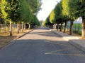
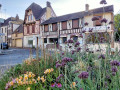
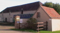
In Senonches, parking is available at Place de Champ de Foire, Rue du Tramway.
No signposting
(S/E) From the car park, head left along Rue du Tramway to the Carrefour des Vallées. Turn left and cross Rue des Marronniers to follow the footpath along Rue de la Ferté-Vidame. Cross at No. 9 and continue through the square. Exit to the right via the path leading to Rue des Moulins, which you should follow to the left.
(1) Veer off to the right for a few metres to catch a glimpse of Lucien Descaves’ house at No. 2, then retrace your steps. Cross the street at the pedestrian crossing. Continue along Rue de la Ferté-Vidame, on the pavement, until you reach the corner of Allée Simone Veil. Turn right. At the end, turn left onto Allée Louis Goupil, then right onto Allée du Docteur Fournier, near the “Chêne Alliance” block of flats.
(2) Turn right onto Allée des Enfants de Soissons. You’ll reach Chemin de Paris; follow it to the right until you reach the Fossé Rouge junction.
Yellow and red markings for the GRP® Vallées de la Blaise et de l’Avre.
(3) Turn left, towards La Framboisière. Follow the D25 until you reach the edge of the forest. Take the first path on the left, near the edge of the forest. Follow it until you are close to the D941. Turn right onto the track which leads to the Ligne des Trois Pierres, 100 m from the Rond de Diane, which you reach by turning left.
(4) At the Rond de Diane, cross the D941 carefully and continue straight ahead. At the next junction, with the Ligne de Sauveloup, leave the GRP®.
No signposting
(5) Carry on straight ahead until you reach the bend to the right in the lane.
(6) Take the path on the left alongside the fenced-off plot. After the fence, carry on straight ahead until you reach the edge of the woodland. Turn right onto the small Tardais-Laudigerie road. Follow it to the left. Turn left onto the D20. Cross it carefully and head towards Rue de l’Évêché. At the end of the street, turn right into Rue de l’Ancienne École. Continue until you reach the entrance to a path on the left.
(7) Follow it to the left, then turn right to follow the path running behind the houses. At the corner of an orchard, take the path on the left through the fields which joins the D319. (Start of the shorter alternative route on the left.)
(8) Follow it to the right as far as the small copse and the junction with the gravel track to Haut Cornet. Turn left onto this track. Pass the radio mast and continue to the Rond de Condé.
(9) Cross the D140 with care, and follow thefirst lane, slightly to the right, which climbs gently but continues straight on to the Rond des Ruelles.
(10) (Chêne Fauteuil 100 m to the left), follow the Route Forestière des Ruelles to the left until you reach the left-hand bend. To reach the site of the Camp des Canadiens (400 m there and back), take the path on the right at the bend in the road. You’ll come to large concrete blocks covered in moss, the remains of the sawmill machinery’s bases.
(11) Turn round and head back to the Route des Ruelles. Continue to the right until you reach the Rond de Monsieur picnic area.
Yellow markings
(12) Cross the Ligne du Haut Cornet and follow the path alongside the disused railway line to the D140.
No markings
(13) Follow the road to the left to the Rond de la Sablonnière. Continue straight ahead along the lane. On the descent, you’ll reach the start of a path on the right (the end of the alternative route), in the embankment, which leads to the Étang Loiseau.
(14) Follow this path until you reach the top of the Étang Loiseau embankment.
(15) Turn right onto the path that runs alongside a fence, crosses a lane and, after crossing the railway line (take care, steep section), comes out at the side of the D25, at the entrance to Senonches.
(16) Cross the D25 with care. Take the path opposite, behind the ‘Orée du Bois’ housing estate. Join the discovery route and continue straight ahead to the picnic tables. Cross the car park, then Avenue du Général de Gaulle. Take the path opposite leading to the secondary school. Cross Avenue Poucin (lovely view towards the church). Continue straight ahead for a few dozen metres along the path behind the secondary school until you reach the start of a path on the right.
(17) Turn right onto the winding path, which is sometimes damp. At the Fork in the road, take the path on the right, which stays close to the D941 and leads to an area of excavations for iron ore mining: “La Vente des Trous”. Walk carefully along the edge of the pits and join a path coming from the road.
(18) Turn left and head straight down this track until you reach the fence of the holiday village.
Yellow markings
Continue to the left to reach the entrance to the holiday village. (In season, you can visit the Étang de Badouleau, a bar-restaurant open to all).
(19) From the entrance to the holiday village, carry on straight ahead along the path leading down to the Source de la Hutte. Walk past the farm – now a riding centre – to reach the Route de Pontgouin.
No signposting
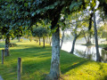
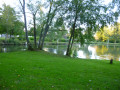
(20) Turn left. Then take Rue des Sormes on the left. At the wash house, turn right, following the Ruisseau de Saint-Cyr. Head towards the shore of Lac Arthur Rémy. Continue straight ahead, staying close to the shore, cross the weir, then pass the Evés wash house. Continue along the water’s edge until you reach the Rond de Battenberg.
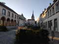
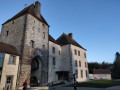
(21) Follow Avenue Poucin to the right, towards the church. Turn right onto Rue du Château. Cross the square. Enter the castle courtyard (tourist office – museum).
(22) On leaving, walk under the market halls, then turn right. At the end of Place des Halles, turn left onto Rue du Four Banal. Walk past two beautiful monumental gateways. Walk alongside the village hall car park until you reach Rue Michel Cauty.
(23) Cross the street and, at the corner by the hotel-restaurant, follow Rue Foucault, which leads to the church. After visiting the church, you’ll reach the crossroads (public toilets on the right, on the corner).
(24) At the crossroads, turn right onto Rue Louis Peuret, heading towards the town hall. Continue along Rue de Verdun, then turn left at the pedestrian crossing next to the war memorial. Follow Rue Aristide Briand. Opposite the police station, cross at the pedestrian crossing and turn right onto Rue du Chemin de fer, which leads to the old railway station. Go down the stairs to reach the Champ de Foire car park (S/E).
 Visorando Member
 Easy
Easy 
 Difficult