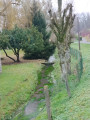
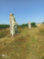
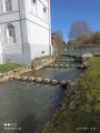
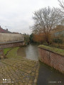
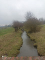
Walk through the Bois de Marœuil, known as the ‘Squirrel Trail’

A lovely little walk through woods and fields, ideal on hot days. You’ll regularly catch sight of the ruins of Mont-Saint-Éloi Abbey.
Strictly speaking, it’s not a proper hike, as it’s less than 3 km long, but it’s a very enjoyable walk. What’s more, for those who enjoy foraging in the wild, this area is teeming with wild blackberries.

Details

n°25214103
Creation:
Last update:
Last review:
  • Walking
    Activity: Walking
  • ↔
    Distance: 1.58 mi
  • ◔
    Average duration: 0h 50 
  • ▲
    Difficulty: Easy

  • ⚐
    Back to start: Yes
  • ↗
    Ascent: + 118 ft
  • ↘
    Descent: - 118 ft

  • ▲
    Highest point: 377 ft
  • ▼
    Lowest point: 256 ft
  • ⚐ Country: France
  • ⚐ City: Marœuil (62161)
  • ⚑
    Start/End: N 50.335323° / E 2.701658°
  • ❏
    IGN map(s): Ref. 2406E, 2406O
  • Hour-by-hour weather

Photos

Description of the walk

Car park on the edge of the Bois de Marœuil with a few shaded parking spaces. Very well maintained.

(S/E) With your back to the car park, take the path along the edge of the woods on the right, heading towards the Abbey Church of Mont Saint-Éloi. In season, there are plenty of bushes bearing magnificent and delicious blackberries along this stretch.

(1) At a fork in the road, leave the main path and turn onto the small, less shaded path that descends to the right.

(2) Turn left onto the path that heads into the woods for a well-shaded stretch and carry on until you reach the edge of the woods.

(3) Turn left and continue along the edge of the woods until you reach the junction with aGRP®. Turn left for the final stretch towards the car park (S/E). This section is very scenic as it is slightly undulating.

Waypoints

  1. S/E : mi 0 - alt. 374 ft - Car park on the edge of the Bois de Marœuil
  2. 1 : mi 0.54 - alt. 266 ft - A path leading downhill
  3. 2 : mi 0.71 - alt. 259 ft - Entrance to the woods
  4. 3 : mi 1.1 - alt. 299 ft - Exit from the woods
  5. S/E : mi 1.58 - alt. 374 ft - Car park on the edge of the Bois de Marœuil

Notes

- Some sections may be muddy following heavy rain

Worth a visit

- Ruins of the Abbey Church of Mont-Saint-Éloi.
- The Places in Arras.
- Loisinord in Nœux-les-Mines.
- The Canadian Memorial at Vimy.

Reviews and comments

4.7 / 5
Based on 1 review

Reliability of the description
5 / 5
Ease of following the route
5 / 5
Route interest
4 / 5
Alex62
Alex62

Overall rating : 4.7 / 5

Date of your route : Jul 16, 2023
Reliability of the description : ★★★★★ Very good
Ease of following the route : ★★★★★ Very good
Route interest : ★★★★☆ Good
Very busy route : No

A very easy route to follow as it is well signposted. There is a car park at the entrance to the woods. Bicycles, pushchairs and the like are not permitted on the route; it can only be walked on, and dogs must be kept on a lead.

Machine-translated

Other walks in the area

For more walks, use our search engine .

The GPS track and description are the property of this route's author. Please do not copy them without permission.