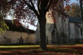
The dovecote at Marœuil

This walk takes you through the woods to the villages of Marœuil and Bray.

Details

n°66423890
Creation:
Last update:
Last review:
  • Walking
    Activity: Walking
  • ↔
    Distance: 4.71 mi
  • ◔
    Average duration: 2h 20 
  • ▲
    Difficulty: Easy

  • ⚐
    Back to start: Yes
  • ↗
    Ascent: + 164 ft
  • ↘
    Descent: - 180 ft

  • ▲
    Highest point: 384 ft
  • ▼
    Lowest point: 223 ft
  • ⚐ Country: France
  • ⚐ City: Marœuil (62161)
  • ⚑
    Start/End: N 50.335508° / E 2.701927°
  • ❏
    IGN map(s): Ref. 2406E, 2406O
  • Hour-by-hour weather

Description of the walk

Start from the Bois de Marœuil car park, Chaussée Brunehaut.

(S/E) Leave the car park towards the woods and take the path leading down to the left, then turn right past the wooden gate. You’ll reach a crossroads at the end.

(1) Turn left for 50 m to leave the woods.

(2) Carry on straight ahead until you reach Chemin de Bray.

(3) Turn left, then carry on straight ahead at the three forks in the road.

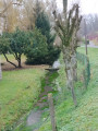
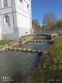
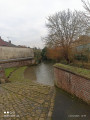
(4) Cross the bridge over the Scarpe waterfall. Continue along Rue du 11 Novembre, then first turn left then right to pass through Place de la Gare. Keep right at the junction to cross the level crossing.

(5) Turn right onto Rue des Champs and carry on straight ahead until you reach a Fork in the road at a place called Bois de la Ville. Turn right and carry on until you reach another level crossing.

(6) Turn right again to cross it and carry on straight ahead. At the end of Rue de l’École, turn right and then right again onto Rue de Marœuil, after crossing the Scarpe once more. Carry on to a junction after number 36 bis.

(7) Turn left up the footpath and go through the gate to enter the woods, then turn right and carry on straight ahead to reach a fork in the path you passed on the way out.

(2) Turn left for 50 metres to reach the junction you passed on the way out.

(1) Continue to the left. At the top, turn left again and pass the Forest Ranger’s House.

(8) Immediately afterwards, turn right. A little further on, veer slightly to the left then carry on straight ahead. Leave the woods for a short while, then keep to the right to re-enter them until you reach a crossroads.

(9) Stay on the path to the right, then turn left and walk past the animal shelters before continuing to the end.

(10) Turn left and head for the car park (S/E).

Waypoints

  1. S/E : mi 0 - alt. 371 ft - Bois de Marœuil car park, Chaussée Brunehaut
  2. 1 : mi 0.46 - alt. 308 ft - Crossroads – 1st circular loop
  3. 2 : mi 0.49 - alt. 295 ft - Junction for the 2nd circular loop
  4. 3 : mi 0.68 - alt. 236 ft - Chemin de Bray
  5. 4 : mi 1.22 - alt. 230 ft - Level crossing
  6. 5 : mi 2.28 - alt. 243 ft - Level crossing
  7. 6 : mi 2.9 - alt. 243 ft - 36 bis Rue de Marœuil
  8. 7 : mi 3.67 - alt. 335 ft - Forest House
  9. 8 : mi 4.18 - alt. 335 ft - Junction
  10. 9 : mi 4.47 - alt. 344 ft - End of the path
  11. S/E : mi 4.72 - alt. 371 ft - Bois de Marœuil car park, Chaussée Brunehaut

Notes

No water source.

Worth a visit

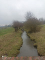
(4) Waterfall.

Reviews and comments

4.7 / 5
Based on 1 review

Reliability of the description
5 / 5
Ease of following the route
5 / 5
Route interest
4 / 5
souchez rando
souchez rando

Thank you for your feedback. We are a charity, and I am updating our walks so that we can share them. Have a lovely day.

Machine-translated

michel tout court
michel tout court

Overall rating : 4.7 / 5

Date of your route : Dec 12, 2024
Reliability of the description : ★★★★★ Very good
Ease of following the route : ★★★★★ Very good
Route interest : ★★★★☆ Good
Very busy route : No

A lovely walk without too much mud, despite the recent bad weather.
Lovely woodland, beautiful houses in Bray and an original nativity scene by the Maroeuil waterfall

Machine-translated

Other walks in the area

For more walks, use our search engine .

The GPS track and description are the property of this route's author. Please do not copy them without permission.