Le Bois de Bray et les marais

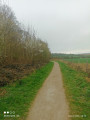
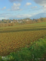
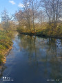
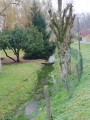
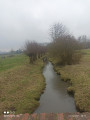
Cette randonnée vous mèneras à travers bois et marais en passant par les village et hameau de Bray, Étrun et Maroeuil.

Details

64657238
Creation:
Last update:
Last review:
  • Walking
    Activity: Walking
  • ↔
    Distance: 6.44 mi
  • ◔
    Average duration: 3h 10 
  • ▲
    Difficulty: Moderate

  • ⚐
    Back to start: Yes
  • ↗
    Ascent: + 200 ft
  • ↘
    Descent: - 197 ft

  • ▲
    Highest point: 377 ft
  • ▼
    Lowest point: 197 ft
  • ⚐ Country: France
  • ⚐ City: Marœuil (62161)
  • ⚑
    Start/End: N 50.335457° / E 2.701963°
  • ❏
    IGN map(s): Ref. 2406E, 2406O
  • Hour-by-hour weather

Photos

Description of the walk

Start from the Bois de Marœuil car park, on Allée des Tilleuls.

(S/E) From the car park, turn right, walk along the edge of the woodland and then enter the woodland by taking a sharp left turn. Continue straight on (note: part of the path may be muddy after rain), leave the woodland and turn off the track onto the path on the right. Carry on to the edge of the woodland until you reach a fork.

(1) Turn right, go through the gate and, when you reach the tarmac, turn right (Rue de Marœuil) and follow the road to Bray.

(2) Keep to the left. Cross the Scarpe, then turn left onto Rue de l’École and continue to the level crossing.

(3) Turn left, then go straight on to the end. Keep left, then veer slightly right onto Rue de la Gare, and continue to the wayside cross.

(4) Continue to the right, then take the second on the right, Rue du Général de Gaulle. Take the first left. Keep left at the pumping station and continue to the end of the street.

(5) Turn right onto Rue d’Étrun, then take thefirst left and carry on straight ahead until you reach the confluence of the Gy and the Scarpe.

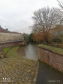
(6) Turn sharply left and walk along the Scarpe on your left. At the end of the path, turn right to leave the marsh and arrive at the Source Sainte-Bertille.

(7) Walk past the spring and, a little further on, you’ll reach Rue de la Marlière.

(8) Follow it to the left until the end, then first turn right then left onto Rue du Four, then turn right onto Rue Notre-Dame and follow it until you reach Rue du Moulin.

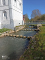
(9) Turn left onto this street and continue along it until you reach the waterfall.

(10) Take a moment to rest, then carry on along this street, with the waterfall behind you. Head straight on, then take the path on the right once you’ve left the residential area. Carry on until you reach the gate.

(11) Follow the path to the left, then go straight on until you reach the junction you passed on the way there.

(1) Turn right, walk past the forest ranger’s house and follow the path to the right. At the next junction, turn left and then left again at the end, uphill, to reach the car park (S/E).

Waypoints

  1. S/E : mi 0 - alt. 371 ft - Bois de Maroeuil car park
  2. 1 : mi 0.64 - alt. 259 ft - Junction
  3. 2 : mi 0.86 - alt. 236 ft - Bray - Scarpe (rivière)
  4. 3 : mi 1.32 - alt. 243 ft - Level crossing
  5. 4 : mi 2.51 - alt. 220 ft - Calvary
  6. 5 : mi 2.75 - alt. 207 ft - Turn right
  7. 6 : mi 3.4 - alt. 197 ft - Turn left - Scarpe (rivière)
  8. 7 : mi 3.91 - alt. 203 ft - Source Sainte-Bertille (Étrun)
  9. 8 : mi 4.14 - alt. 207 ft - Rue de la Marlière
  10. 9 : mi 4.37 - alt. 223 ft - Rue du Moulin
  11. 10 : mi 4.52 - alt. 217 ft - Waterfall
  12. 11 : mi 5.02 - alt. 299 ft - Barrier
  13. S/E : mi 6.44 - alt. 371 ft - Bois de Maroeuil car park

Notes

Pas de point d'eau

Worth a visit

Source Sainte-Bertille.
Cascade.
Attention dans le marais : les chemins peuvent être très boueux.

Variante à partir du point (3) : aller tout droit sur le PR®, au bout à gauche, continuer tout droit jusqu'à Étrun (attention en traversant la D56), passer devant le cimetière, puis prendre à gauche et passer le pont SNCF, puis après 70 m, faire un gauche droite et continuer tout droit jusqu'à la Rue des Courtils. Faire alors, un droite gauche sur la Rue François Lemaire sur 50 m. Puis prendre le sentier à droite le long du ru, rester à droite à la bifurcation qui suit, puis continuer sur la gauche, et rejoindre l'itinéraire initiale entre le point (5) et (6). Tourner alors à droite sur celui-ci.

Always be cautious and plan ahead when you're outdoors. Visorando and the author of this route cannot be held responsible for any accidents occurring on this route.

The GR® and PR® markings are the intellectual property of the Fédération Française de Randonnée Pédestre.

Other walks in the area

For more walks, use our search engine .

The GPS track and description are the property of this route's author. Please do not copy them without permission.