Country:

 City:
City:



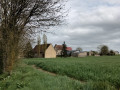
In the Puisaye region between Senonches and La Ferté-Vidame; access via the D941 then the D146 to the Étang d’Haron.
Parking near the church – large car park near the tennis courts.
Signposted with yellow + yellow and red
(S/E) Head towards the church, then turn right onto Route de la Verrerie (D318). After 150 m, take the path on the left, which joins the D318.1. Follow it to the right for 50 m.
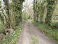
(1) Turn right again at the next track. Continue straight on through the fields, then enter the woods. Carry on to the Rond de la Rangée. Leave the yellow and red markings.
Yellow markings
(2) Turn right facing the Ligne d’Orléans. Join the D318 and follow it to the left as far as the large crossroads known as the Rond du Hère.
(3) Turn left to follow the Ligne des Trois Pierres to the Rond des Petits Feuillards.
(4) Carry on straight ahead, then cross the D155 carefully and continue straight on to the Rond de la Gazinière.
(5) Turn left onto the Ligne des Bretons. Cross a stream and leave the forest. Carry on straight ahead until you reach a major road running perpendicular to it.
(6) At this track coming from the hamlet of La Barberie, which you can see on your left, turn right. At the end of the track, turn left towards the buildings at La Basse Giboudière. Here you’ll rejoin the GRP® Vallées de la Blaise et de l’Avre.
Yellow + Yellow and Red markings
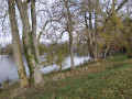
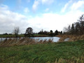
(7) Turn left, then continue straight on along the Meuvette. Cross the D155 with care, then head for the Étang Rouge at Le Minerai. The banks are on private land. The access route to La Ferté-Vidame starts on the right, on the embankment.
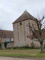
(8) Go straight on and follow the road to the village. Before the bridge, there is a picnic area and a wash house. Continue to the car park (S/E).

 Visorando Member
 Easy
Easy 
 Difficult


 Association / Club / Walk leader
 Very difficult