Tour du Bénal in Counozouls

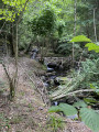
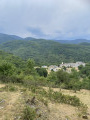
A short walk before visiting the village of Counozouls and its craft brewery. There are a few shaded sections along the Ruisseau de Bailleurs. When we walked this route in July, crossing the stream was straightforward. After heavy rain, you may need to take off your shoes.

Details

101594342
Creation:
Last update:
Last review:
  • Walking
    Activity: Walking
  • ↔
    Distance: 5.01 mi
  • ◔
    Average duration: 3h 50 
  • ▲
    Difficulty: Moderate

  • ⚐
    Back to start: Yes
  • ↗
    Ascent: + 1,791 ft
  • ↘
    Descent: - 1,791 ft

  • ▲
    Highest point: 3,773 ft
  • ▼
    Lowest point: 1,952 ft

Photos

Description of the walk

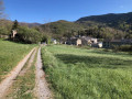
A large meadow serves as a car park at the entrance to the village.

(S/E) Head down to the right, past the cemetery, along the path that runs underneath it and leaves it on your right. Follow the sign for “Tour du Bénal”. This is also the start of the Chemin Vieux. Walk alongside a meadow until you reach a Fork in the road.

(1) Take the path that descends to the left into a wooded area.

(2) The path crosses a track and rejoins it a little further down. Turn left, then right. The yellow markings and the “Tour du Bénal” signposts lead to Sainte-Colombe-sur-Guette.

(3) At the entrance to the village, cross a bridge, head down to the road and take Rue Le Carrié on the right. A sign screwed to the wall again indicates “Tour du Bénal”. The street becomes Rue du Barry d’Amount. The tarmac ends. Continue along the track until you reach a fork.

(4) Head down to the right along the same track towards the Ruisseau de Bailleurs and continue to follow it.

(5) Leave the track and head down to the stream, which you must cross.

(6) Continue along the path which winds its way up through the forest to the Col de Feuillé.

(7) At the pass, turn left and follow the small signposts carefully back to the village (S/E).

Waypoints

  1. S/E : mi 0 - alt. 3,222 ft - Large meadow at the entrance to the village
  2. 1 : mi 0.3 - alt. 3,176 ft - Fork in the road
  3. 2 : mi 1.02 - alt. 2,418 ft - junction
  4. 3 : mi 1.74 - alt. 1,965 ft - Sainte-Colombe-sur-Guette - Aiguette (rivière) - Affluent de l'Aude
  5. 4 : mi 2.12 - alt. 2,238 ft - Junction
  6. 5 : mi 3.27 - alt. 3,035 ft - Junction on the path
  7. 6 : mi 3.35 - alt. 3,068 ft - Crossing the stream
  8. 7 : mi 4.21 - alt. 3,757 ft - Col de Feuillé
  9. S/E : mi 5.01 - alt. 3,222 ft - Large meadow at the entrance to the village

Worth a visit

(S/E) You can take a detour to see the menhir.

The craft brewery in the village is well worth finding out more about.

Other walks in the area

For more walks, use our search engine .

The GPS track and description are the property of this route's author. Please do not copy them without permission.