Puilaurens Citadelle Cliffs (climbing routes) – round trip

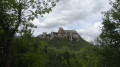
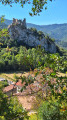
This route describes the access path to the crag at the Puilaurens Point climbing site, starting from the car park. It is not a hike in its own right but serves to facilitate climbers’ access to this magnificent crag. The view is splendid, taking in the castle, the forests and the Pic Dourmidou.

Details

89805810
Creation:
Last update:
Last review:
  • Walking
    Activity: Walking
  • ↔
    Distance: 0.34 mi
  • ◔
    Average duration: 0h 20 
  • ▲
    Difficulty: Easy

  • ⚐
    Back to start: Yes
  • ↗
    Ascent: + 253 ft
  • ↘
    Descent: - 240 ft

  • ▲
    Highest point: 1,752 ft
  • ▼
    Lowest point: 1,558 ft

Description of the walk

Park in the small car park by the roadside just before you reach Puilaurens-Est.

(S/E) Take the right-hand branch of the path. Turn left (20 m) and step over the wire fence

(1) Walk uphill through the forest, veering slightly to the right towards the cliff visible through the trees. The first cliff is the Citadelle sector

(2) Walk along the cliff face to the left, down the slope, to reach the Hogwarts sector.

(3) Follow the route in the opposite direction to return to the car park (S/E).

Waypoints

  1. S/E : mi 0 - alt. 1,558 ft - Car park
  2. 1 : mi 0.02 - alt. 1,572 ft - Fence
  3. 2 : mi 0.1 - alt. 1,680 ft - Citadelle sector
  4. 3 : mi 0.15 - alt. 1,673 ft - Hogwarts sector
  5. 4 : mi 0.17 - alt. 1,752 ft - Car park
  6. S/E : mi 0.34 - alt. 1,558 ft - Car park

Other walks in the area

For more walks, use our search engine .

The GPS track and description are the property of this route's author. Please do not copy them without permission.