Country:

 City:
City:


From Perpignan: D117, Estagel, Maury, Saint-Paul-de-Fenouillet, Caudiès-de-Fenouillet, then at Lapradelle, turn left onto the D22 towards Puilaurens, Salvezines, Gincla and Montfort-sur-Boulzane.
Car park at the village church. It is also possible to park further down, at the junction with the Route de Boulzane (D22).
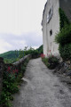
(S/E) With your back to the church, climb the steps facing due west along the Rue des Rosiers, which is full of flowers. Continue straight on until you reach a bend in a very narrow road (Chemin Sainte-Colombe). Look out for the yellow signposting on the left.
Yellow markings are sparse and basic, even confusing
(1) Head up the pretty forest track opposite and reach a bridge over the Ruisseau de Ramberge. Cross it and arrive at a junction of three tracks, at an elevation of 829. Very odd signposting which I couldn’t make head nor tail of!
(2) Head off to the far left (north-west). Carry on straight ahead at every junction, crossroads or fork, eventually reaching the open area of La Couillade at an elevation of 1103.
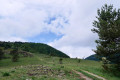
The only signpost present reads: ‘Serre de Montfort’ on the left. The picnic area is on the right in the pasture.
(3) Turn left, heading south-southeast along a track through the forest; further on, let a track on the right lead uphill and, a little further down, at a bend, join another track. A vast area of pasture still in use.
(4) Turn sharply right, heading west, onto the same track and continue for about 600 m until you reach the junction with another track at a sharp bend. Follow the sign: viewpoint!
(5) Continue to the right, south-west, through the forest, along this other track for 600 m, and look out for a wide, grassy forest path on the right.
(6) Caution. Leave the track and head steeply uphill to the right through the forest along this path to reach the Col de l’Hommenet at an elevation of 1,369 metres.
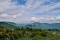
A very beautiful viewpoint.
Unmarked
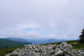
(7) If necessary, go through the large gate and close it behind you. * Immediately head steeply uphill to the left, following the fence on your left-hand side. Follow it first due south, then south-east, through low-lying vegetation, until you reach Pech Pedré at an elevation of 1,572 metres. A vast and very beautiful 360° panorama.
(8) Head north-east towards a large pile of stones. A good spot for a lunch break.
Then continue straight down, heading due east, through the low vegetation, towards a group of fir trees. Go round them on the left, look out for a hunting blind and you’ll immediately come to a junction of three tracks. Note: at this point, the third track is not shown on the IGN map. No tracks are shown on the OSM map.
(9) Then head down to the right, due east, along the edge of the forest. Continue straight down, generally heading east, pass a wet area (spring) whilst keeping the various tracks on either side, and reach, further down, a junction where six tracks meet, with a hunting post opposite, on the other side.
(10) Continue straight ahead on a track with more grass, still heading generally east, pass the hunting post and reach the Fouga at elevation 1250, at the junction of several tracks. There is a galvanised steel enclosure on the right.
(11) Ignore the first grassy track which climbs to the left. Continue along the second cross-track, which is passable by vehicle and then enters the forest, heading north-west. Much further on, when the track turns south-west, look out for a small stony track on the right.
(12) Turn sharply right, heading north-east, onto this track, which remains within the forest. After a long, gently descending walk through this fir forest, you’ll reach a mobile phone mast at elevation 1006, at a junction of tracks and forest paths.
(13) Go round the mast on the left. Head down the opposite slope, due south, along a forest track. 200 metres further down, at the fork, carry on straight ahead, slightly downhill, due south-south-west, and you’ll come to another fork a little further on.
(14) Turn sharply left, heading due east, and continue down the forest track via a series of hairpin bends until you reach a cross-country track suitable for vehicles.
(15) Turn left onto this track, cross the Boulzane stream and join the D22 at a sharp bend. Follow it to the left for about 500 metres until you reach a track on the left signposted: car park and start of walking routes.
Ignore the various signposts until you reach the village
(16) Turn left off the D22 and cross a bridge over the Boulzane. At the car park, continue to the right into the forest and, after 200 m, cross an old bridge over the Ruisseau des Escoumeilles.
(17) Immediately afterwards, at the junction of tracks, turn right onto an open stretch, heading slightly uphill due north until you reach the next Y-junction.
(18) Turn right, heading downhill towards the village. Join Rue de la Mairie, turn left onto it and you’ll soon reach the church car park (S/E).



 Visorando Member
 Moderate
 Easy
Easy