Gibradou viewpoint – Pla des Estable – Le Caunil

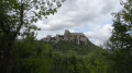
A very beautiful walk with stunning views: Madres – Pérics – Ginèvre – Roc Blanc – Tarbesous – Saint-Barthélémy – Bugarach – Canigou, as well as the three valleys and Puymaurens Castle. Please note: the path runs along the edge of a cliff and should be avoided in strong winds or rainy weather.

Details

66810275
Creation:
Last update:
Last review:
  • Walking
    Activity: Walking
  • ↔
    Distance: 9.16 mi
  • ◔
    Average duration: 6h 25 
  • ▲
    Difficulty: Moderate

  • ⚐
    Back to start: Yes
  • ↗
    Ascent: + 2,539 ft
  • ↘
    Descent: - 2,523 ft

  • ▲
    Highest point: 4,787 ft
  • ▼
    Lowest point: 2,805 ft

Description of the walk

Small car park at the exit of the hamlet of Caunil, at the hairpin bend.

(S/E) Follow the road for about fifty metres, then turn onto the path on the left: marked in yellow. The path is well marked but slippery in wet weather. Continue to the Col du Fraychet and the picnic area.

(1) Continue to the right.

(2) Take the path on the right and head towards the Col d’al Bouich.

(3) Turn right (north-west), pass under the high-voltage power lines, and climb up to the Forêt d’en Malo. Cross a log bridge and reach a junction.

(4) Leave the signposted path and take the track heading due west on the left. Continue to a turning area.

(5) Turn right, heading north-east, for about 200 m, to reach the Barrenc de la Neu.

(8) Turn back.

(5) Turn right to see the ravine, precipice, karstic cave and snow chasm.

(8) Turn back.

(5) Turn right again and follow the well-marked west-north-west track to reach a viewpoint directly below an electricity pylon.

(9) Turn right. The track is faint for about thirty metres, then becomes a very good, easy-to-follow path until it joins the yellow-marked trail, which you leave at the junction.

(10) Turn left and you’ll soon reach a pleasant spot where you might want to stop for a break.

(11) Continue to the right, heading due east, and climb through the boxwood forest. Take care on the section along the cliff edge, which is slippery in wet weather. The signposted path runs alongside the boundary of a forest estate. You’ll reach another viewpoint at Plat d’Estable: views over the Fenouillèdes, Puylaurens Castle, with Peyrepertuse and Queribus in the distance.

(12) Follow the path as it turns south and cross the plateau until you come to a track.

(13) Cross it and head down the slope opposite until you reach the road.

(13) Follow the road, turning left to return directly to the car park where you started (S/E).

Waypoints

  1. S/E : mi 0 - alt. 2,805 ft - Hairpin bend
  2. 1 : mi 0.79 - alt. 3,376 ft - Col du Frayche – picnic area
  3. 2 : mi 1.03 - alt. 3,435 ft - Three-way junction, on the right
  4. 3 : mi 1.62 - alt. 3,642 ft - Col d’al Bouich
  5. 4 : mi 2.15 - alt. 4,124 ft - En Malo Forest
  6. 5 : mi 2.71 - alt. 4,252 ft - Turning area. Return via karstic cave and Barrenc
  7. 6 : mi 2.84 - alt. 4,272 ft - Barrenc de Neu
  8. 7 : mi 3.1 - alt. 4,314 ft - Gorge, karstic cave, snow chasm
  9. 8 : mi 3.85 - alt. 4,295 ft - Gibradou viewpoint
  10. 9 : mi 4.52 - alt. 4,012 ft - Junction with the signposted path
  11. 10 : mi 4.72 - alt. 3,980 ft - Viewpoint
  12. 11 : mi 6.44 - alt. 4,711 ft - Pla d’Estable – viewpoint
  13. 12 : mi 6.84 - alt. 4,603 ft - Track
  14. 13 : mi 7.83 - alt. 3,373 ft - Route
  15. S/E : mi 9.16 - alt. 2,805 ft - Hairpin bend

Notes

You can drive up to the Col du Frayche (1).
(13) In dry weather, you can return to the Col de Frayche (1) and head back to the start by following the path you took on the way up.
There is a water point at the picnic area.
Not to be attempted in rainy or very windy conditions.

Worth a visit

Puylaurens Castle.

Reviews and comments

4.3 / 5
Based on 3 reviews

Reliability of the description
4.3 / 5
Ease of following the route
4.3 / 5
Route interest
4.3 / 5
Nathguido
Nathguido

Thanks for the information

Machine-translated

fabre.jp
fabre.jp

Overall rating : 4 / 5

Date of your route : Apr 06, 2026
Reliability of the description : ★★★★☆ Good
Ease of following the route : ★★★★☆ Good
Route interest : ★★★★☆ Good
Very busy route : No

Please note: Between points 8 and 11, the path can be difficult. The trail is sometimes obscured or even dangerous because trees have been felled and branches left strewn across the path.
The signposting is inadequate and ambiguous (conflicting with a double yellow line).

Machine-translated

LEFRANC Sylvie
LEFRANC Sylvie

Overall rating : 4 / 5

Date of your route : Sep 29, 2025
Reliability of the description : ★★★★☆ Good
Ease of following the route : ★★★★☆ Good
Route interest : ★★★★☆ Good
Very busy route : No

We shortened the route by going from point 4 to point 9. A beautiful hike with superb views of the mountains

Machine-translated

Texierala
Texierala

Overall rating : 5 / 5

Date of your route : Sep 09, 2025
Reliability of the description : ★★★★★ Very good
Ease of following the route : ★★★★★ Very good
Route interest : ★★★★★ Very good
Very busy route : No

A very beautiful hike with a slight elevation gain.
In good weather, the panoramic view of the Pyrenees is magnificent.
The trail is well marked, and the cliff-edge sections are accessible as there is always an alternative route available.
This hike offers a variety of landscapes.
You can shorten the distance by starting from the pass above the village of Le Caunil.
A must-do.

Machine-translated

caminador66
caminador66

regarding the ‘Belvédère du Gibradou – Pla des Estable – Le Caunil’ walk.
I’m sending you the correct coordinates for the “Barrenc de la Neu”: 31T 0438453 4736900
It’s already poorly marked on the IGN map, and the route on your website that’s supposed to lead there doesn’t actually reach it. Several walkers turn back without having found it.
Which is a shame, as it’s a very interesting spot.

Machine-translated

Other walks in the area

For more walks, use our search engine .

The GPS track and description are the property of this route's author. Please do not copy them without permission.