Country:

 City:
City:


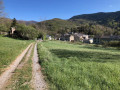
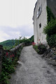
There are two possible car parks (at the entrance to the village, on the left, when coming from Axat or the Col de Jau, or behind the town hall). You’ll immediately spot the ‘Chemin vieux’ signs.
(S/E) Take the path leading to Buillac, starting from the rear of the post office/town hall building.
Once you reach the hamlet of Buillac, head up to the right, then to the left.
(1) At the wash house and car park, take the hairpin bend down to the left, cross a road and join a track.
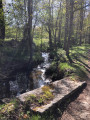
(2) Turn left onto it for 100 metres, then turn right. Through the woodland, head to the bank of the stream, passing the ruins of Montplaisir (sign summarising the history of the site). Signs about the Pyrenean desman.
(3) Continue along the path. Reach Le Bousquet, enter via Rue de la Loubatière and walk uphill to the town hall.
(4) Turn left onto Rue du château d’eau. Walk up to the mast via a track above the road.
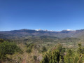
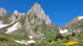
(5) Cross the road and, opposite, follow the sign for “Tour du Casteldos”. Follow these small yellow signs to the Col du Garabeil, going round the Roc du Casteldos. Splendid views of the Pyrenees mountain range, particularly the Donezan and the Roc Blanc.
At the Col du Garabeil, leave the Tour du Casteldos and Tuc de Flanzy route and take the road on the right for about twenty metres.
(7) Then follow the path down to the left (west). After 200 metres, turn due south onto a path. Cross a stream and join a track.
(7) Follow it down to the right until you reach the road (D17).
(8) Cross it carefully and take the smaller tarmac road opposite, until you reach a junction between the road and a track near the Ruisseau de Rebiscagné.
(9) Turn right and follow the path for 100 metres, then turn left, heading north-west, to reach the village of Escouloubre.
(10) Head straight ahead and, after a walk round the village, you can visit the farmhouse inn Le Cochon du Madres (booking recommended for meals).
(11) From the farmhouse inn, turn back for 30 m and head right (north-east) to reach the entrance to the village, which you passed on the way there.
(10) Turn right and, following the route in the opposite direction to the outward journey, head towards the Col du Garabeil.
(6) Carry on along the D17 for 80 metres, and continue straight ahead at the left-hand bend in this road. Follow the path which takes you to the junction near the mast, without going round Casteldos again.
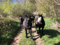
We came across some horses and a stone marten. Birds of prey flew overhead. A real treat.
(5) Return to Roquefort by the same route as on the way there, to the car park behind the town hall
(S/E).

 Visorando Member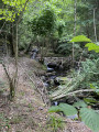

 Difficult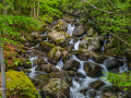
 Easy
Easy