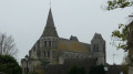
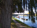
Beauregard Circuit via the Bois de Viville.

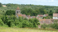
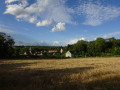
A peaceful and pleasant walk through a charming valley and well-maintained woodland.

Details

12450628
Creation:
Last update:
Last review:
  • Walking
    Activity: Walking
  • ↔
    Distance: 4.06 mi
  • ◔
    Average duration: 2h 05 
  • ▲
    Difficulty: Easy

  • ⚐
    Back to start: Yes
  • ↗
    Ascent: + 272 ft
  • ↘
    Descent: - 256 ft

  • ▲
    Highest point: 505 ft
  • ▼
    Lowest point: 266 ft
  • ⚐ Country: France
  • ⚐ City: Dieudonné (60530)
  • ⚑
    Start/End: N 49.230767° / E 2.248062°
  • ❏
    IGN map(s): Ref. 2312ET
  • Hour-by-hour weather

Description of the walk

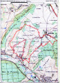
Car park opposite the Dieudonné town hall and school.

(S/E) Turn left and walk up the street for about 400 metres.

(1) Turn right onto Ruelle du Stade (signposted). Walk past the stadium and continue straight on along the path through the woodland.

(2) At the junction, continue along the path that goes uphill. At the top of the hill, take the path veering slightly to the right and continue to the end.

(3) Turn left into the housing estate until you reach the junction, then turn left. Enter the woods.

(4) Take the path leading uphill to the left. After the rest area (benches), continue to the left for 100 m.

(5) Follow the path down to the left. This path is a bit steep and slippery in wet weather.

(6) At the bottom of the path, turn right and carry on straight ahead until you rejoin the path you took on the way there.

(2) Turn right. Follow the path back along the same route you took on the way there.

(1) Turn left and return to the town hall and school car park (S/E).

Waypoints

  1. S/E : mi 0 - alt. 266 ft - Town Hall car park
  2. 1 : mi 0.21 - alt. 282 ft - Ruelle du Stade
  3. 2 : mi 0.91 - alt. 328 ft - At the foot of the hill, at the junction of the circular route
  4. 3 : mi 1.56 - alt. 472 ft - Residential estate
  5. 4 : mi 2.33 - alt. 446 ft - Junction, on the left
  6. 5 : mi 2.61 - alt. 472 ft - Junction, on the left
  7. 6 : mi 2.73 - alt. 361 ft - At the bottom of the steep path, on the right
  8. S/E : mi 4.05 - alt. 266 ft - Town Hall car park

Worth a visit

Places to stop for a picnic halfway along the route:
- before the woods, in one of the meadows on either side of the path.
- in the woods: an open area with benches where dogs or children can play.

Reviews and comments

3.9 / 5
Based on 4 reviews

Reliability of the description
4.3 / 5
Ease of following the route
4.5 / 5
Route interest
3 / 5
User 17876212

Overall rating : 4.7 / 5

Date of your route : Jan 25, 2026
Reliability of the description : ★★★★★ Very good
Ease of following the route : ★★★★★ Very good
Route interest : ★★★★☆ Good
Very busy route : Yes

If you are hiking on this route during hunting season, do not forget to wear fluorescent clothing or a vest. We were lucky enough to see a deer.

Machine-translated

User 15644052

Overall rating : 4 / 5

Date of your route : Sep 21, 2025
Reliability of the description : ★★★★☆ Good
Ease of following the route : ★★★★★ Very good
Route interest : ★★★☆☆ Average
Very busy route : Yes

A pleasant walk with my dog through varied scenery of fields and forests.

Machine-translated

geoffala
geoffala

Overall rating : 3.7 / 5

Date of your route : Feb 28, 2022
Reliability of the description : ★★★★☆ Good
Ease of following the route : ★★★★☆ Good
Route interest : ★★★☆☆ Average
Very busy route : No

We had a bit of trouble figuring out what the designated area was. It all became clear when we saw three benches in the woods, but until we found them, we thought we’d got the wrong place...

Machine-translated

ticoqvex1
ticoqvex1

We went on this walk on 1 August. The paths were in great condition, and the hillside was in full bloom. We thought the area was really lovely. That’s why I posted about it. Now, if the tractors have been through in the meantime and ruined the paths, I’m sorry about that. I’ll go back to have a look.
As for the sun exposure, you only need to look at the map to see that, and if you’re sensitive to the sun, I can only advise you to stick to walks exclusively in the national forest or at times when the temperature is more bearable.

Kind regards,

Machine-translated

agrandspas
agrandspas

Overall rating : 3.3 / 5

Date of your route : Sep 09, 2021
Reliability of the description : ★★★★☆ Good
Ease of following the route : ★★★★☆ Good
Route interest : ★★☆☆☆ Disappointing
Very busy route : No

Route through fields and tracks rutted by tractors, mostly in full sun

Machine-translated

Other walks in the area

For more walks, use our search engine .

The GPS track and description are the property of this route's author. Please do not copy them without permission.