Country:

 City:
City:


Park in the large car park at Place Charles de Gaulle (market on Saturday mornings).
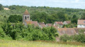
(S/E) Follow Rue Aurélien Cronnier towards the post office and the church. Cross Rue Roger Salengro (on the left) and Rue de l’Église (on the right) to reach the church forecourt.
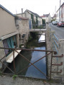
(1) Walk round the church on the left, then turn left onto Rue Florentin Gaudefroy. Walk alongside the Coisnon. At the end of the street, first turn left then right and follow Rue Vermand. At the next junction, turn left onto Rue Donatien Marquis. Continue straight on, crossing Rue André Caron and then Rue du Grand Beffroi in turn.
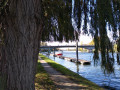
(2) Just before the River Esches, turn right into Parc Chantemesse. Walk alongside the river, then cross it at a bandstand. You’ll come out onto Rue Henri Barbusse; follow it to the right. At the next junction, first turn left then right and continue along Rue Henri Barbusse. Take thethird left, Rue de Ronquerolles.
(3) At the next junction, carry on straight ahead and go under the railway bridge. Continue along Rue de Chambly.
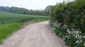
(4) At the fork in the road, turn right, still on Rue de Chambly. Cross the wide bridge over the A16 motorway. On the other side of the bridge, turn right onto Route de Renouval. About 150 m further on, turn right onto a wide dirt track (fields on the left and a fence on the right). Follow the A16 on your right.
(5) After about 1.2 km, turn left onto the track. Head uphill through a wooded area. You’ll come out onto a tarmac road; follow it to the right towards Gandicourt. After about 75 m, take thefirst track on the left. Head uphill, first along the edge of a field and then through woodland.
(6) At the crossroads, take thesecond path (ignore the signposted path). At the next junction, turn left and, at the T-junction, left again. Cross the Route des Tuileries (tarmac road) and continue along the wide path opposite.
(7) At the next junction, turn right (yellow markings). The path is bordered by a meadow on the right and a fence on the left. At the next two junctions, continue straight ahead along the marked path.
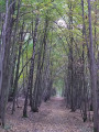
(8) Atthe third junction, turn left onto a small path that leads into the Bois de la Tour du Lay (yellow markings). Pass the first path on your left and, at the next junction, carry on straight ahead (yellow markings). At the next junction, turn left (due east) following the yellow markings, then take the first left and continue straight on (still following the yellow markings).
(9) Pass through a metal gate and carry on straight ahead (ignore the signposting that veers off to the right). The path runs alongside the castle fence on the left. Further on, ignore a path on the right and carry on straight ahead (fence on the left and field on the right).
(10) After about 500 m, turn left onto the path that descends and continues to run alongside the fence. You’ll come out onto a tarmac road (Allée des Écuries) and follow it to the right.
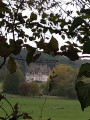
(11) Walk past the entrance to Chambly Castle and carry on straight ahead along the Sentier du Haras (gravel track). Walk past the Chambly equestrian centre and, at a junction (with a wayside cross), carry on straight ahead along Rue de la Croix Maillet.
(12) In the residential area, take thefirst right onto Rue de Chambly. At the roundabout, cross Route de Champagne and head up into the park overlooking the A16 motorway. Walk through the park and head back down at the other end via a hairpin bend.
(4) Carry straight on along Rue de Chambly (which you took on the way there) and pass under the railway bridge again.
(3) Turn immediately right into Rue des Marchands. Take thesecond left, Rue de la Marne. At the next junction, turn left onto Rue de la Cave des Chevaliers. Cross Rue Léon Blum to reach Rue de la Chevalerie.
(13) First turn right then left, and follow Rue Madame Lecomte. At the end, turn right onto Rue Henri Barbusse. Carry straight on and ignore the streets on the left. Walk past a small triangular square. Cross Rue Louis Leclère on the left-hand side and follow the footpath running alongside the River Esches. Take thesecond footbridge on the left, cross the river and carry straight on until you reach Notre-Dame Church.
(1) Then turn right onto Rue Aurélien Cronnier to return to Place Charles de Gaulle (S/E).

 Visorando Member
 Easy
Easy 
 Difficult