Country:
 City:
City:


Car park opposite the cemetery
Yellow PR® signposts
(S/E) Start with your back to the cemetery, turn left at the Crédit Agricole and follow the footpath that runs alongside the Intermarché supermarket, then turn left into the street that runs alongside the supermarket’s car parks. Continue straight on until you reach a barrier (sign: ‘No entry except for users’).
Turn left onto a wide stony path that runs alongside the fence of Quimper-Pluguffan Airport on your right and the allotments on your left. You’ll reach a crossroads with a cross.
(1) Turn left, walk alongside the football pitch and you’ll come to a ‘Stop’ sign (with a view, straight ahead, of the church tower). Turn right towards the town hall (note an old well on your left near it).
Cross Rue de Quimper at the pedestrian crossing and follow it to the right for about ten metres.
(2) Turn left into the first street, Pen ar Créac’h (signpost poorly positioned and hard to see), then right into Allée des Ajoncs and, at the end, turn left.
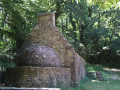
(3) Turn right onto a path running alongside a wash house; turn right at the footbridge, then veer left to head down towards an old house containing a bread oven restored by the ULAMIR Association (Union Locale d’Animation en Milieu Rural, a community education organisation). With your back to the bread oven, head towards another footbridge, then continue to the right through the woodland and veer left, ignoring a path on the right, to reach a road. Turn right and follow the wide path that descends towards the sewage treatment plant on your right.
Carry on, still through the woodland, along this wide path which climbs past the pumping station and reach the top of the path.
(4) Turn right (the signposting is poorly positioned; the signpost with the Yellow Cross is located at the end of the street) and you’ll arrive opposite a construction site for a water retention basin (June 2020). Turn left towards Rue de Guengat.
Turn left, follow the footpath which is slightly separated from the road, and you’ll reach a roundabout.
No signposting
(5) Go round the roundabout and take the first street on the left, Rue Mathurin Meheut, following the footpath which then turns right. Continue straight on to the end of this street. Note the well-designed layout of the housing estate, which prioritises pedestrian safety.
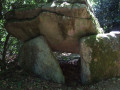
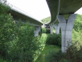
(6) Turn right, ignore the path leading to a footbridge over the D56 (barrier) and continue straight on along the path behind the houses until you come out onto a street near the D56 roundabout. Turn left to cross the roundabout. Near a small car park, look out for a clearing leading into the woods (a large tree trunk is visible in the middle). Turn slightly left; the dolmen is about a hundred metres further on, on the right.
(7) Continue through the woods, following a clearly visible track which veers to the right and then runs along the edge of the woods, emerging near the D56. At the exit, take the small dead-end road, Hent Kerinig ar Vourc’h, which overlooks the D56; ignore the access to the footbridge on the left and the farm on the right.
Yellow PR® signposting (very old)
Continue due south along a wide, sunken farm track which leads out onto the D40 between a notary’s office on the left and a large warehouse belonging to a gardening equipment company on the right. Continue through its car park.
No signposting
(8) Carefully follow the D40 on the right-hand side, using the wider verge. Pass a road leading to a farm on the right and reach another small road on the left (house on the right: Ty Gwenn). Carefully cross the D40 and take the small road opposite until you reach the entrance to Kerguebed Farm.
Yellow PR® signposting(newPR®)
(9) Turn left towards the farm, then right – before a house – onto a track, keeping the buildings on your left, and join a cross-track which you follow to the left towards a road.
Just before the junction with the road, turn left onto the path running alongside a field. You’ll come to a roundabout.
(10) Cross with care and follow the footpath towards the village, first to the right, then to the left.
Opposite the Intermarché supermarket, cross at the pedestrian crossing, then cross the veterinary clinic car park to reach the car park on the left (S/E).

 Visorando Member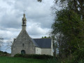


 Moderate