Country:
 City:
City:


(7) Cemetery car park.
YellowPR®® signposts
(S/E) With your back to the cemetery, head towards Rue de Pouldreuzic and follow it to the left.
(1) Ignore the lane on the left (which you’ll take on the way back) and continue along Rue de Pouldreuzic, following the existing footpath to the right and then to the left.
(2) Turn left at the roundabout, crossing the Route de l’Aéroport. Follow the path running alongside the field and parallel to the road. At the end, turn right and continue along an ascending sunken lane.
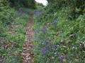
(3) Just before a crossroads, turn left onto a sunken lane towards Kerguébed, pass through the hamlet by turning left and cross a small road. Opposite, take the path that leads down towards a stream. At this point, look out for a small bridge on the left, made of a single stone. Head back up towards Kernizon, pass through this hamlet and turn right. Follow this sunken track, which joins a small road just before Meilh Boaz. Follow it to the right for about a hundred metres.
No signposting (traces of old signposting have faded)
(4) Let thePR®® head off to the left and, at the end of the road, take the ascending sunken track which then turns left and joins a small road. Follow it straight on until the next T-junction (elevation 88). Then turn left.
(5) Turn left towards Keraou, then take the farm track on the right, which continues through meadows.
PR®® yellow markings+ MTB
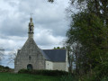
(6) At the old signpost, rejoin thePR®® trail you left earlier and follow it to the right until you reach the next road. On your left, you’ll see the Notre-Dame des Grâces Chapel. Turn left and climb up into the chapel’s enclosure. You’ll also notice the old cross. A good spot for a break.
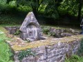
(7) Continue along the road and, at the ‘Meilh Cornigell’ sign, take the hairpin bend to the right and head down into a small valley along a wide, hard-packed earth track to the votive fountain.
(8) Return to the road and carry on straight ahead (north) following thePR®® sign; cross a stream via the footbridge and continue along the path on the right, which overlooks a valley through which a stream flows. You will reach the hamlet of Kergoad Uhelan.
(9) Turn right and head down into the valley. Cross the stream over large boulders and join a small road at Kervorvan Farm, which you leave on your right. At the next road, turn left and continue straight on until you reach a transformer.
(3) Turn right back onto the path you took on the way there and follow the edge of the field.
(2) Turn right to cross the roundabout and head towards the village centre.
(1) Turn right to walk past the shopping centre, then turn left. Follow the path, from where you can see the airport runway on your right. Walk past the allotments; at the cross, turn left and walk alongside the football pitch.
(10) Turn right into the first street towards the town hall and join the D40. Follow it to the right for a few dozen metres, turn left into the first street and then right into the next one, Allées des Ajoncs. At the end, turn left to reach the wash house, slightly to the right. Go down the stone steps and then back up the other set of steps.
Unmarked
(11) Turn slightly left onto Rue du Lavoir, go past a roundabout and rejoin the D40 just before the roundabout by the 15th-century Saint-Cuffan Church. Turn right, then left at the roundabout. Walk past the imposing church and immediately turn right onto the Venelle de l’Église, which joins the main street further on. The car park is about a hundred metres to the left (S/E).



 Visorando Member


 Moderate