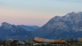
Tour of the Semnoz resort, Annecy side

From the resort to the plateau. Discover a hidden viewpoint in the forest, which is not signposted.

Details

2983062
Creation:
Last update:
Last review:
  • Snowshoeing
    Activity: Snowshoeing
  • ↔
    Distance: 3.04 mi
  • ◔
    Duration according to the author: 3 hrs 
  • ▲
    Difficulty: Easy

  • ⚐
    Back to start: Yes
  • ↗
    Ascent: + 636 ft
  • ↘
    Descent: - 636 ft

  • ▲
    Highest point: 5,515 ft
  • ▼
    Lowest point: 4,843 ft

Photos

Description of the walk

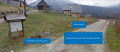
(S/E) Set off from the resort car park on the Annecy side and follow the walking route (yellow markers) on the downhill skiing side. To do this, cross the beginner’s slopes to the far end of the resort, at the Belvédère ski lift.

(1) Turn left, follow this route and climb up to the plateau, where you’ll find the Courant d’Ere bar and restaurant (around 2 km). Join the shared trail – a link trail used for cross-country skiing and walking – on the left, heading towards the top of the ski lift. Head back down towards the Les Rochers Blancs hotel and restaurant.

(2): Take the track behind the hotel – please note, this is a shared track – as far as Les Combes. Cross the road, head down into the valleys and follow the route, walking alongside the cross-country ski trail. Cross the track, turn right towards Crêt de Tertère. Head up to the right through the forest. Turn left and continue for 100 m.

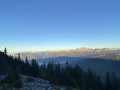
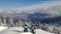
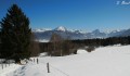
(3) Discover a viewpoint with views of the mountains and the lake. Retrace your steps.

(4) Continue alongside the Lamas trail, through the bottom of the valleys, and rejoin the walking route (yellow markers). Follow this route to the resort (S/E)

Waypoints

  1. S/E : mi 0 - alt. 4,898 ft - Resort car park
  2. 1 : mi 1.37 - alt. 5,397 ft - Le Courant d’Ere Restaurant
  3. 2 : mi 1.98 - alt. 5,417 ft - Les Rochers Blancs Hotel and Restaurant
  4. 3 : mi 2.35 - alt. 5,220 ft - Viewpoint
  5. 4 : mi 2.57 - alt. 5,210 ft - Walking trail
  6. S/E : mi 3.04 - alt. 4,898 ft - Resort car park

Notes

Be careful in areas shared with cross-country skiers: walk in single file on the right-hand side of the track, if possible alongside it, where you can.
Please note: point 3 is not marked by poles. Follow the signposts carefully in Les Combes.
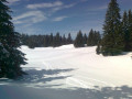
The best time to do this hike is on snowshoes, when the resort is closed, just after the season has ended.

This route passes through multiple protected areas, which may be subject to special regulations:

Worth a visit

On the plateau, you can follow the ‘3 Lakes’ route.
Along the connecting trail, you can climb up to the orientation table: 360° view.
At Les Rochers Blancs, there’s a view of Mont Blanc.
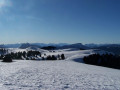
At the Belvédère, there are views of the villages, mountains and Lake Annecy.
You can rejoin the walking route via the top of Les Combes (heading back up towards the road) and explore the igloos (when there’s plenty of snow).

Reviews and comments

4.2 / 5
Based on 4 reviews

Reliability of the description
4.3 / 5
Ease of following the route
4 / 5
Route interest
4.3 / 5
Lenaic
Lenaic

Overall rating : 4 / 5

Date of your route : Nov 04, 2024
Reliability of the description : ★★★★☆ Good
Ease of following the route : ★★★☆☆ Average
Route interest : ★★★★★ Very good
Very busy route : No

A lovely walk – the route actually runs right alongside the one marked on the map, but you can’t get lost 😜😂As for point 3, it’s true that it isn’t signposted (you have to look for the viewpoint… once you’ve gone through the wire fence, look for the little path going uphill on your right… then, on the rocks, head left towards the fir trees to find the superb view)
A really lovely walk that took 1 hour 40 minutes at a leisurely pace 👍🏼👍🏼👍🏼

Machine-translated

Loop28
Loop28

Overall rating : 4 / 5

Date of your route : Feb 27, 2021
Reliability of the description : ★★★★☆ Good
Ease of following the route : ★★★★☆ Good
Route interest : ★★★★☆ Good
Very busy route : No

An easy walk in the snow – a shame we couldn’t find the viewpoint even though we were right on the trail 😁? The yellow markers make the route much easier to follow in the snow. A lovely family walk.

Machine-translated

queyrubay
queyrubay
• Edited:

Overall rating : 4.7 / 5

Date of your route : Jan 21, 2021
Reliability of the description : ★★★★★ Very good
Ease of following the route : ★★★★★ Very good
Route interest : ★★★★☆ Good
Very busy route : Yes

A unique route with some wild and unusual sections.
Do make sure you don’t miss the viewpoint – it’s unmarked, which is part of its charm.
A safe snowshoe hike suitable for most people.

Machine-translated

Meije2015
Meije2015

Overall rating : 4 / 5

Date of your route : Mar 01, 2020
Reliability of the description : ★★★★☆ Good
Ease of following the route : ★★★★☆ Good
Route interest : ★★★★☆ Good

Please note that the path to point 3 (the viewpoint) is not marked with yellow posts like the rest of the walk, so you might miss this viewpoint if you only follow the markings provided by the resort
Otherwise, it’s a lovely, varied and very accessible walk

Machine-translated

Other walks in the area

For more walks, use our search engine .

The GPS track and description are the property of this route's author. Please do not copy them without permission.