Tour de l’Angle Est via the Tour des Ebats

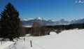
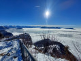
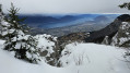
A snowshoe hike at Le Revard, along the ridges, with lovely views of Les Bauges, Aix-les-Bains and its lake, and the Chartreuse...

Details

n°406982
Creation:
Last update:
Last review:
  • Snowshoeing
    Activity: Snowshoeing
  • ↔
    Distance: 2.61 mi
  • ◔
    Duration according to the author: 4 hrs 
  • ▲
    Difficulty: Moderate

  • ⚐
    Back to start: Yes
  • ↗
    Ascent: + 1,148 ft
  • ↘
    Descent: - 1,119 ft

  • ▲
    Highest point: 5,125 ft
  • ▼
    Lowest point: 4,032 ft

Photos

Description of the walk

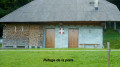
Park at the roadmender’s cottage on the edge of the D913, a few hundred metres below the start of the Revard ski runs.

(S/E) The route begins behind the house on theGRP® Tour des Bauges trail (marked in yellow and red). This trail climbs through the mountain pastures before heading west into the forest.

After a few hairpin bends through the forest, you’ll reach the Tour des Ébats (1,470 m) at the northernmost point of the massif.

(1) Continue along the ridge heading south-west to reach the Tour de l’Angle Est (1,562 m).

(2) Continue south-west to reach the top station of the Revard chairlifts.

(3) Turn left, heading north-east, to follow the ski run down to the car park.

From there, carry on straight ahead across the fields to reach the roadmender’s cottage (S/E).

Waypoints

  1. S/E : mi 0 - alt. 4,032 ft - Roadmender’s house, D913
  2. 1 : mi 0.93 - alt. 4,754 ft - Tour des Ébats
  3. 2 : mi 1.52 - alt. 5,125 ft - East Angle Tower
  4. 3 : mi 1.68 - alt. 5,075 ft - Chairlift top station
  5. S/E : mi 2.61 - alt. 4,032 ft - Roadmender’s house, D913

Reviews and comments

3.7 / 5
Based on 2 reviews

Reliability of the description
3 / 5
Ease of following the route
3.5 / 5
Route interest
4.5 / 5
Barnabepcrd
Barnabepcrd

Overall rating : 4 / 5

Date of your route : Jan 31, 2021
Reliability of the description : Not used / Not applicable
Ease of following the route : ★★★☆☆ Average
Route interest : ★★★★★ Very good
Very busy route : No

The day before we set off, I decided to check the reviews for this hike, and the only review (3.5/5) made me have second thoughts about this snowshoe walk.

I decided to give it a go anyway, and in the end, it was brilliant!

There were four of us (two 55-year-old adults and two 20-year-olds) and we completed the route without any difficulty.

The route is very pleasant, even in foggy conditions.

I wouldn’t recommend taking very young children, though, as the section along the ridge is quite vertiginous.

It’s better to take the route along the ridge rather than the ‘S’-shaped path through the forest (between points 0 and 1).

In any case, do give this walk a go – it’s well worth it (accessible with or without snowshoes)

Barnabé

Machine-translated

jeff777
jeff777
• Edited:

Overall rating : 3.7 / 5

Date of your route : Feb 20, 2019
Reliability of the description : ★★★☆☆ Average
Ease of following the route : ★★★★☆ Good
Route interest : ★★★★☆ Good

:!(!)!:
PLEASE NOTE: this is a summer hike. It’s ideal for the ascent on snowshoes, except that:
It is advised against by a sign located on the East Tower, which is just after the tricky section on the ridge.
The descent is disappointing, following the ski run and then the road further down, where a sign warns that the area is off-limits to pedestrians.
The section along the ridge can be tricky or even dangerous depending on snow conditions, the weather and the experience of the snowshoe walkers. In short, an alternative route is needed for the descent, and good conditions are required for the ascent, which is nonetheless enjoyable.

Machine-translated

Other walks in the area

For more walks, use our search engine .

The GPS track and description are the property of this route's author. Please do not copy them without permission.