Mala Tower

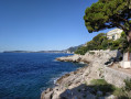
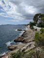
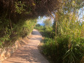
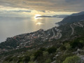
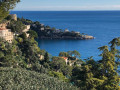
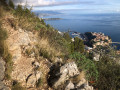
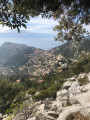
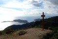
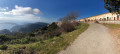
This short coastal walk will take you along a lovely stretch of the seafront lined with sumptuous villas.

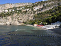
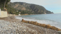
After passing Cap Mala (weather permitting), you will reach Mala Beach, situated in a sheltered cove at the foot of the Barre des Pissarelles.

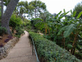
You will then head back up via the Mala steps and cross the lovely Sacha Guitry Park to return to the starting point.

Details

2535752
Creation:
Last update:
Last review:
  • Walking
    Activity: Walking
  • ↔
    Distance: 1.50 mi
  • ◔
    Average duration: 0h 55 
  • ▲
    Difficulty: Easy

  • ⚐
    Back to start: Yes
  • ↗
    Ascent: + 249 ft
  • ↘
    Descent: - 240 ft

  • ▲
    Highest point: 203 ft
  • ▼
    Lowest point: 3 ft
  • ⚐ Country: France
  • ⚐ City: Cap-d'Ail (06320)
  • ⚑
    Start/End: N 43.720179° / E 7.395182°
  • ❏
    IGN map(s): Ref. 3742OT
  • Hour-by-hour weather

Photos

Description of the walk

Park on Avenue Raymond Gramaglia near La Pinède restaurant.

(S/E) Follow this avenue eastwards until you reach a hairpin bend to the left. Head down to the right along the Chemin du Cap Rognoso to The Rock villa (black and gold gate).

(1) Turn right towards Cap Mala via the steps leading to the coastal path.
Follow this path until you reach a small gate leading to Cap Mala.

(2) Weather permitting (access closed in rough seas), continue straight on to go round Cap Mala and reach Mala Beach via a series of steps leading up and down overlooking the sea.

If the gate is closed, follow the diversion in place (go up the stairs on the right, then follow the road to the left and go down the stairs three bends further on) to rejoin the coastal path on the other side of the headland.

(3) Once at La Mala Beach, take the steps leading up to the right just in front of the La Réserve beach establishment. Follow the small Rue Allée Mala to the right and pass in front of the Eden Palace. Continue to the right along Avenue François de May to reach the entrance to Sacha Guitry Park. Walk down through the park on the left to rejoin Avenue Raymond Gramaglia near the restaurant La Pinède (S/E).

Waypoints

  1. S/E : mi 0 - alt. 43 ft - Avenue Raymond Gramaglia
  2. 1 : mi 0.21 - alt. 69 ft - Villa The Rock
  3. 2 : mi 0.73 - alt. 33 ft - Access to Cap Mala - Cap Mala
  4. 3 : mi 0.99 - alt. 10 ft - Plage de la Mala
  5. S/E : mi 1.5 - alt. 43 ft - Avenue Raymond Gramaglia

Notes

Hiking strictly prohibited (access closed by municipal order) in rough seas.

Public toilets and showers at Mala Beach (3).

Sacha Guitry Park open from 8.00 am to 6.00 pm from 16 October to 14 April and from 7.00 am to 8.00 pm from 15 April to 15 October.
Water point inside the park.

Picnic area next to La Pinède restaurant (S/E).

Worth a visit

An interesting walk for a swim at Mala Beach in summer, but it gets very busy and it can be very hot on the coastal path between points (1) and (2).

This walk can also be very pleasant on a fine day out of season.

Reviews and comments

5 / 5
Based on 5 reviews

Reliability of the description
5 / 5
Ease of following the route
5 / 5
Route interest
5 / 5
User 25734116

Overall rating : 5 / 5

Date of your route : Apr 20, 2026
Reliability of the description : ★★★★★ Very good
Ease of following the route : ★★★★★ Very good
Route interest : ★★★★★ Very good
Very busy route : Yes

The walk runs from Marquet Beach to Mala Beach and back. Stunning coastal scenery. Belle Époque villas on the way back. At Mala Beach, there is just one restaurant, Éden (very expensive). Picnic tables halfway along the route. The path is very well signposted. Best done before the summer crowds arrive.

Machine-translated

Treblac
Treblac

I wasn’t able to go on this walk because the coastal path starting from Cap d’Ail is closed for works (from 10 February towards the Cap). However, this gave me the chance to head back into Cap d’Ail, where I happened to come across a producer of orange blossom essence and rose water – a really lovely lady who showed me around her garden and explained her work.

Machine-translated

berlib
berlib

Overall rating : 5 / 5

Date of your route : Apr 15, 2024
Reliability of the description : ★★★★★ Very good
Ease of following the route : ★★★★★ Very good
Route interest : ★★★★★ Very good
Very busy route : Yes

This route on 13 April, with summer weather and a perfectly calm sea, was very enjoyable!
It’s very easy to follow and you walk only on paths that are perfectly suitable for vehicles!
For those who love beautiful mansions... there are plenty of them, some of them well hidden!

Machine-translated

bertenere
bertenere

Overall rating : 5 / 5

Date of your route : Feb 18, 2020
Reliability of the description : ★★★★★ Very good
Ease of following the route : ★★★★★ Very good
Route interest : ★★★★★ Very good

A lovely short walk with stunning views and beautiful villas – best done at the end of the day to catch the sunset.

Machine-translated

galli06910
galli06910

Overall rating : 5 / 5

Date of your route : Jan 03, 2020
Reliability of the description : ★★★★★ Very good
Ease of following the route : ★★★★★ Very good
Route interest : ★★★★★ Very good

Hello, a lovely winter walk along the coast – it’s a shame the coastal path leading to Mala Beach was still closed for works, I didn’t go to that beach; as my wife had recently had knee surgery, I avoided the descent and the numerous steps, but to make up for it we headed back up to the main road (M6098) from there. After having a coffee, we went back down to join the coastal path via the Chemin de Da Souta and the Chemin du Chien Bleu; Once we reached the coastal path, we headed towards Marquet beach and the port of Cap d’Ail on the border with Monaco, returning to the car along the coast, not forgetting the walk around the Cap d’Ail headland – a very pretty landscape, a walk well worth doing, not very long and easy.

Machine-translated

• Edited:

The user account associated with this content has been deleted.

Other walks in the area

For more walks, use our search engine .

The GPS track and description are the property of this route's author. Please do not copy them without permission.