Country:
 City:
City:


Head to the end of Avenue Marquet in Cap-d'Ail, where our car park and starting point are located.
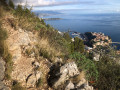
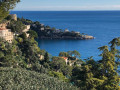
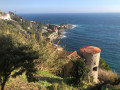
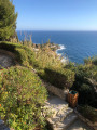
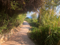
(S/E) This walk begins by taking the coastal path, also known as the Chemin des Douaniers or the seaside path. Follow the path to the junction with Avenue des Douaniers. At this point, turn left. Walk past a restaurant to complete the full circular route around this small headland known as Cap d’Ail and discover the volcanic rocks along the coast. Once you have completed this circular route, return to the coastal path and continue towards Cap Fleuri and then Cap Rognoso.
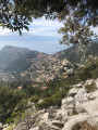
(1) Turn right onto Chemin du Cap Rognoso, following the sign for “Villa les Camélias”. This is a steep tarmac road with little traffic. After about fifty metres, the road winds left and then immediately right. Turn right at this second bend and continue along the path up to Cap Rognoso, which, at its summit, ends in a series of steps leading onto Avenue du Trois Septembre, also known as the “lower corniche”.
(2) Follow this avenue to the right, then, after about 150 metres, turn right slightly downhill into a small, welcoming public garden with a sea view. Access it via three steps flanked by two fire hydrants and a sign reading “Chemin da Souta”.
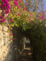
The Chemin da Souta begins with a flight of steps on the right, which turns into a concrete path a few metres further down. Walk alongside gardens where the vegetation is completely different from that found by the sea. At the junction of the Chemin du Golfe and the Chemin da Souta, continue straight ahead, go down a few steps and cross a bridge that once spanned the Cap-d’Ail–Monaco railway line. Continue along this tarmac road and carry on straight ahead along Avenue du Docteur Onimus, running parallel to the former railway line.
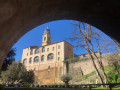
(3) Ignore the road bridge on the left and continue straight on along Chemin du Chien Bleu, which still runs alongside the old railway line. This path turns into a flight of steps leading uphill and opens out onto Avenue Winston Churchill. Turn right and follow this avenue for about 100 metres. At the next junction, continue straight on towards the dead-end: look for the blue metal sign saying “escalier de la coquille”. A few metres further on, turn left onto Allée Auguste Dalmasso. Walk alongside the old railway line again, past its wild vegetation and a few gardens. You will reach the remains of a tunnel, which mark the end of the railway line.
(4) Turn right at the foot of the building and immediately right again: signposted “accès Plage Marquet”. Go down this large flight of steps which leads onto Avenue Marquet. Cross the avenue and pass between the two tennis courts. Continue straight on towards the sea, which can be seen in the distance. At the beach, turn right to reach the car park (S/E).



 Visorando Member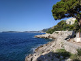

 Moderate