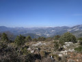
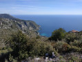
The beach and the woodland of Èze-Bord-de-Mer

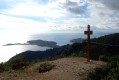
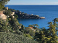
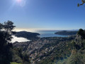
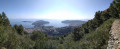
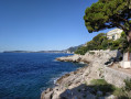
This walk consists of a return trip along the pebbles of Èze-Bord-de-Mer beach, interspersed with a beautiful circular loop through lush woodland.

Details

4468821
Creation:
Last update:
Last review:
  • Walking
    Activity: Walking
  • ↔
    Distance: 2.28 mi
  • ◔
    Average duration: 1h 15 
  • ▲
    Difficulty: Easy

  • ⚐
    Back to start: Yes
  • ↗
    Ascent: + 233 ft
  • ↘
    Descent: - 256 ft

  • ▲
    Highest point: 243 ft
  • ▼
    Lowest point: 0 ft
  • ⚐ Country: France
  • ⚐ City: Èze (06360)
  • ⚑
    Start/End: N 43.722484° / E 7.356956°
  • ❏
    IGN map(s): Ref. 3742OT
  • Hour-by-hour weather

Photos

Description of the walk

Park along the road near the railway station.

(S/E) The walk starts on the RM6098 near the Èze-Bord-de-Mer railway station.
Take the tarmac road called Chemin des Pins, which runs alongside the station, and, after the left-hand bend, cross the level crossing.
At the bottom of this path, turn right onto the path leading to the beach. Walk along the seafront from east to west.

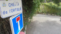
(1) About a hundred metres before the port of Èze-Bord-de-Mer, just after the yellowish house, turn right up the steps which lead onto Chemin de l’Ortigue and continue to the junction where the path meets Avenue de la Liberté.

(2) Cross the avenue at the pedestrian crossing and turn left until you reach the bend.

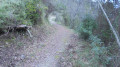
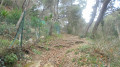
(3) At the bend, turn right onto this tarmac road called Chemin Saint-Michel. Follow this tarmac road uphill; it turns into steps and then into a forest track.
At marker 675, turn right towards Èze-sur-Mer. Continue along this forest track, which becomes tarmac again as you enter the village of Èzasque. You’ll reach the junction where the track meets Avenue Antoinio Lamaro.

(4) Turn right and walk down this avenue to the traffic lights (Avenue de la Liberté). At the traffic lights, turn right and walk for about 100 metres until you reach Chemin de l’Ortigue on your left.

(2) Head down to the beach.

(1) Continue walking along the pebble beach from west to east, then retrace your steps along the route you took on the way there to reach the SNCF station (S/E).


Waypoints

  1. S/E : mi 0 - alt. 59 ft - Railway station – Bus stop
  2. 1 : mi 0.6 - alt. 3 ft - Yellowish house, start of the steps
  3. 2 : mi 0.65 - alt. 66 ft - Avenue de la Liberté.
  4. 3 : mi 0.79 - alt. 82 ft - Start of the Chemin de Saint-Michel
  5. 4 : mi 1.28 - alt. 187 ft - Junction of Chemin Saint-Michel and Avenue A. Lamaro
  6. S/E : mi 2.28 - alt. 59 ft - Bus stop. - Gare d'Eze

Notes

Please note: this walk should only be undertaken in fair weather.
In the event of “rough seas”, the local council prohibits access to the beach.

Head to the Èze-Bord-de-Mer SNCF station via the lower coastal road RM6098, either by car, bus or train.

Worth a visit

At the end of the walk: a swim

Complete all or part of another walk, “Èze and Mont Bastide via the Frédéric Nietzsche trail” (see description on Visorando), which starts from the same point as this walk.

Reviews and comments

4.7 / 5
Based on 3 reviews

Reliability of the description
4.7 / 5
Ease of following the route
5 / 5
Route interest
4.3 / 5
bernard bb
bernard bb

Thank you, Hervé, for this very spot-on review
Best wishes, B.

Machine-translated

Hervé/Antibes
Hervé/Antibes

Overall rating : 4.7 / 5

Date of your route : Apr 17, 2024
Reliability of the description : ★★★★★ Very good
Ease of following the route : ★★★★★ Very good
Route interest : ★★★★☆ Good
Very busy route : No

It’s a short walk that takes you along a path you might not otherwise have thought to explore. The start is quite a steep climb. The walk through the forest is pleasant, as is the section that runs alongside the gardens.

Machine-translated

bernard bb
bernard bb

Thanks, Berlib, for this review, b.

Machine-translated

berlib
berlib

Overall rating : 4.3 / 5

Date of your route : Mar 11, 2023
Reliability of the description : ★★★★☆ Good
Ease of following the route : ★★★★★ Very good
Route interest : ★★★★☆ Good
Very busy route : No

The stretch along the seafront is lovely… even if there’s an inevitable risk of getting your feet soaked by a wave that’s a bit stronger than the rest, as the customs officers’ path has all but disappeared! The climb up to the wooded area is best avoided in hot weather until you reach the shade of the undergrowth. There weren’t many people out that day. The walk then continues between the hedgerows that hide the villas along the shore.

Machine-translated

bernard bb
bernard bb

Thank you for your review
Best regards, Rando B.

Machine-translated

Zielinsky
Zielinsky

Overall rating : 5 / 5

Date of your route : Feb 05, 2023
Reliability of the description : ★★★★★ Very good
Ease of following the route : ★★★★★ Very good
Route interest : ★★★★★ Very good
Very busy route : No

A pleasant little ‘after-lunch’ route in calm, mild weather, suitable for everyone. However, for a very short while and depending on the individual, walking poles – whilst not essential – can make it more comfortable – with all due respect to our cheerful little yellowish dog… It’s easy to combine with any other exploration during the day, allowing you to appreciate (in terms of both quality and scale) the astonishing Eze region, with its 700-metre elevation gain and such varied vistas: as for us, we started with a very early morning visit to the exotic garden (plenty of parking, winter rates and few visitors). Then a picnic by the sea, a walk, and the climb up to the Col d’Eze, for a short stroll through the magnificent Parc de la Grande Corniche.
A very full day.

Machine-translated

Other walks in the area

For more walks, use our search engine .

The GPS track and description are the property of this route's author. Please do not copy them without permission.